The population as given by the successive censuses commencing with 1810 is as follows: 1810,
507; 1820, 582; 1830, 965; 1840, 974; 1850, 2,345; 1860, 2,513; 1870, 1.882; 1880; 1,935;
1890, 1,751; 1900, 1,332. It will be noticed that the population steadily increased after the
furnaces were built until they began to close down between 1850 and 1860. Since 1860 there has
been a corresponding decrease and in 1900 there was an excess of only 358 over the population
in 1840. It now ranks eighth among the townships in population.
Surface, Drainage, Etc.
On the western side of the township is the broad and fertile Ohio Valley, from ‘a half to two
miles wide and extending the whole length of the township. Immediately to the east the river hills
slope precipitously to the valley and form, as it were, a sort of wall, with here and there,
projecting from the crest great cliffs, some with a perpendicular height of eighty feet and at an
altitude of 300 to 400 feet above the valley below, suggesting the towers on the walls of ancient
cities. One of these, the "High Rock." is known for miles around and when the weather is
favorable, hundreds of people flock to this place to breathe the fresh air and take in the delightful
view of the surrounding country. Pine Creek enters the Township towards the southeast corner,
from Lawrence County, and winds a tortuous course across the northeastern part, forming a wide
valley of productive farm land. The rest of the township is very much broken up into sharp ridges
and flat topped hills by the tributaries of Pine Creek and some of the small affluents of the Ohio
riser. Some of the table lands and the gentler slopes are farmed and are fairly productive.
The whole Township was originally densely wooded with trees indigenous to this section, but all
the primitive forest has disappeared before the ax of the charcoaler and has been consumed by
the furnaces in the manufacture of iron. The roughest portions of the Township are now covered
with a scattered second growth of timber and scrubby undergrowth.
The population along the Ohio Valley is chiefly descended from the early immigrants from New
England and the Middle States, though there are still a few descendants of the early French
inhabitants. The eastern portion of the Township is inhabited by German families who
immigrated after 1830, and were compelled to purchase land in the back portion of the
Township, as the choice land on the river had already been occupied.
The French Grant
embraces 23,934 acres in Green Township. It is all of Green Township, except about 120 acres.
The act providing for the Grant was approved March 3, 1795. Vol. 1. U. S. Statutes at Large,
page 442. It authorizes a grant of land to the French inhabitants of Gallipolis. It was to front eight
miles on the Ohio river beginning one and one-half miles above the mouth of the Little Sandy
River and thence down the river and extending back at right angles to include 24,000 acres. The
French settlers of Gallipolis were to be ascertained, males above eighteen years and widows, on
November 1, 1795. John Gabriel Gervais was to have 4,000 acres opposite Little Sandy, but the
grant was to be void if he, or his heirs should not personally settle on the tract within three years
and remain there three years.
The Gervais tract extended from the river to the back line of the Grant and was 376.17 chains on
the eastern line, 416.17 chains on the west line and 100.11 chains on the back line.
The French settlers, males above eighteen years and widows, were to have each a lot of the
20,000 acres surveyed and set off to them and they were to have patents in severalty, but they
were each to settle on the lands within five years and remain five years on the grant or the patents
were to be void
368 - HISTORY OF SCIOTO COUNTY.
and the act was not to impair the settler's claims against others on account of previous contract.
This Grant was surveyed on April 9, 1796, by Absalom Martin and 34 lots of 217.39 acres each
fronted on the Ohio River. Lots one to four lay southeast of the Gervais tract and lots 5 to 34
northeast of it on the Ohio River. The remaining lots were rectangular, 217.39 acres each. The
back lots 38, 42, 55, 67 and 91 lay southeast of the Gervais tract and the remaining square lots up
to 92 lay northeast of the Gervais tract.
The assignment of the lots was made in Gallipolis on November 1, 1795, by lot. A list of the 92
persons who drew their loth is given below. Of this number not over ten settled in the Grant
Soon after the allotment, it was discovered that eight persons who should have received lots, had
been left out and on June 25, 1798, an- act was passed for their benefit, Vol. 6 General Statutes
page 35. This Grant was for 1,200 acres adjoining the southwest corner of the First French Grant,
640 poles on the Ohio River, and thence back from the river to include the quantity. The
Grantees of the Second Grant were: Stephen Monot, Louis Anthony Carpenter, Louis Vimont,
Francis Valton, Lewis Philip, A. Fishon, Anthony Magnet, Margaret G. C. Champaigne, wife of
Peter LaForge and Maria J. Dalliez, wife of Peter Luc. The lots were assigned as follows:
1. Francis Valton.
2. Louis Vimont.
3. Lewis Phillip—A.Fichon.
4. Margaret G. C. Champaigne, wife of Peter LaForge.
5. Anthony Magnet
6. Stephen Monot.
7. Maria J. Dalliez.
8. Louis Anthony Carpenter.
Letters patent were to be issued to these and they were to hold in seseralty.
On February 21, 1806, General Statutes, Vol. 2.'350. The fourth section of the Act for the
original Grant was repealed. This waived the conditions requiring settlement and residence for a
specified time.
Original Owners of the French Grant Lots.
LOT - NAMES DRAWN AGAINST.
1 Matthew Berthelot, Sr.
2 Nlcholas Thevenin.
3 John Baudot.
4 Peter Matthew Chaudivert.
5 Francis Valodin.
6 William Duduit.
7 Nicholas Hurteaux. Peter Lewis LeClere, Jr.
9 Peter Marret, Sr.
10 Michael Mazure.
11 Louis Ambrose Lacour.
12 Louis Berthe.
13 John Baptist Cinat.
14 Louis Anthony Francis Cei.
15 Andrew Lacrouix.
16 John Baptist Berthone (Bertrand).
17 Francis Davous.
18 Anthony Bartholomew Duc.
19 Philip Augustus Pithoud.
20 Stephen Bastide.
21 John Parmantier.
22 Martinus Vandenbemden (now Vanden).
23 Nicholas Prioux.
24 Francis Alexander Larquilhon.
25 Nicholas Questel.
26 Christopher Etienne.
27 Francis Duverger.
28 Claudius Chartier Dufligne.
29 Nicholas Petit.
30 John Baptist Letailleur.
31 Claudius Berthelot.
32 Francis Charles Duteil.
33 John Peter Romain Bureau.
34 James Francis Laurent.
35 John Bantist Gobeau.
47 Anthony Henry Meriguy.
48 Louis Peter LeClere, Sr.
49 Mary Magdalen Brunier (widow).
50 Remy Thierry Quiffe.
51 Peter Magnier.
52 Matthew Ibert.
52 John Baptist Nicholas Tillage.
54, Anthony Claudius Vincent.
55 John Gilbert Petit.
56 Louis Augustin Lemoyne.
57 Basil Joseph Marret.
58 John Michau.
59 Joseph Dazet.
60 Michael Crawsaz.
61 Francis D'hebecourt.
62 John Francis Pervey.
63 Claudius Romaine Menager.
64 Peter Richon.
65 Peter Matry.
66 Peter Serve.
67 Francis Marion.
68 Peter Marret, Jr.
69 Francis Winox Joseph Devacht.
70 Nicholas Charles Visinier.
71 Augustus Waldemand Mentelle.
72 Stephen Chaudivert.
73 Peter Robert Magnet.
74 Stephen Villenni.
75 John Baptist Ferard.
76 Francis Alexander Dubois.
77 John Louis Malden.
78 Francis Mennepier.
79 Peter Serrot.
80 Anthony Francis Saugrain.
81 Joachim Pignolet.
GREEN TOWNSHIP - 369
Original Owners of the French Grant Lots - Cont'd.
LOT - NAMES DRAWN AGAINST
36 John Julius Lemoyne.
37 Peter Duteil.
38 Louis Joiteau.
39 Agnotus Chereau.
40 Peter John Desnoyers.
41 Marin Duport.
42 Augustin Leclercq, sr.
43 Nicholas Lambert.
44 John Brouin.
45 Augustin Leclercq, Jr.
46 Anthony Philipeau.
82 Anthony Vibert.
83 John Louis Violette.
84 Peter Lafflillard.
85 Peter Chabot.
86 Peter Thomas Thomas.
87 Michael Chanterel.
88 Francis Carteron.
89 Claudius Cadot.
90 Louis Victor Vonschriltz.
91 Peter Francis Augustin Leclercq.
92 Peter Ferard.
As will be seen by reading the sketches of Jean Gabriel Gervais, Samuel Hunt, and Asa Boynton,
the French Grant was sold out to New Hampshtre Yankees, and what was expected to be a
French settlement became a New England one. Of the names of the original 100 French
Emigrants, the only ones now known in this county are: Valodin, Duduit, Duteil, Chabot and
Cadot, five in number. Descendants of LeClercq, LaCroix, Bertrand, Bureau, Vincent, Menager,
Devacht, Magnet, Serrol, Sandgram and Le Moyne are known to the editor, but they are
descendants in the maternal line. Of the remaining 76 out of 100 not a trace is known to the
writer.
Claudius Cadot who has a picture and a sketch herein was the last distinctive survivor of the old
French. He was the son of the Claudius in whose name lot 89 was drawn.
In regard to the bill for the French Grant introduced into Congress on March 24, 1794, the
Attorney General to whom it had been referred reported on it.
William Bradford was the Attorney General and he filed an exhaustive report over all the facts.
He recommended the Grant on April 30, 1794. when the bill was read in the Senate and referred
to Senators Brown, Burr, Taylor, King and Potts. On June 13, 1795, Senator Brown laid before
the Senate the petition of John Gabriel Gervais for the bill and it was referred. On February 8,
1795, the bill was reported and on February 24 and 25, 1795, it was debated. On motion to strike
out the first section, the vote was yeas 9, nays 15, and the names are given. The bill was referred
to Messrs. Potts, Burr and King to report. On February 28, it was read the third time, and
amended in two particulars. On the passage of the bill the yeas were 14, the nays 8, and the
names are given. Burr voted aye. In the House on the same day the bill was read and referred to a
committee of three, named. On March 2, 1795, it was reported back and passed and the vote not
given. It was approved the next day.
Haverhill
is the site of the first settlement in the township and was the fourth settlement above Cincinnati
on the Ohio river. The place was settled by Jean G. Gervais in 1797, as the most favorable spot
on his 4,000 acres for a town. He gave it the name of Burrsburg, in honor of Aaron Burr, who
was chairman of the Senate Committee to which was referred the report of the Attorney General
on the Memorial of the French inhabitants of Gallipolis. Taylor and Ellsworth were the other two
members of this committee. The report was referred to the committee March 24, 1794 and on
April 29, 1794, Mr. Burr, its Chairman, reported a bill for their relief. He afterwards used his
influence for its passage. When the emigrants from New England came they gave the settlement
the name of Haverhill for their native town in New Hampshire. No plat of Burrsburg can be
found on the records and it is safe to assume that none was ever made as the town was only a
cluster of half a dozen cabins for twenty-five or thirty years after settlement. The first plat of the
town was made by Thomas Davisson and was recorded April 27, 1848. There were 13 in- lots in
this plat. It was surveyed again, June 16, 1859, into 25 inlots and the plat was recorded August
24, 1859. Lawson Drury was the first Postmaster and the first ferryman. A Mrs. Naylor, who sold
dry goods, was one of the first to carry on business. The town was once the shipping point for the
iron made at Ohio furnace; and charcoal and ore were brought across from Kentucky for this
furnace. The population is about a hundred. Haverhill station
370 - HISTORY OF SCIOTO COUNTY.
on the Norfolk & Western Railroad is a mile and a half distant and Greenup, Kentucky, is just
across the river. Ironton is nine miles up the river and Portsmouth twenty miles down the river.
There is but one church in the place, the Methodist Episcopal. This organization has been in
existence since 1815 and the Rev. Thomas Gilruth was its first pastor. The present brick structure
was erected in 1870, at a cost of $4,500. The church has a large membership and the Sabbath
school numbers 140. One might search the state over and he would not find a more sociable or
more religious people than can be found in the membership of this church. Reverend Henry S.
Alkire is the present pastor and Malcomb Clay is Superintendent of the Sabbath School. The
trustees are: George C. Winkler, Evan Vandervort, Peter Boynton, William Brush and Samuel
Crickenberger. In 1892 a parsonage was built near the church.
The Antioch Baptist Church is two miles north of Haverhill on the Haverhill and Portsmouth
turnpike and was built in 1878. Its first minister was a Reverend Kirkpatrick and its last minister
was V. N. Murphy. It is not used at present.
The Gervais House
was a hewed log house, weather boarded. It was forty feet square and the lower story twelve feet
square and the upper story ten. A large chimney stood in the center, which had four fire places.
One room upstairs was a ballroom, 18x10. The floor was tongued and grooved. It had a single
chimney. This house was built by Jean Gabriel Gervais. It was torn down by Asa Boynton, Jr.,
and the logs used for fire wood. It stood in front, just above where Joe Boynton now lives,
between him and the river.
Powellsville.
This hamlet is situated on the eastern edge of the township, midway of the boundary between
French Grant lots 85 and 86. Poplar Fork, a small branch of Pine Creek, flows through its edge.
Pine Creek is only a mile away. It was laid out by William Powell, John and Washington Irwin
and was named for Powell. The business of the town was in its early days conducted by the sons
of Powell: William, Peter and Jacob. They conducted a tannery, a shoe shop and a store. The first
survey for town plat was made July 31, 1846, and recorded July 15, 1848. This survey was made
for Powell and his associates, and the plat consisted of 21 inlots.
Churches.
The German Lutheran Church has the largest membership and it is made up from the German
population on Pine Creek. The church is about half a mile west of the town and was built in
1875. The congregation has a very large Sabbath School and a day school is conducted two days
in the week by the minister, August Busse, in the German language.
The Powellsville Free-Will Baptists hold their meetings and Sabbath school in an old school
house in the center of the village. This church was organized August 16, 1841, and a church was
built, but since destroyed. William Lane was the last minister.
The Pine Creek Free-Will Baptist Church was organized in 1872. The church is located two and
a half miles northwest of Powellsville on the Powellsville Branch turnpike. The last minister was
William Lane, hut no meetings have been held for several months. All the trustees have died and
no successors have been elected.
The Methodist Episcopal Church of this place is the old organization which formerly held its
meetings at Empire Furnace, Cartright's Mills and in the Baptist Church and School house. It
now has a large edifice, built in 1875, to the southeast of the village one-half mile. It has a
Sabbath school, but no minister, and no trustees.
The United Brethern organization holds its meetings in the Ptne Creek school house. This
organization dates from 1850. William Wagner is the minister.
GREEN TOWNSHIP - 371
Furnaces.
Franklin Furnace was built in 1826 and went into blast in 1827. It was built by the natives of
New Hampshire: Daniel Young, Jesse Y. Whitcomb, Joshia Merrill, John Hurd and Martin Ruter
on lot 22 of French Grant, about a half mile from the Ohio river. Franklin Furnace Station on the
Norfolk & Western railroad is located near the site of the Furnace. The builder's operated the
furnace for some years and it then passed into the hands of John Young and a Van Horn who
either sold or rented it to A. Q. Rogers & Company. Rogers was a man who drank and gambled
and soon lost out and the furnace was sold to John Gould, Jacob Hurd and Jesse Hurd. They did
well, but Gould and the Hurds did not get on together so Gould bought the Hurds out, and during
the Mexican War, when all furnaces flourished he made a small fortune. Not caring for the
furnace any farther, he gave it to his brother, 0. B. Gould. It blew out in 1860. The site and lands
are now owned by 0. B. Gould, Jr.
Junior Furnace was built in 1828, by the same Company which built Franklin and it was called
"Franklin Junior Furnace" having been built after Franklin. It passed into the hands of John
Young who sold it to Jefferson W. Glidden. When it blew out in 1865, it was owned by 0. B.
Gould, Jesse Young. John J. Glidden and Wells Hutchins. Almost all traces of it are gone. The
property is now owned by Charles A. Goddard.
Union Furnace was built in 1826 by a company composed of James Rogers, John Means, John
Sparks and Valentine Fear. It went into blast in 1827. When it blew out in 1851 or 2, it was
owned by David Sinton and Thomas W. Means. David Sinton became manager of Union, at the
age of nineteen. This furnace was located on the eastern border of Green Township, but nothing
remains of it now.
Ohio Furnace was located about three miles from the Ohio river, was built in 1824, and went into
blast the following year with John T. Woodrow as Superintendent with a force of fourteen men.
It was built by Thomas W. Means and David Sinton and it was continued in blast until February
24, 1882, without a break except for repairs. It passed into the hands of Means, Kyle &
Company, who still own the grounds and land belonging to the furnace. Some traces of the
furnace remain. A large quantity of coal and iron ore are mined on the furnace lands. The ore is
used in Hamilton Furnace at Hanging Rock. The ore is taken to a place near Union landing by
means of a tramway and is there loaded on Norfolk & Western cars. The furnace site and all the
land which belonged to Means, Kyle & Company, was sold to Rogers, Brown & Company, in
1900.
Schools.
The schools of Green Township are among the best in the County. The people pay their teachers
liberally and usually have the best teachers to be had. For several years the length of the term has
been eight months. It ranges from seven to nine. The first vote for a school tax was taken in
1841, but met with little encouragement. The next year the vote stood 20 for and 64 against. In
1843, the vote was 59 for and 76 against. In 1844 for the first time a special levy was made for
school purposes, by a vote of 94 to 40. In 1829, there were four districts in the Township. On
March 1, 1829, the trustees re-distracted the Township adding District No. 5. On June 12, 1830,
District No. 6 was added. On March 2, 1840, No. 7 was added. On March 7, 1842, No. 8 was
added, also No. 9, which was taken from Vernon Township. Since then there have been three
more added, No. 10, No. 11, and No. 12.
District No. 1 is now the Haverhill Special District. The first school building was a frame one
and stood opposite where the Methodist Church now stands. About 1850, the brick building,
which is now used, was erected. The township built the lower rooms and the Sons of
Temperance, the upper. Both are now owned by the Special School District and the upper is used
for a ball. This school was formerly large and two teachers were employed, hut only one teacher
is employed now. John Warren has taught this school for thirteen years. The district is the
wealthiest in the Township.
District No. 2, has a two room modern style building which cost $1,800, built in 1894." This was
intended for high school purposes but as yet no high
372 - HISTORY OF SCIOTO COUNTY.
school has been established. A brick school house which stood on the same site, was burned in
1893. It was built in 1873 and Ruby Feurt was the first teacher. Wilber Stout is the present
teacher at a salary of $45.00 per month.
District No. 3, or the Franklin Furnace School has a new frame building put up in 1890. There
was an older one which stood just across the road from the new one on 0. B. Gould's land. This
was built in 1853 and the tirst teacher was James Palmer. There was an old school house and
church built by the Furnace Company in 1827. A Mr. Taylor was the first teacher.
District No. 4, commonly called the "Ball school house" is located on the Portsmouth pike about
a mile and a half north of Franklin Furnace. This house was built in 1846.
District No. 5, or the "Buckeye Grove School" is situated about a mile and a half from Haverhill
and a quarter of a mile from Haverhill station on the Norkolk & Western Railroad.
District No. 6 is located at Ohio Furnace. The building was erected in 1845. This school
occupied two departments when the furnace was in blast and also for several years after.
District No. 7. This school had its beginning in 1829 and was cut off from District No 2 in 1840
and made a separate district. The school is about the smallest in the township.
District No. 8, is known as the "Pine Creek Bridge" school. The house was built in 1852.
District No. 9, or the Powellsville school was inaugurated in the winter of 1858-9. The old
building has been abandoned and a new one was built in 1886, seats and all costing $672.95. It is
in the center of the village.
District No. 10, was instituted in 1881. It is a very large district and has the largest enrollment in
the Township. John Lee was the first teacher.
District No. 11 is known as the "Dark Lick" school. There was an old house which was given up
for a new one in 1878. The new house was built on the hill near where it now stands, but was
moved to its present site in 1895. It enumerates under forty pupils of school age. It is sometimes
called the Hubbard school.
District No. 12 is located at Union Furnace and the pupils were partly from Lawrence County.
The house was built in 1884,. costing $572.
In the spring of 1899 a vote was taken in the township on the question of establishing a
Township High School. The measure was defeated, with the result that four of the more
progressive citizens, anxious for a more complete education for their children, took it upon
themselves to institute a school of this character at their own expense and employed Mr. Charles
E. Davis, of Rio Grande, Ohio, to take charge of it. The school has flourished, notwithstanding
there was a great amount of opposition, and has so far won in popularity, that the Haverhill
Special School District, is at present bearing half, the expense while the other half is paid by
private subscriptions. Miss Mayme Batterson is at present teacher. The originators of the school
were: James H. Yingling, Henry Folsom, Joshua Oakes and Charles A. Goddard. Much credit is
due them both for the public spirit and the sacrifice incidental to it.
Haverhill Grange, No. 947
was chartered March, 1873. There were thirty-tive charter members. The organization lapsed
twice, but was reorganized each time, the last time, in May, 1888. Since then it has been in
existence continuously. For some years the Grange met in the hall in the school house at
Haverhill, but in the last three or four years its meetings have been held at the homes of the
members. Its membership now numbers about forty. This is the only Grange in the County.
Cemeteries.
There are numerous private burial grounds in this Township, besides four Township Cemeteries.
The oldest burial found is that of Samuel Hunt, who died July 27, 1807, and was buried in the
edge of Haverhill near the hank of the rlver. The next oldest is the Boynton burial ground,
located north of Haverhill. This is private, but others may use it with the consent of the owner,
Malcom Clay.
HARRISON TOWNSHIP - 373
Another of the oldest is located near Franklin Furnace, on the property of 0. B. Gould.
Another is the old Feurt graveyard, located a mile south of Franklin near the old Feurt
homestead. Peter Feurt, one of the tirst inhabitants of Scioto County, is buried here.
The Pine Creek Cemetery is located about two and a half miles northwest of Powellsville near
the Pine Creek Baptist Church. It was originally a private burial ground, but is now a Township
Cemetery.
The Lamb or Franklin Furnace Cemetery, is located about one and one half miles north of
Franklin Furnace on the Portsmouth Turnpike, and it contains two acres, only one of which is
fenced in. The Township purchased this cemetery from Horace and Ira Lamb in 1875. It was
originally a private burial ground.
The Powellsville Cemetery is located near the edge of Powellsville, and was a private burial
ground until 1860, when it was given to the Township by Joseph Hudson. It contains an acre of
ground.
The Ohio Furnace Cemetery is located about halfway between Haverhill Station and Ohio
Furnace. It was formerly a private burial grouud, but was transferred to the Township about
1880.
The German Lutheran Cemetery is near Powellsville, about a half mile to the west. In it stands
the Lutheran Church. It was opened in 1875, and it is the neatest cemetery in the Township.
HARRISON TOWNSHIP.
It was named for General William Harrison and was formed from land, first part of Union and
Upper Townships, but afterwards Madison and Porter. The Commissioners met March 6, 1832,
and established Harrison Township. See Commissioners' Journal of above date, page 32. On June
7, 1832, the boundary was changed. See Commissioners' Journal of that date, page 40. On June
7, 1861, another change was made. See Commissioners' Journal of that date, page 283. The
Township is bounded north by Madison, east by Bloom, south by Porter, and west by Clay and
Jefferson.
Surface, Productions, Rank, Etc.
The whole Township with the exception of Little Scioto and Long Run Valleys is hilly, but more
than three-fourths of the land is tillable. The hills are not high but have moderate slopes and
round tops. The Little Scioto enters Harrison Township near the northeast corner and leaves it
near the middle of the southern boundary to enter and leave again 1 1/2 miles west of this point.
The valley is tortuous but wide and contains some of the best farm lands in the County. The soil
of the valleys is soft and sandy adapted to corn, while the uplands have clay subsoil and are good
wheat lands. Some attention is given to fruit culture. The hill soil contains all required for the
growth of peaches, apples, strawberries, etc. Harrison is an agricultural Township, there being
but few mills or factories. Its area is 23,687 acres.
The value of its real estate is $160,330. The value of its personal property is $100,262. In
Harrisonville Special School District, the real estate value is $25,550 and the value of the
personal property is $23,161, making a total valuation of $309,303 for the Township. It ranks
seventh in area, ninth in population, sixth in value of personal property, ninth in value of real
estate and seventh in value of both. The Township was first settled near its southern border on
Little Scioto river. The early settlers were: John Snyder, Simeon Wood, Thomas Feurt, Daniel
White, Samuel Crull, James Haney, Solomon Monroe, Joseph Bennett, Jacob Barr, John and
Calvin Hatch, Franklin Batter-son and Emanuel Traxler.
Harrisonville.
Harrisonville is situated on the northern line of the Township about the, middle point from east to
west. It was named for General William Henry
374 - HISTORY OF SCIOTO COUNTY.
Harrison. In 1836 Gen. Harrison passed through the village when there were a few log cabins
erected. The town site was then owned by Joseph Bennett, an ardent Whig, with whom General
Harrison lodged. The town was platted by Deputy County Surveyor, Frank C. Gibbs, May 24,
1859, and recorded August 22, 1859. It had been platted in 1832 by Moses Gregory but no record
was made. Harrisonville has been a business point since about 1823, when Peter Lagore built a
blacksmith shop, near the corner where B. F. Lantz's store now stands. He also built the frame
house now owned by Captain Henry Lantz (then in Madison Township) which is the oldest
building in Harrison- vine and the oldest frame house in the Township. The post office is named
Scioto. The first Postmaster was Ephriam Rockwell. There are three good general stores in the
village. There is a blacksmith shop and an undertaking establishment, also a harness shop. Henry
Lantz has an apiary. Jacob Eckhart is the postmaster. The physicians are: Dr. James B. Ray, and
son, and T. H. McCann. The present population is about 200.
The Harrisonville school is taught by Miss Bertha A. Coburn, who teaches for seven months at
$35 per month. There are 37 pupils. This special district was established in 1878.
Schools.
In 1806, the first school house in Harrison Township was built. It was about 16 feet square, of
rough logs, with puncheon floor and seats made of half logs with the flat sides up, with four legs
made of oak pins. The windows were made by leaving out a log on each side of the house, which
space was filled with greased paper. The room was heated by a large tireplace, the chimney was
of sticks, plastered with mud. The first teacher was Robert Finley. The present school system was
established in 1853. There were eight sub-districts with a larger attendance than at present,
although the number of districts is greater and the population more numerous now. The value of
the school property is about $5,000. The schools and teachers are nine in number.
Each of the schools from No. 1 to 9 is conducted for six months and the teacher paid $30.00 per
month.
Officers.
The first election in the Township was held at the home of Daniel White on the tirst Monday of
May, 1832. The first Township officers were: Treasurer, Abner Wood; Clerk, Abijah Batterson;
Trustees, Thomas Hatch, Daniel White, and Sylvanus Shumway; Overseers of the Poor, Henry
Bonser and Simeon Wood; Constables, George Scott and R. T. Collis; Justices, T. R, Wood and
Luther Wheeler. The present officers are: Clerk, Charles Brisker; Treasurer, William Jenkins;
Tustees, Frank Coles, F. C. Whitt and John Shump; Justices, Henderson Clark, W. L. Webb and
Andrew Purtee; Constables, L. Fenner and William Smith.
Harrison Furnace
was built in 1853, by Boston Eifort and Henry Spellman. It went into blast in 1853 and continued
seven years. The Company failed and Daniel Sommers and Samuel McConnell bought the
property and continued the business until 1872. They failed, the furnace blew out, John Lodwick,
as receiver, sold all the property, the land became farms, part of the employees moved out of the
Township, others bought farms and still remain. Most of these were Germans who had saved
some money by working at the furnace.
Mills.
In 1812, Samuel Crull, father of Doctor William Crull, and grandfather of Ira Crull, built a saw
and grist mill which still stands on Long Run on the farm of G. S. Neary. It was owned and
operated by the Crull family until about 1880.
The Scioto Mill was built by Joseph Bennett and Henry Power in 1828. In 1831, Bower became
sole owner. It has been owned by a number of persons since. Levi Wheeler sold it to John T.
Miller and William H. Wheeler in 1881. 'Miller soon sold out to Wheeler. It is now in the
possession of George Wheeler who has added a great deal of machinery of the best and most
HARRISON TOWNSHIP - 375
modern patterns. This is the finest mill seat in the County. Mr. Wheeler recently added a fine
engine and saw mill which insures a steady run the year around.
Dixon Mill. In 1804, Emanuel Traxler built the first mill on the present site of Dixon Mill.
Others beside Benjamin Scott owned the mill before 1836. Silas Dixon bought it of Joseph Smith
in 1850. In 1866, George and Noah Dixon became the owners and made great improvements in
the machinery. It has been owned by Noah Dixon since 1880. It is now one of the best mills in
the County and contains a good saw mill besides all the modern machinery for making tlour.
Churches.
The Methodist Protestant Church was organized May, 1858, by Rev. Jacob Nichols. The first
services were held in the Free Will Baptist Church at the Glade. Some of the first members were:
M. W. Brown and wife, James Samson, J. Q. Shumway, John Smith and wife, Charles Hopkins,
Richard King, Samuel McGee and C. H. Ketter. In 1272, the Church now standing was built at a
cost of about $600. The pastor is W. W. Gadd. The Trustees are: M. W. Brown, James Samson,
Edward Samson, James Q. Shumway, John Shumway and Edgar Brown. The membership of the
Church is about 30, and the Sunday School about 45.
Harrisonville Methodist Episcopal Church was organized in 1837. The tirst services were held in
a log church at the northern end of Harrisonville. Another Church was built in 1856. Rev. S.
Parker was the pastor. J. M. Violet, John Crull, James R. Taylor and William Slattery were the
Trustees. The present building was erected in 1873 at a cost of about $800. The pastor ls Rev. G.
E. Hughes. Harrisonville has two Sunday Schools, one is a Baptist School and has about 60
pupils. The other is held by the Methodists, pupils about 50.
Harrison Mills United Brethren Church was organized in 1902. It has 23 members. Rev. Charles
B. Tuttle is the pastor.
The Tick Ridge Catholic Church was erected in 1861. The first priest was Father L. Shriver, the
Trustees, Benedict Seidel, Lawrence Cordell and Joseph Spitznogel. The congregation numbered
45. The membership now is about 60. The incumbent priest is Rev. Father James T. Banahan.
The German Lutheran Church was organized in 1880 by Rev. Theodore Yeager who became the
first pastor. The incumbent pastor is Rev. Henry Schenk. The Church has about 25 members and
the Sunday School about 20 pupils.
Lodges.
Ives Lodge, Knights of Pythias was instituted in February, 1890. with about 20 charter members.
There are now about 100 members. Soon after the institution the lodge built a large two story
hall. The hall, fixtures and paraphernalia cost about $1,800. The lodge is free from debt and is in
a flourishing condition.
Scioto Post, No. 287, G. A. R. was established about 1880.
Lois Camp, Sons of Veterans, No. 16, was established about 1880. It is in a flourishing condition
and enjoys second rank in the state, being the oldest but one. Scioto Post, and its auxiliary, Lois
Camp have for years conducted an annual reunion, which occurs on August 17th.
The Origin of the Great Harrisonville Reunion in
the Summer of 1865
At the close of the war, everybody felt rich and happy. The patriotic fever was at white heat.
Everyone felt that there should be a grand reunion of the returned soldiers. At a meeting in
Dugan's Grove on July 4, 1865, it was resolved to have a Grand Soldier's Reunion and Peace
Jubilee. It was to be an affair of the two Counties of Pike and Scioto. Abram F. Millar, Thomas
Dugan and John L. Ward were the master spirits in the movement. Many committees were
appointed in Portsmouth and a grand tine was arranged for; the time fixed was August 17.
Dugan's Grove was then three
376 - HISTORY OF SCIOTO COUNTY.
times the extent at present, and was not marred by a railroad. It was one of the most delightful
spots in the County. The day was an ideal one. There were two entrances to the grove. Over one
appeared the motto, "Victory at Last," over the other, "Welcome to the Soldiers."
There was a free dinner, with two tables each over a thousand feet in length, At one was a banner
inscribed, "We honor the private soldier." At the other at each end were banners bearing the
names "Logan," "Thomas," "Rosecrans." In the center were banners bearing the names, "Grant,"
"Sherman," "Sheridan." On the speaker's stand was a banner reading, "The War was not a
Failure." Five thousand people took dinner. Colonel John R. Hurd made the opening speech.
Colonel T. W. Higgins spoke as did General Robert Schenk who was the orator of the day. Hon.
Eli Glover made the closing speech. There was dancing in the afternoon and the band of the 73rd
0. V. I. furnished the music.
Lucasville failed to keep up the function and August 17, 1880, the day began to be observed by
the people of Harrisonville and vicinity and since then Harrisonville reunion has become an
institution. It is now managed by the Sons of Veterans. That organization rents a grove and sells
out the privileges for all manner of restaurants, candy stands, etc. The. Reunion is always held on
the 17th of August unless that day falls on a Sunday. Everybody within a radius of twenty miles
turns out and the day is a general holiday. It is understood to be a general meeting place. One can
there see friends he has not seen for twenty years. Portsmouth is a great contributor 'to the crowd
and on that day every buggy, carriage o" conveyance is in demand. The crowd assembled varies
from 5,000 to 7,000.
The affair has lost its distinctive feature as a soldiers' reunion and has become a clearing house
for old acquaintances.
Cemeteries.
Rodger's Cemetery is situated one half mile northwest of the Glade schoolhouse and contains
about one half acre, but it has some very old graves.
Shumway Cemetery lies back of the Methodist Protestant Church. Some of the inscriptions are as
follows: Abner Wood died August 25, 1824, aged 58 years. Rebecca Wood died April 18, 1853,
in the 80th year of her age. Lucella, consort of Jacob Gilliland and daughter of Daniel and Sarah
White, died June 24, 1855, aged 23 years, 8 months and 3 days. Jacob Gilliland born April 28,
1827, died February 25, 1875, aged 47 years, 9 months and 29 days. Daniel White died June 8,
1857, aged 64 years, 8 months and 14 days. Sarah, wife of Daniel White, died,May, 1851, aged
54 years, 8 months and 23 days. '
Batterson Cemetery contains about one acre and is one of the best kept in the Township. It is a
Township burying ground. The following are some of the inscriptions: Elias C: Coriell died
December 13,. 1862, aged 81 years, 9 months and 2 days. Lucretia, his wife, died September 13,
1858, aged 79 years, 6 months and 15 days. John C. Colgrove died December 4, 1865, aged 61
years, 2 months and 4 days. Franklin Batterson born April 12, 1818, died May 5, 1887. Ira C.
Coriell born July 29, 1812, died June 5, 1899. V. B. Farney died November 5, 1872, aged 36
years, 7 months and 15 days.
JEFFERSON TOWNSHIP.
Organization and Settlement.
Jefferson was a township prior to 1810, but the exact date of its organization is unknown. It
included Valley Township until 1860, when the township was divided, the eastern part retaining
the name of Jefferson and the western part becoming Valley Township. Jefferson Township was
formerly part of Seal and Union Townships.
The present Jefferson Township was settled first on Long Run in the southeast corner of the
township in 1808. Some of the earliest settlers were James "Painter" Wilson, Joshua Tritt, J. H.
Munn, James Haney, Jesse
JEFFERSON TOWNSHIP - 377
Rice, Rodney Marshall, Samuel Farmer, Jacob Crouse, Richard Grimshaw, Jared Spriggs, Abner
Field, Aaron Gee, Daniel Conkell, Daniel McLaughlin, Thomas Carlisle and Solomon Munn.
The original Jefferson Township settlements were on the Scioto River in what is now Valley
Township.
Boundary, Area and Valuation
The boundary of Jefferson Township was first changed December 5, 1826, as follows: The east
half of the southeast quarter of section 25, township 3, range 21 taken from Jefferson and
attached to Madison. There have been other small changes for .the accommodation of certain
residents, but none are of much importance. The township records are very incomplete. Nothing
of consequence ls recorded prior to 1838, when Leonard Groninger was clerk. The present
boundary is north by Pike County, east by Madison and Harrison Townships, south by Clay and
west by Valley Township.
The area of Jefferson Township is 14,940 acres. The value of the real estate is $49,660; personal
property, $25,013, making a total valuation of $74,673. It ranks 14th in area, 15th in population,
(smallest), 16th in real estate, 16th in personal property and 16th in total of both.
Topography.
Jefferson contains very hilly and rough land, but also some very good farm land. In the southeast
corner, the Valley of Long Run contains good farms. Southwest of the center and extending to
the eastern boundary of Valley Township is a strip of bottom land on Marsh's Run, that is very
productive farm land. On Blue Run are found the widest fertile bottoms, but in the region called
"Flat Wood" is a large area of level high land that produces well, both grain and fruits. Fallen
Timber Valley, in the north-east corner, is narrow but it contains some good farms. Jefferson has
a great many hills but all of them can be profitably cultivated in berries, peaches and other fruits.
Except Vernon, Jefferson is the roughest township east of the Scioto river.
Officers.
The township officers in 1851 were: Treasurer, James L. Thomas; Clerk( Leonard Groniger;
Justices of the Peace, Mark Snyder and Isaac N. Johnson; Constables, Thomas Carlisle, John
Stewart and 0. B. Murphy. The present township officers are: Clerk, T. Frank Craig; Treasurer, P.
H. Reinoehl; Trustees, John Shuman, Jerry Field and W. L. McCain; Justices of the Peace, James
McWilliams and Jared Spriggs; Constable, Stephen Keller.
Jefferson Township has no furnaces nor factories, and never has had but three mills, one water
power, one horse power and one steam power.
Schools.
There are few townships but have a better school system than Jefferson. In 1851, Jefferson had
eight schools, one special and 7 sub-districts. The following is copied from its first records.
District Number 1, 78 youth, $64.13 school fund: District No. 2, 67 youth, $55.08 school fund;
District No. 3, 71 youth, $58.38 school fund; District No. 4, 39 youth, $32.06 school fund;
District No. 5, 63 youth, $51.80 school fund; District No. 6, 60 youth, $49.35 school fund;
District No 7, 34 youth, $27.96 school fund; Special District, 54 youth, $48.91 school fund. The
township fund for the same year was $69.81.
Jefferson Township at present has five schools, as follows: District 1, Munn's School, 41 pupils;
District 2, Flat Woods, 39 pupils; District 3, Black Run, 36 pupils; District 4, Blue Run, 39
pupils; District 5, Fallen Timber, 60 pupils. The term is seven months and the teachers' wages are
$30.00 per mouth. Two of the school buildings, Flat Woods and Fallen Timber, are nearly new.
The average value of each school house and site is about $500.
Churches.
Blue Run Methodist Episcopal Church was organized, and a church built in 1859. Rev. Harrison
Willis was the first pastor. The first trustees were: James Varner, Milton Deselen and John
Morgan. The original members were: John Morgan and wife; Abner Field and wife; Samuel
Miller and wife; Jared
378 - HISTORY OF SCIOTO COUNTY.
Spriggs and wife; Eliza Varner, James Varner and wife and Mrs. Nancy Marshall. The pastor is
Rev. G. E. Hughes.
Falleu Timber Christian Cfiurch was organized in 1865. The first pastor was Rev. Asa Eblin. The
membership of the church is nearly 100 and the Sunday School is large. Edward McWilliams is
Superintendent of the Sunday School.
Flat Woods Methodist Protestant Church was organized in 1876. The first pastor was Rev. Perry
Orr and the trustees were: Hamtlton Myers, Nicholas Funk and Jared Spriggs. The original
members were David Crull and wife; William Porter and wife; Henry Bricker and wife; Abigail
Crull, Catherine Farmer and Rachel Ralphsnider. The pastor is Rev. W. W. Gadd. The church
has about fifty members and a large Sunday School.
Cemeteries.
Jefferson Township Cemeteries are fenced and kept at the expense of the township.. The Morgan
Cemetery is located on the high hill back of the Blue Run Church. Here are buried some of the
oldest pioneers of Jefferson, but few if any of their graves have record stones from which data
can be obtained.
The Jacobs Cemetery is located on Fallen Timber Run. None of the old pioneers' graves can be
found in this.
Flat Woods Cemetery is near the Flat Woods Church on Stony Htll.
The Hickman Cemetery is on the farm of Jacob Hickman.
Perhaps the most noteworthy grave in Jefferson Township ts that of Major James Munn, who
was buried on top of the hill near Oertel Corner, on the Portsmouth and Harrisonville turnpike. It
is well cared for and the grave can be seen from the road near the Oertel homestead. While it has
no stone, it is well known.
MADISON TOWNSHIP
was named for James Madison, the fourth President. It was origtnally part of Union and Seal
Townships. In 1810, Madison was one of the ten Town-. ships of the County. March 2, 1840,
Sections 13 and 14 were taken from Jefferson Township and attached to Madison. See
Commissioners' Journal of that date, page 231.
Topography.
Madison Township is very hilly, but it has a large area of level high land extending from Pike
County nearly to Harrison Township on a line south from California, Pike County. This region
known as "The Flats," averages three miles wide and contains good farm lands. West of this is
the Rocky Fork Valley separated from the "Flats" by a range of low hills. Thts valley is not wide
but contains some very fertile land. To the east of the "Flats" are several ranges of hills, some
high ones, which extend to the valley of Brushy Fork, or the largest branch of the Little Scioto.
Here also are first rate farm lands. Although more than half of Madison is hilly, at least
seven-eights of it are tillable and productive land. Most of the hills can be cultivated.
Old Settlers.
Madison Township was settled as early as 1797, on Rocky and Brushy forks of Little Scioto
river. The first persons born in the Township of whom a record has been preserved were Thomas
Bennett born June, 1800 and William Bennett born July, 1802. Some of the oldest settlers are:
John, Thaddeus, Robert and Caleb Bennett, Jacob and Joseph Rickey, Edward Dawson, Absalom
Pyles, Daniel Dodge, Aaron Miller, Joseph, Benjamin and Ephriam Rockwell, Peter Lagore,
Moses Mault, George Adams, George and William Dever. Moses Barnabus, Solomon, Aaron and
Jesse Monroe and Daniel McKinney. Of the early settlers, but two are living: Ephriam Rickey,
aged 82 and L D. McKinney, aged 86. The Bennets were about the first settlers, some were
MADISON TOWNSHIP - 379
Yankees from New York and New England and some were from Virginia. The Browns came
from New England and the Maults from South Carolina.
The exact area of Madison Township is 32,322 acres. The value of its real estate was $231,990,
aud its personal property was $82,684 making a total valuation of $314,674.
Mills.
Madison is a purely agricultural Township. It has no factories nor furrounaces. It has had eight
mills, two of which still stand but they are almost abandoned. The following are noted:
In 1807, Martin Collings built a grist mill on Brushy Fork at the same place where Martin's Mill
now stands. In 1812, it was abandoned.
In 1824, John Higgins built a grist mill on the farm of John Wilson. It was the only horse power
mill in the Township. He built it by subscriptions of work and when the timber was all ready the
mill-wright, E. B. Marritt, agreed to start the mill for a young horse which Mr. Higgins owned. It
ran until 1839.
In 1831, Ebenezer Corwin built a saw and grist mill on Rocky Fork, near what is called the
Dodge Corners. Corwin ran it six years and sold it to Lyons Dodge. Dodge ran it five years and
the creek washed around the dam and the mill was abandoned.
Wallace Mill is in the southeast corner of the Township on Rocky Fork, a branch of Little Scioto
river. It was built in 1840, by John White and afterwards became the property of Isaac Wheeler
who sold it to William Wheeler. In 1870, Samuel Wallace bought the mill, hence its name. It is
now the property of Joseph Stockham. As a flour mill its day of usefulness is past.
Churches.
Madison Baptist Church was the first in the Township. It was founded in 1825 by Thaddeus
Bennett. Among the first members were Thaddeus Bennett and wife, William Crawford and
wife, Jacob Rickey and wife. The first services were held in private houses, but in 1836 a log
church was built.l In 1868, this was replaced by a frame church which was destroyed by fire ten
years later. A new church was built about 1890 and is still standing. The present membership is
about 35. 'No regular minister is employed. The last services were conducted by Rev. J. B.
Carter, of Portsmouth. The Sunday School numbers about 40.
Fairview Free-Will Baptist Church was organized in 1880. It has a membership of about 75. The
church stands northwest of the Noble school house. The minister is Rev. William Rissinger. The
Sunday School has about 50 pupils.
The United Brethren Church was organized in 1867. A church was built which stood nearly 20
years. A new and better church was built about 1887 which still stands.
Harrison Union Church. In 1874, the Free-Will Baptist and the United Brethren Societies built a
church near the southern line of Madison Township on the Dever pike about 2 miles east of
Harrtsonville. This church was free for all denominations, when not used by the Free-Will
Baptists, and the United Brethren. The United Brethren Society was organized by Rev. Jesse
McCann. The Free-Will Baptist Society was organized by Samuel Erwin and wife.
Hamilton Free-Will Baptist Church is near the eastern edge of the Township. The church was
organized and the building completed in 1881. It had thirty members at organization. The pastor
is Rev. Alva Crabtree.
Glendale Methodist Episcopal Church was organized and the house built in 1894. The pastor is
Rev. G. E. Hughes.
Pleasant Grove Methodist Episcopal Church was organized and the building erected about 1880.
The pastor is Rev. G. E. Hughes.
White Gravel United Brethren Church was organized at Mt. Carmel tn 1860. The building stood
near the Mt. Carmel Cemetery. It was destroyed by fire in 1863. The present building at White
Gravel was erected about 1869. The pastor is Rev. Hoffman.
380 - HISTORY OF SCIOTO COUNTY.
Officers.
The officers of Madison Township for the year 1902 are: Treasurer, Thomas M. Kent; Clerk, J.
M. Mohat; Assessor, John Alexander; Justices of the Peace, John L. Samson and J. W. Jackson;
Trustees, J. B. Bennett, Allen Stockham and Samson Sherer; Constable, J H. Dewey.
Schools.
Madison Township has eleven schools (Mohat's school No. 9 is abandoned) as follows:
No. 1. Adams, 54 pupils.
No. 2. Fairview, 50 pupils.
No. 3. "Hard Scrabble," 24 pupils.
No. 4. Stockhams, 47 pupils.
No. 5. Mt. Carmel, 42 pupils.
No. 6. Dewey, 44 pupils.
No. 7. Glade, 40 pupils.
No. 8. Salem, 53 pupils.
No. 10. White, 66 pupils.
No. 11. White Gravel, 35 pupils
No. 12. Oak Grove, 35 pupils.
The term of school is seven months. Numbers 1, 2, 4, 10 and 12 pay $35 per month; Nos. 3 and
11, $30 per month and 5, 6, 7 and 8, $33 per month.
The schools of Madison Township have made a marked improvement in the past year which is
due to the earnest efforts of the Madison Township Teacher's Association and the co-operation of
the Board of Education. Although the wages are small, the schools are among the best of Scioto
County. The value of her school property is about $6,000.
Cemeteries.
Kronk Cemetery on Jacob Kronk's farm and enclosing about 1 acre, is not one of the oldest but
one of the best kept of all the Madison Township burial grounds. It is not a family cemetery, but
is used by the public, although not a Township cemetery.
Martin's Cemetery is in the western part of the Township near James S. Rickey's farm. It contains
some very old graves, but the oldest legible record is "James S. Rockwell, died February 15,
1835, aged 71 years, 11 months, 9 days." It covers about one acre of land and is open to the
public, but is not controlled by the Township.
The Carmel Cemetery is near Mt. Carmel school house and contains about one acre. The
following is the oldest inscription: George W. Swaim, died March 9, 1862, aged 45 years, 5
months and 16 days.
Bennett's Cemetery is situated 1-4 mile south of Fairview Church, and contains about 3-4 of an
acre. The following is the oldest inscription: Ellinor Bennett, died January 26, 1834, in her '61st
year.
Bennett's Cemetery is situated 1-4 mile northeast of Harrisonville, on the farm of Thomas
Bennett. It contains about 3-4 of an acre. The oldest inscription is: John Bennett. died June 4,
1845, in the 79th year of his age.
Glendale Cemetery contains about 1 1-2 acres in the southwest corner of the Township. It is the
old Presbyterian Churchyard. The oldest grave is that of Robert Anderson, Senior, who died June
17, 1855, at the age of 83.
The Adams Cemetery on the farm of William Adams in the northwest corner of the Township
contains about 1-2 acre. The oldest' inscription is: Catherine, wife of Nathan Gilliland, died
January 2, 1850, aged 24 years, 7 months and 7 days.
Hamilton or Jenkins Cemetery is situated near the eastern edge of the Township.
Squires Cemetery located one mile north of Harrisonville, contains 5 acres. The following are
some of the inscriptions: M. Bennett, died 1815, at the age of 83, 11 children, 68 grandchildren,
and 71 great-grandchildren. William Stockham, died 1815, at the age of 67 years. Hon. Samuel
Crull born July 24, 1780, died October 3, 1854. Daniel McKinney, born May 17, 1787, died June
3, 1831. Catherine, wife of Daniel McKinney, born February 9, 1789, died September 4, 1875. L.
D. McKinney, born June 17, 1816, died ___ Icybinda, his wife, born February 26, 1819, died
Juue 29, 1886. William Slattery, born March 2, 1809, died February 12, 1881. William Slattery,
died March 1, 1847, in the 76th year of his age. Samuel Crull, died November 19, 1872, aged 62
years, 11 months. Joseph Stockham, died July 7, 1833, aged 49 years and 12 days.
MORGAN TOWNSHIP - 381
MORGAN TOWNSHIP.
Organization, Boundary, Etc.
It was formerly parts of Seal and Union, and was organized June 7. 1825. It was named for
Thomas Morgan, an early settler. It was first settled on the Scioto river and on Bear Creek near
its mouth, about 1800.
Some of the first settlers were: John and William Devers, Thomas Morgan, Abraham Glaze,
Isaac Glaze, David Shelpman, Spicer Shelpman, Pliny Cutler, Joshua Cutler, Aaron Noel. There
was also a settlement of Murphys, Walls, McCullochs and Corbleys.
The boundaries were: Beginning at John Dever's lower line on the Scioto river, following said
line to the west end thereof; thence in a direct line to Comstock's cabin on McCulloch Creek;
thence in a direct line to the County line between Scioto and Pike Counties, so as to include
twenty-two square miles for said township; thence with said County line to the Scioto river;
thence with the meanders of the said river to the place of beginning. There have been no
important changes in the boundary.
The value of the Township real estate is $107,500; personal property, $35,190, and the total
valuation is $142,694. Among the Townships; it ranks twelfth in population; thirteenth in value
of real estate; fifteenth in the value of personal property and thirteenth in total value of both. It is
tenth is size and contains 18,369 acres.
The electors of Madison Township met on the 4th of July, 1825, at the house of Cornelius
Shelton and elected their first Township officers. The first Justice of the Peace was William
Devers. The records are lost, so none other of the tirst officers are known. ,Nothing of
consequence is recorded prior to 1880.
Topography.
Bear Creek flows from northwest to southeast across the Township north of the center. The
surface is broken and contains some very rough lands but the valleys of the Scioto river and
Lower Bear Creek are excellent farm lands. No better land is found in the county than the strip of
bottom bordering the Scioto. Perhaps three fourths of all the land can be protitably cultivated.
There is yet some timber and quite an important part of the business of the Township consists of
trading in lumber and cross ties. Morgan Township has some minerals, and petroleum springs are
found at different places. At three places in the Township, natural gas was found while boring for
oil. There are also a number of mineral springs, similiar to the Blue Lick Springs of Kentucky.
Some free stone is quarried in this Township, and small quantities of coal have been mined. The
main crop is corn.. The high lands produce good crops of wheat. The hills make excellent fruit
lands.
Churches.
Sedan Baptist Church was organized on Upper Bear Creek in 1879. Rev. A. K. Murphy, pastor.
The church now has about fifty members.
The Macedonia Christian Church at Sedan was organized about 1865. It held its first services in
the Upper Bear Creek school house, but now has a good building which cost about $500.
Lower Bear Creek United Brethren Church was organized in 1845. It was the first church in the
Township. Rev. Kretzinger was the first pastor. The services were held in the school house. The
tirst members were: Abraham, Socrates and Jonathan Glaze, William,. Thomas and Miss Maria
Shelpman. The building is perhaps fifty years old'. The church has about seventy-five members
and a large Sunday School. The pastor is Rev. William Rowe.
Schools.
The first school in Morgan Township was taught in a log school house near the mouth of Bear
Creek in 1823, by A. B. Banes, who continued to teach here until 1830. There are now six
schools.
382 - HISTORY OF SCIOTO COUNTY.
District No. 1, pupils, fifty-one. District No. 2, pupils, thirty-three. District No. 3, pupils,
sixty-six. District No. 4, pupils, forty-seven. District No. 5, pupils, eighty-one. District No. 6,
pupils thirty-one. The wages paid teachers is $30.00, and the term is six months. The school
property of the Township is worth about $3,000.
Cemeteries.
There are five Township Cemeteries: Glaze, or Bear Creek Cemetery, Booten, Rimby, Mead's
and Martin's. There are also two more public, hut not Township, the Rockwell, and the Crabtree
Cemeteries. The first four are on Bear Creek. Crabtree Cemetery is on what is known as the
Divide. All three of the latter are in the southwestern corner of the Township. The most
important in the Township is the Glaze Cemetery.
NILE TOWNSHIP
Nile Township has the distinction of being the largest township in the County. It is one of the
four original townships and has retained its original shape much more than any of the others.
When it was organized, August 9, 1803, the boundary was as follows: On the west by the county
line, on the south by the Ohio river, on the east by Carey's Run and on the north by the top of the
dividing ridge between Pond Creek and Scioto Brush Creek and the Ohio River. But two changes
have been made since that time. The eastern boundary was changed from Carey's Run to Stony
Run, when Washington Township was created in 1814. The north-western corner was enlarged
by adding to it the regioh at the head of Rocky Fork.
The area at present is 51,438 acres. The assessed value of real estate in 1902 was $240,030;
personal property, $61,780; total, $302,810. It ranks third in population, sixth in value of real
estate, eleventh in value of personal property, eighth in value of property of all kinds.
The beautiful and fertile Ohio Valley extends the entire length of the township and makes one of
the most productive farming regions in the county. Some valuable farm land lies along Turkey
Creek, Pond Run and Twin Creek. The Creek and Valley region contains the' population and
very little farming is done elsewhere. The creeks named take their beginning within the northern
border of the township, and have a rapid fall to the Ohio Valley. The hills descend precipitously
to the valley below and present a long line of rocky prominences. The country back from the
river and away from the above named creeks is very rough and broken, and not adapted to tillage.
Recently a drove of three hundred Angora goats was turned loose in this region as an experiment.
In the wildest portions of the township there are, wild cats, foxes, minks, raccoons, opossums,
skunks and weasels.
Among the pioneers of this township were: David Morrison, David Mitchell, George M. Kinney,
John Tucker, David McCall, George Hutton. Abraham Tucker, Sr., Jesse Williams, Solomon
McCall, John Calloway, Thomas Cooper and Middleton Harmon. Their first settlements were
along the Ohio Valley. Later they ascended the streams and built their cabins there. The first
lands located in the county lie in this township, Survey Number 453, entered in the name of
James Culbertson, August 2, 1787, and surveyed, March 27, 1788. The largest part is now owned
by George A. Vaughters.
The records of the Township prior to 1870 seem to have been lost and consequently nothing is
known of the early officers of the township. In 1870, the trustees were: W. P. Williams. A. F.
Givens and George Hoobler; Clerk, H, McCall; Treasurer, Mitchell Evans; Justices of the Peace,
L. W. Elliot, William H. Williams. In 1902, the Trustees were: Alex. Cole, S. C. Compton, John
T. Sullivan; Clerk, Albert Turner; Treasurer, Henry Cuppett; Justices of the Peace. Henry
Lockhart, James M. Piatt, Solomon P. Mershon.
NILE TOWNSHIP - 383
The first school taught in the township was taught about 1814. Now there are nine districts in the
township, outside of Buena Vista. They were laid out in 1840. No. 1, is known as the Friendship
school and has a two room frame building. Two teachers are employed. salaries of $40 and $25
per month. No. 2. is the Pond Run School. The salary of the teacher is $37.50 per month. No. 3,
is known as the Leatherwood School. The salary of the teacher is $37 .50 per month. No. 4, is
known as the Elm Tree. It has a modern two-story frame building with a beautiful spreading elm
standing in front. The salaries of the teachers are $40 and $35 per month.
All the above named schools are along the border of the hills. The remaining ones are up the
creeks, and all pay $37.50 per month.
No. 5, Middle Turkey Creek. No. 6, Twin Creek. No. 7, Odle Creek. No. 8, Brushy Fork. No. 9,
Upper Turkey Creek.
Buena Vista.
Beuna Vista lies in a bend of the Ohio River in the southeast corner of the county. The valley on
the Ohio is narrow and the hills rise back of the village abruptly. It was quite a thriving place
once, when the stone business was at its best, but it has since become a very restful place. The
village was, first platted by John McCall, September 3, 1850. The plat contains eighteen acres,
sub-divided into 79 lots. Loughry and Caden's Addition was platted March 6. 1873, by W. L. and
William Caden and John C. Loughry. This addition contained four and a half acres, sub-divided
into twenty-one lots. A third addition was platted by J. M. Crockett. July 6, 1873. The plat
contained three acres, sub-divided into 15 lots.
The first store in this place was opened by G. S. McCormick in 1848. The first post-master was
D. W. Murphy.
Buena Vista Special District.
The schools of Buena Vista are on a par with the other schools of the county. It has from six to
seven months of school, and pays its two teachers $50 and $35 per month respectively. The
present modern frame building was erected in 1875 at a cost of $1,500. Three teachers were
formerly employed, but now there are but two.
Churches.
The Methodist Episcopal Church of this place was organized in 1857. The society built a church
editice the following year and Rev. Daniel Tracy was the first minister. The first trustees of this
church were: Dr. W. A. Frizell, Joseph Smith and Jesse Williams. Among the members of the
organization were: D. W. Murphy and wife; Joseph Smith and wife; Jesse Williams and wife;
Thomas Williams and wife; David McDermott and wife; Mrs. S. B. McCall. The membership
numbers 65 and the Sunday School averages 60. 1ts pastor is Rev. S. A. McNeilan, and Miss
Mary Sidell is superintendent of the Sunday School.
German Presbyterian Church. This church was organized in 1856 and its edifice was erected in
1871. Rev. Wiley was the first pastor. 1t has 40 active members and its Sunday School averages
40. Fred Weghorst is superintendent of the Sunday School, and Rev. T. M. Patterson. Jr., is the
pastor. The church cost $4,500.
The Roman Catholic Church was organized in 1859 and its first meetings were held in the same
building which it uses today. It was formerly an old store room, but was afterwards fitted up for
church purposes. Rev. Bernard is the Priest, and services are held about once a month. It has 30
to 40 communicants and a Sunday School of 15.
Friendship.
Friendship is a small settlement on Turkey Creek, a quarter of a mile above the exit of the stream
from the hills. For a number of years there were cooper shops in this place, owned by Andrew
Angele, John Royse and David McCall.
384 - HISTORY OF SCIOTO COUNTY.
Churches.
McKendree Chapel, M. E. Church was built in 1884. It is located on the south side of the
Portsmouth and Buena Vista turnpike, near McGaw. The church is prosperous and growing. Rev.
S. A. McNeilan is pastor. The trustees are: A. F. Givens, William Stockham, Lafayette Jones,
Samuel Thatcher and David Metzger. It has 70 members and the Sunday School averages 60. A.
F. Givens is serving his twenty-seventh year as superintendent.
Asbury Chapel M. E. Church is located on Pond Run and has a mem bership of 60, an average
attendance at Sunday School of 30. Services are held every two weeks. •
Wesley Chapel, M. E. Church at Friendship was built in 1897, at a cost of $2,500. It is a modern
frame structure with a capacity of about 2,000 sittings. The Trustees are: C. E. Worley, Mitchell
Evans, James Pyles, Henry Cuppett and George Vaughters. Rev. John C. Chandler is the
minister. Its membership numbers 60, and its Sunday School averages 35. Mitchell Evans is
superintendent.
Cemeteries.
There are three township cemeteries in Nile Township. The Friendship Cemetery contains two
acres, purchased of George Vaughters.
The Mitchell Cemetery is on the Morrison Farm, and is noted for containing the remains of three
of the old Associate Common Pleas Judges, Mitchell, Moore and Givens. Hon. Joseph Moore
died October 28, 1884, aged 95 years; David Mitchell, Sr., died November, 1805, aged 72 years;
David Mitchell, Jr., died November 19, 1883, aged 59 years, 8 months, 15 days; David Morrison,
died March 23, 1863, aged 55 years, 6 months, 7 days; Martha, wife of David Morrison, died
March 18, 1886; aged 73 years, 27 days; Sarah Mitchell, died September 19, 1801, aged 68
years; William Givens, died June 26, 1863, aged 80 years, 9 months, 8 days.
Loughry Lands.
These lands embrace 745 acres in one body, lying partly in Scioto and partly in Adams counties
in the state of Ohio. There are 254 acres in Scioto County and the remaining 491 acres are in
Adams County. The tract is made up of no less than 12 surveys and parts of surveys in the
Virginia Military District of the state of Ohio, numbered as follows:
Survey No. 1,623, containing (part) 168.75 acres; survey No. 14,249, containing (whole) 35
acres; survey No. 13,103, containing (whole) 10 acres; survey No. 9,689 containing (whole) 12
acres; survey No. 10,846 containing (whole) 21 acres; survey No. 14,890 containing (whole) 40
acres; survey No. 15,584 containing (part) 30 acres; survey No. 15,521 (part) 33 acres; survey
No. 15,87115,881 containing (part) 10 acres; survey No. 13.119 containing (part) 120 acres;
survey No. 2,459-2,558 containing (part) 145.33 acres; survey No. 15,572-15,633 containing
(part) 124 acres; total, 745 acres.
These lands are now described, conveyed and embraced in two tracts (formerly described in
twelve tracts) of which 168.75 acres in survey No. 1623 is the first tract and the remainder is the
second tract, and contains 576.33 acres. The entire two tracts as one body, front for about one
mile along the Ohio river on the north or right bank, beginning, at the western line of the village
of Buena Vista in Scioto County, Ohio, and extending thence westerly to the village of Rockville
in Adams County, Ohio. The steamboat landing for the village of Buena Vista is upon this land
and parties using it pay the present proprietor a rental. There is deep and good water along the
entire river bank and between that and the foot of the hill.
The bottom land varies from 6 to 20 rods in width, and is separated from the hills by a county
road, leading from Buena Vista in Soioto County, to Rome in Adams County.
Three small streams form in the hills and pass through the bottom lands to the Ohio river. First of
these is Flat Run which flows along at a height of 375 feet above the river to the brow of the hill
just in the rear of Buena Vista, is precipitated 300 feet down the hillside to the bottoms and then
flows gently to the river. A broad valley extends from either side as it flows
NILE TOWNSHIP - 385
through the hills which rise 200 feet above it. A half mile west of Flat Run, a smaller stream,
Grog Run, tumbles over the face of the hill, after tinding its way through the hill which runs
parallel with the river and having its source in two small forks which form in the valley to the
rear of the hill. A quarter of a mile further on we come to what is known as Rock Run, and this is
the largest of the three streams. It heads in the hills to the north of the Loughry property, tumbles
down as it flows on this property over 300 feet and winds through a deep gorge a distance of two
or three miles before emerging finally on the broad bottom land just east of the village of
Rockville.
The portion of these lands on the river front were located first as early as 1801 by General
Nathaniel Massie. The late Judge Joseph Moore, in early life, was a stone cutter and he
purchased two of the tracts on the river from Massie, prior to 1814, and in that year he built the
famous stone house previously mentioned. He resided on these lands until 1830, and between
1814 and 1830 he made rafts of deadened poplar trees, loaded them with freestone from the foot
of the hills and shipped them to Cincinnati for building stone, where was then and ever since has
been a good market. There has not been a year since 1814 to the present that the Waverly stone
has not been shipped from these lands or from adjoining lands to the Cincinnati market. The late
John Loughry went to Rockville in 1831, Judge Moore having retired to his farm four miles
above Buena Vista in 1870. Mr. Loughry brought with him 16 yoke of oxen and 60 or 70 men to
get out stone with which he built ten locks in the Miami canal at Cincinnati.
Judge Moore got his stone from the bottom of the hill, from those that had broken off in ages
past, but John Loughry began his work at the top of the hill and there got his stone for the canal
locks which he built, and which are perfect to this day and have stood the test of water, air and
frosts for sixty years without any signs of disintegration. The foundation of the house he resided
in, built of this same stone, is as perfect this day as it was 59 years ago when it was built, and the
marks of the bush hammer upon the stone are as fresh as though made but yesterday. Cincinnati
is full of business and dwelling house fronts made of this stone and is largely used, when
properly sawed, for paving sidewalks, for making steps and for window caps and sills, and for
the latter purposes, in brick houses, its use in Cincinnati and surrounding cities is. universal. I
oughry tirst dragged the stone with ox teams to the river, afterwards built immense skids or
chutes on the hill sides, down which the stone was run to the bottom of the hill, but tinally built
well graded roads down the hillsides and hauled the stone down oh wagons. In more recent years,
however, an incline railway was built near Buena Vista and locomotives were employed to haul
stone from the quarries to the top of the incline and they were lowered to the bottom by endless
cables, the loaded cars hauling up the empty ones. Stones were tirst loaded on decked scows by
means of rollers and crowbars, but later great hoisting machines capable of lifting the largest
stone were built in such a manner as to carry the stone from the land to the barges, greatly,
facilitating and cheapening the output. The decked barge for transporting stone down the river
was a great stride above Judge Moore's log raft and these went down the river never to return.
being sold to produce merchants at Cincinnati. and then after being loaded with produce were run
to Louisville and New Orleans markets. Timber, however, got to be scarce and towboats were
brought into use, towing loaded _barges to Cincinnati and returning the empties to be again
loaded.
A certain ledge of stone seemed more popular with the stone workers of Cincinnati than the
others, because of the evenness of color and the ease with which it could be worked, and to this
ledge John Loughry gave the name "City Ledge" and by this name it is known to the present day
throughout all markets where this stone is sold.
The "City Ledge" is a light drab or gray in color. For special orders, stone containing 300 cubic
feet and weighing about 22 to 24 tons have been quarried and shipped away, but ordinarily
blocks containing 50 to 70 feet are quarried. John Loughry in his day did not contine his work to
any single ledge, but quarried ledges above and below the "City Ledge;" but since 1843, the work
has been principally confined to the "City Ledge." For the construction of the locks in the canal at
Cincinnati, Loughry used the yellow ledge
386 - HISTORY OF SCIOTO COUNTY.
on the top of the hill, and when the Trust Company Bank was built at the southwest corner of
Third and Main streets in Cincinnati. a fine white ledge below the "City Ledge" was selected, and
to this was given the name "Trust Company Ledge." Twenty-five years ago the old Trust
Company building was pulled down to make way for a larger and more modern building, and
when the new building was constructed the famous "City Ledge" was used. However, the stone
taken out of the old building was in excellent state of preservation and the Trust Co. Ledge is
really harder and more durable than the City Ledge, being older and having been subject to a
greater pressure than the City Ledge, which lies some distance above it.
John Loughry died in 1862, and is buried in the Sandy Springs churchyard, three miles from the
family residence, in what is known as the Irish Bottom. For his monument, three great blocks of
stone were taken out of as many different ledges, were dressed and placed one on the other,
making a lasting and appropriate monument to the memory of one who developed the stone
industry here.
John Loughry retired from active work in 1856, and was succeeded by his son, John C. Loughry,
who continued the work up to 1861, when the civil war came on and quarrying ceased. It
commenced again in 1863 and John C. Loughry continued to work the quarries until 1865, taking
out the stone for John M. Mueller to be used in the piers of the suspension bridge at Cincinnati.
In this year, 1865, he sold out to the Caden Brothers who continued the work on a very large
scale up to 1873, at which time Mr. Loughry re-purchased the tract.
We tind no less than 60 ledges of stone ranging in thickness from eight inches to five feet.
Twenty-two of these are below the "City Ledge," the lowest of which is 200 feet above the level
of the bottom lands, thus being high enough to afford dump ground for all stripping and refuse
matter. They are of an excellent quality, harder and finer grain than those above the "City Ledge."
All these can be worked for more than a mile along the hills fronting on the river, and on both
sides of Rock Run for two or three miles up that stream, the wide deep valley of that latter stream
affords plenty of dump ground for all refuse matter.
This stone has been in demand for 77 years and there is no apparent indication of that demand
lessening, on the contrary, it seems on the increase and the many industries springing up
wherever the stone is found and where railroads have penetrated, can but' strengthen that belief.
Not the least valuable features of this tract, are the clays found therein. These are as follows: 200
feet of black shale or clay extending from the level of the bottom land up to the lowest ledge of
stone. This shale was formerly distilled (before the discovery of petroleum) for lubricating and
illuminating oils. Lying above and on the city ledge is a stratum of blue clay which burns to a
color of the famous Milwaukee brick and immediately below the city ledge is another vien of ten
feet of the same blue clay lying on a sixteen foot stratum of black shale and all of these clays
make an excellent grade of sewer pipe.
Sixteen feet above the city ledge and between a twelve inch ledge of stone on the bottom and a
thirty inch ledge of stone on top, is a vein of ten feet of red clay which has gained some fame
among lovers of pottery. on account of the beautiful vases and other articles made from it. It
burns to a rich red-brown and stands fire better than any red clay that has been used at Rookwood
Pottery in Cincinnati. Beautiful building brick have also been made from it, and in this probably
lies its chief value.
A two inch cube burned from this clay, on a test at the Smithsonian Institute, withstood a
pressure of 110,000 pounds. This clay is adapted to the use in Art Pottery, for building handsome
house fronts, and burned a little harder, in paving streets.
In this connection it might be mentioned that several articles of pottery made and decorated by
Mrs. Bellamy Storer, from clay taken from these lands and burned at Rookwood Pottery, took a
distinguished prize at the recent Paris Exposition, and Mrs. John C. Loughry has some very fine
specimens of pottery made from the red clay.
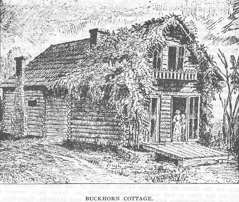
Buckhorn Cottage.
In 1855, just before the war, under the magic of money, a curtous structure arose on the hills near
the lines of Adams and Scioto Counties. It was in a beautiful country, some little way back of
Buena Vista. The cottage was of peeled white poplar logs, resin-varnished and mortar-daubed, it
was therefore peculiar. It was seventy-four feet long by twenty-two feet broad: in two parts, on
the plan of the ordinary double cabin, with a seventeen-foot-wide floored and roofed space
between them. A stone kitchen in the rear is out of the view. The chimneys were also of stone.
Vines were placed to climb over it, which they accomplished in profusion; the summer breezes
fluttered their leaves and the autumnal frosts put on them a blush.
In the Buckhorn lived for a term its owner and architect, Honorable William J. Flagg, and wife, a
daughter of the late Nicholas Longworth, of Cincinnati, with occasional guests to share the
romance of their solitude. On writink to him as an old friend and schoolmate, how he came to
build it, and what he ,did when there, he gave this characteristic reply: "In 1852, 1 bought a tifty
acre tract of hill land near Buena Vista, on the Ohio, through which the line runs that divides
Adams and Scioto Counties, bought it because I supposed
BUCKHORN COTTAGE
there was valuable stone in it. This purchase led, step by step, to the acquisition of something
over 9,000 acres adjacent. I cleared off woods and planted orchards and vineyards to the extent of
more than 100 acres; opened a quarry; built a tramway, until my operations culminated in a log
house on a hill-top, a mile east of the county line and a half mile from the river, where in
different broken periods of the time from '56 till '68, we spent about five years. It was mighty like
being out of the world, but none the worse for that. In that heritage we managed to lodge as
comfortably as in a palace, and feed better than at Delmonico's. Our society, too, was excellent.
William Shakespeare was a frequent visitor; Francis of Verulam was another, he was a
nobleman, you know, a baron, so were others; Viscount Montesquieu, for instanoe, and Sir
Charles Grandison. To prove how agreeable these made themselves, I will mention that the two
packs of cards I provided myself with to pass away
388 - HISTORY OF SCIOTO COUNTY.
the time, were never cut or shuffled but for two games in the whole five years. Buckhorn, as we
called the place, after the form of the hill and its branching spurs, was indeed an ideal retreat. I
have never found a climate equal to it. But even souls at rest in Buddha's Deveghan, after a
certain stay there, feel a desire to live again, and so did we, and we returned to earth. Two years
later the cabin went up in flames. I am glad it did. No insurance."
Mr. Flagg is the author of several books, as "A Good Investment", "Three Seasons in European
Vineyards", "Wall Street and the Woods". etc. This last is a novel description of the wild hill
country in the regions back of Buckhorn, while the characters are mainly drawn from the very
primitive inhabitants who dwell there, made so because of the inaccessibility of their homes,
little or no intercourse being had with the outer world, not even in the way of books and
newspapers; while from the slender area of land for tillage, and the want of other industrial
occupation, there is abundant leisure for meditation and the practice of a wisdom and morality
peculiarly their own.
PORTER TOWNSHIP.
This township has the honor of being the first settled in Scioto County. In the month of February,
1796, Samuel Marshall came from Manchester, Adams County, and built a small cabin just
above where New Boston now stands, and within the present limits of Porter Township. In the
following month John Lindsey also moved from Manchester, to a point on the Ohio near the
mouth of the Little Scioto river. The first white person born within the limits of Porter Township,
as well as the first in Scioto County, was Fanny Marshall, one of the younger daughters of
Samuel Marshall; and the first person married within the County and township was a daughter of
Mr. Marshall to John H. Lindsey, son of John Lindsey. John H. Lindsey afterward became
Captain of the tirst rifle company organized in the county and was afterward known as Captain
John Lindsey. The graves of these two pioneers, Samuel Marshall and John Lindsey, are side by
side near where Scioto Furnace formerly stood. In the previous year, 1795, came Isaac Bonser,
who had been sent out by a number of persons living in Northumberland County, Pennsylvania,
to select a site for a home in the North-west Territory. The next Spring, five families. those of
Isaac Bonser, Uriah Barber, John Beatty, William Ward and Ephriam Thomas set out to settle on
the site selected by Mr. Bonser, the year before. It is claimed by some to be the first attempt at
settlement in Porter Township for the reason that Mr. Bonser selected his place of settlement
before Marshall and Lindsey came from Manchester in Adams County.
Porter Township was organized December 6, 1814, the part east of the Little Scioto was taken
from Green, and the part west, from Wayne Township. The order for forming it is as follows:
"Ordered that the petition for a new township by sundry persons of Wayne and Green Townships
be granted and that the following be the bounds: To begin at Ira Hitchcock's upper corner; thence
on the river up the Ohio to the mouth of the creek; thence up Hale's Creek so far that a due west
line will strike the lower back corner of the Grant; thence with the line of Bloom Township and
Madison Township so far as to strike a due north line drawn from the place of beginning, called
Porter Township."
Later a petition for a change was presented to the County Commissioners and the following order
was made as to boundaries: Beginning at the mouth of Hale's Creek; thence up the creek with the
meanders to where it strikes the French Grant, lots Nos. 54 and 66; thence a northeast course on
the line of the French Grant to lots 78 and 90 to the southeast corner of fractional section 21,
range 20 in township 2; thence north with the original surveyed township line to the northeast
corner of section 36, range 20 and township 3; thence west with the original section line to the
northwest corner of section 36, range 21 township 2; thence south to the Ohio River; thence up
the Ohio River with the meanders to the beginning of the boundaries of Porter Township."
PORTER TOWNSHIP - 389
The Commissioners ordered another change made in the boundaries in 1836: "Whereas William
Montgomery having made application to be attached to the township of Porter, upon examination
of the said application and upon due consideration of the same, it is ordered, that the said
William Montgomery be attached to the township of Porter beginning on the line bementween
sections 23 and 26 in township 2, range 20 where Hale's Creek crosses said line; thence up the
creek with the meanders thereof until it strikes said line mentioned so as to include within the
limits of Porter Township the said William Montgomery." December 7, 1836.
Valuation and Rank.
Porter received its name from Porter Wheeler, son of Major Porter Wheeler. Porter Township
ranks as follows among the townships outside of Wayne; twelfth in area; first in population;
second in real estate; tirst in personal property; second in total of both real and personal property;
the valuation of real estate in 1900 was $382,800; personal property, $315,292; of both
$698,092. The area is 15,709 acres.
Surface, Drainage and Productions.
The surface of Porter Township is very diversified. Most of the lowlands lie between the
Portsmouth and Haverhill Free Turnpike and the Ohio River. This belt of lowlands in the west
portion of the township is about one-fourth of a mile in width, while in the south it is almost a
mile wide and constitutes the most fertile agricultural region in the township. About two
thousand acres of the fertile valley of the Little Scioto lie within the limits of Porter Township.
The portion southeast of the Portsmouth and Webster free turnpike and included in sections 1, 2,
10, 11, 14, 15, and parts of sections 3, 9 and 12, comprise what is known as "Dogwood Ridge,"
and is one of the best wheat producing sections in the county. Considerable attention is given to
dairying on Dogwood Ridge, and many of the farmers own cream separators.
The hills about Sciotoville contain valuable clays for the manufacture of fire and paving brick.
Some coal is found in the eastern part of the township though not in paying quantities. The
principal streams of Porter Township are Pine Creek, which flows in a tortuous course across the
southern portion and the Little Scioto River, which enters the township from the north and flows
in a southeasterly direction through to the Ohio at Sciotoville. The smaller streams are Lick Run,
Wheeler's Run, Ward's Run and Munn's Run All of Porter Township except the hilly region
about Sciotoville is well adapted to farming and dairying. The Pine Creek and Little Scioto
valleys are each very wide. They are easily cultivated and yield a bountiful harvest. Considerable
attention is given to fruit growing and gardening. Many herds of fine Jersey cows may be found
on Dogwood Ridge, where dairying is an important industry. Much of the milk supply of
Portsmouth comes from Dogwood Ridge.
The population of Porter is of English, German, French and Irish descent. Many of its inhabitants
are of foreign birth.
Wheelersburg
is located near the center of the township and is the oldest village within its boundary. It was first
settled in 1820 and was called Concord. It was laid out by Rev. Dan Young and John Young,
October 8, 1824, and the survey was made June 15, of the same year by Samuel Cole. The plat
consists of forty- two lots covering an area of 14 acres. After two years the name was changed to
Wheelersburg in honor of Major Porter Wheeler, an early settler, a noted Indian tighter and a
soldier of the war of 1812.
Plats, Industries, Etc.
On March 21, 1842, Reizin Enslo platted an addition of seven lots containing 1 4-5 acres. On
August 23, 1859, Wheelersburg was re-platted for the purpose of taxation into 105 lots and the
total number of acres in the whole was 30 1-2. On March 26, 1898, J. B. and Ella McCoy platted
an addition of nine inlots, numbered from 2 to 10 and covering three acres.
390 - HISTORY OF SCIOTO COUNTY.
The machinery for a cotton factory was removed from Greenupsburg, Kentucky, to Wheelersburg
in 1822 by Dan and John Young. They erected the factory on the southwest corner of Broadway
and Center streets. This factory was sold by the Youngs to Edward Cranston in 1835 and
removed to where the tlour mill now stands, and changed to a woolen mill. Here it was operated
by the Cranstons until 1897 when Benjamin Cranston removed the machinery and put in a flour
mill. This flour mill has a daily capacity of 50 barrels.
Another important industry at Wheelersburg is the Fertilizer Factory. A drain tile factory was in
operation here from 1871 to 1902, when it was removed to Wellston, Ohio.
Wheelersburg has three churches, three general stores, one drugstore, one undertaker, one
blacksmith, one shoemaker, one harness dealer, two physicians and one contracting carpenter.
Churches.
The Methodist Episcopal Church was organized in 1822. Among its original members were:
Rev. Dan Young. John Young. Hannah Gould, Josiah Merrill and wife, John Hurd and wife.
Services were held at the homes of the members until 1838. when the first church was erected. In
1844 this building was replaced by a new one at an expense of $4,000. Rev. Dan Young was the
first minister. Rev. Patrick Henry is the present pastor. The membership is 175. The church
auxiliaries are the Epworth League and Junior League. The trustees are J. N. Hudson, Thomas
Hartman, William Duis, J. C. Cadot and George Reif.
The Baptist Church was organized in 1879 by J. N. Clark. The first minister was J. A. Roberts.
For the past ten years there have been no regular services.
St. Peter's Roman Catholic Church.
Among the first settlers in the Ohio valley between Ironton and Portsmouth, there were a number
of Catholics. The work about the iron furnaces of Scioto County. attracted Catholic immigrants
from Germany. The Catholics of Wheelersburg were attended in the early days by priests from
Cincinnati. who made regular trips up the Ohio Valley as far as Steubenville. Among those
whose names are known are those of Rev. Emmanuel Thienpont and Rev. Father Hengehold.,
Religious services were held in private houses. When a church was built at Portsmouth,
Catholics of Wheelersburg attended services there.
By 1850 eleven Catholic families had gathered at Lick Run. The names of some of the pioneer
Catholics were Eberhard Frische, Henry Lipker, Michael Delabar, John Mossman, Christopher
Flanagan, Louis Deutremont, Mrs. Abigail Cranston. Gerhard Rolf, John H. Riepenhoff and John
Kundel. With the aid of these men, the Rev. Emmanuel Thienpont built a log church on Lick
Run. It was placed on the top of a hill on the farm of Eberhard Friscfie. Services were held at
intervals by priests who came from Portsmouth or Pine Grove.
Rev. D. M. Winands erected a parsonage in the autumn of 1863 and in November of the same
year, the Rev. Louis J. Schrieber arrived and became the first resident pastor.
Father Schrieber remained three years. After him there came the following pastors: Rev. H. H.
Mayrose, Charles F. Schelhamer, John B. Gambler Aloysius Nonnen, F. Karge, Alexander
Istwann, F. Albert, J. Neumayer, Peter J. Weisenberger, Philip Kuemmert and P. F. Thurheimer,
who lived at Lick Run for shorter or longer periods ranging from a few months to several years.
When Rev. John B. Ritter assumed charge in March, 1880, he found the log church too small, the
location bad and the road to it impassable. He took measures to build a new church on a better
site. A frame church costing $3,0c10.00 dollars was built on the turnpike on Dogwood Ridge, a
mile from Wheelersburg. It was dedicated by Bishop Watterson in November of 1885. The old
parsonage at Lick Run was removed to the new location.
Rev. Joseph M. Wehrle succeeded Father Ritter in 1889. He was pastor for six years and
improved greatly the parsonage and church yard. In January, 1895, Rev. T. A. Goebel assumed
charge. During the seven years of
PORTER TOWNSHIP - 391
his administration the interior of the church was much improved and beautified. In January,
1902, Rev. James T. Banahan was appointed to succeed Father Goebel. He is the present pastor.
Schools.
The tirst school house in Wheelersburg was built in 1822 and John Young was the first teacher.
When the township system of schools was inaugurated, Wheelersburg was sub-district No. 6 of
Porter Township. Jesse Y. Whitcomb was elected teacher in 1845. He was a New Englander and
had advanced ideas regarding education and the management of schools. He thoroughly
organized the Wheelersburg District and so stimulated the people that two years later they built
their present brick building of four rooms. It is now a special district. The teachers at present are
W. S. Dean, Superintendent, $80 per month; W. H. Grady, Grammar, $50; Miss Anna Stout,
intermediate, $45; Miss Jennie Camp, primary, $45.
Lodges.
The Western Sun Lodge No. 91, F. & A. M. located here is the oldest Masonic lodge in the
County. In 1901, it erected a fine two story brick building at a cost of $4,500.
A Knights of Pythias Lodge was organized in 1890 with 26 charter members.
Sciotoville.
This is the largest town in the county outside of Portsmouth, and lies just west of the Little Scioto
on the Ohio river. The Norfolk and Western and Baltimore and Ohio South-western railroads
pass through it. The first house built on the present site of Sciotoville was by William Brown in
the year 1835. The town was laid out in 1841 by Joseph Riggs for Madison Price, James Taylor
and Charles Moore. The plat consists of 25 lots covering 71/2 acres.
Additional Plats.
In 1841, Madison Price platted an addition of 23 lots, numbered from 26 to 148, consisting of
eight acres. In 1851, John Shoemaker platted an addition of 34 lots, consisting of eight acres.
April 10, 1868, the Wilcox additionl of 26 lots was platted. December 19, 1868, Wm. Corwine
platted an addition of 5 lots, containing 1 1/2 acres. In 1870, Samuel McConnell and H. A.
Towne platted an addition of 35 lots containing six acres. On January 28, 1871, William Corwine
platted an addition of 41/2 acres, sub-divided into 23 lots. June 13, 1889, C. W. Turner and wife,
John S. Mann and wife, Ira S. Farney, W. L. Hitchcock and wife, Thomas Brock and wife,
Andrew Daum and wife, Adam Ault and wife, Melvin Moore and wife platted an addition
containing 6.44 acres, sub-divided into 12 lots.
Manufactures.
The manufacturing interest of Sciotoville began in 1847 when Taylor, Decker & Co. operated a
foundry on the present site of the Scioto Fire Brick Works. This was destroyed later by fire. In
1881, Elias Marshall erected and operated a flour mill and edge-tool factory. Sciotoville has
always been a busy town, having had at different times a number of mills, all of which have been
destroyed by fire, but the different manufacturing industries and the one on which it has largely
depended for the past thirty years and for which it has held more than a national reputation is that
of its clay industry, which had its inception about 1863. That year Reece Thomas took from
Powers Hill two barrels of tire clay. It was taken to Ashland and converted into fire brick as an
experiment. The clay proved to be of an excellent quality for this purpose, and shortly after, two
men by the name of Taylor, brothers, from a brick manufactory at Ashland, came to Sciotoville
and opened clay mines, the output of which was shipped to Ashland to be manufactured into fire
brick. In 1864 or the Spring of 1865, Thomas & Taylor moved their brick plant from Ashland to
Sciotoville and began at once the manufacture of tire brick. This plant stood where the Blast
Furnace Fire Brick yard now stands. In 1866, the name of this firm was changed to Taylor,
Connell & Company.
392 - HISTORY OF SCIOTO COUNTY.
In 1865, McConnell, Porter & Company erected a brick yard where now stands the plant of the
Scioto Fire Brick Company. In 1869, Farney, Murray & Company built a yard near where the
Baltimore & Ohio depot now stands. This was generally known as the Salamander yard. In 1873,
the three companies above mentioned were consolidated and incorporated into the Scioto Fire
Brick Company with Daniel F. Connell as manager. In 1873, W. Q. Adams was chosen in Mr.
Connell's place, and served until 1876, when C. P. Lloyd was made President and
Superintendent. No change was made until 1888, when Mr. C. W. Turner was elected
Superintendent. Mr. Lloyd was retained as president until his death in 1893. Mr. Theodore Doty
was elected to till 'the vacancy, but resigned in 1894, and was succeeded by John Peebles, who
was succeeded by C. W. Turner in 1901. Mr. Turner has been Treasurer of the Company since
1894, and is now superintendent. The other officers are: Ira C. Farney, Assistant Superintendent,
Samuel Reed, Secretary. This company manufactured fire brick exclusively until 1894, when
they erected a plant for the manufacture of paving brick. They employ about 100 men and make
all shapes, styles and sizes of fire brick. The capacity is 16,000 fire brick per day, and the paving
brick plant has about the same capacity.
In 1871, the Scioto Fire Brick Company was organized by Samuel McConnell, Judge H. A.
Towne, R. A. Mitchell, M. B. Williams and T. J. Purse for the manufacture of fire brick. It built
what is known as the "Star Yard", one mile west of Sciotoville. Samuel McConnell was the first
president and treasurer, R. A. Mitchell the first superintendent. The capacity of this yard at
present is 20,000 per day. It also manufactures paving brick in the same plant for two or three
months in each year. The capacity of the paving plant is 16,000 per day and it employs 100 men.
This company was incorporated under the laws of Ohio recently, with Simon Labold, President
and Treasurer, Addison Taylor, Secretary.
In 1898, the Blast Furnace Fire Brick Company was organized and incorporated under the laws
of Ohio, with J. W. Bannon, President; D. B. Hutchins, Vice-President and Treasurer, William L.
Hitchcock, Superintendent. It put in operation what was known as the old Blast Furnace Brick
Yard. The capacity of this plant is 12,000 per day. It manufactures fire brick exclusively.
Churches.
The Christian Church was organized in 1867 and during the first fifteen years of its existence
services were held in the old Marshall Hall. The present church edifice was erected in 1881 and
dedicated in September of that year. S. S. Doyle was one of its early ministers. The present
minister is Rev. T. P. Degman. Its membership numbers 125, and the Sunday School has an
average attendance of 85. Ira C. Farney is the Superintendent.
The Free-Will Baptist Church was organized in 1878 by Isaac Fullerton and Uriah Chabot. The
first minister was Rev. Isaac Fullerton. The first meetings were held in the Marshall Hall. There
are 68 members at present under the pastoral care of Rev. Reissinger. The Sunday School
numbers 30.
The Methodist Episcopal Church was organized about 1840 and soon afterward the church
building was erected. In 1838, a revival was held in Sciotoville, in which 200 persons were
converted to the Methodist faith, which resulted in the above organization. The lot upon which
the church stands was donated by Madison Price. In 1866, this house was removed to a lot in the
rear of where it was then standing and is now known as Marshall's Hall., A new church editice
was erected in 1868 and consecrated by Bishop Merrill. The old circuit embraced Wheelersburg,
Sciotoville, Howard Furnace, Wait's Station, Olive Furnace, Vernon and Webster, with tho
parsonage at Webster. Some of the early members were Uriah and Jacob Bonser, Garrett
Kirkendall, Ephriam Yost and Rev. Taylor. Their present minister is Rev. Patrick Henry. There
are 90 members and the Sunday School averages 100.
The United Brethern Church was organized in the year 1851., This church is one mile east of
Sciotoville. Its present minister is Rev. William Wegner.
PORTFR TOWNSHIP - 393
The Porter Free-Will Baptist Church was organized in 1817. Rufus Chaney was the leading spirit
in the organization and was also the first minister. The present minister is Rev. T. S. Arthur.
The German Methodist Episcopal Church on Dogwood Ridge, was organized in 1855. Its tirst
minister was Rev. John Phetzing. Their first church was built in 1858 and was dedicated the
same year by Rev. John Bier. Its membership numbers about 100, with an average attendance at
Sunday School of 60. It has also an Epworth League.
Schools and Lodges.
The Township has long terms of school, has the best teachers and pays them good wages. There
are at present, seven districts outside of Wheelers- burg Special District. District No. 1, includes
the schools of Sciotoville. The building is a two story brick structure containing six rooms,
situated on Market street. The principal of this school, and principal of the Porter Township High
School, is Thomas Sikes. There are five other teachers. The .tirst school house erected within the
limits of the district was a one story frame, which is still in existence, and is used as a dwelling.
The next building was one of two rooms, and was built of brick. Both of these buildings stood
near the present school house.
Sub-district No. 2, is on the Powellsville Pike two miles southeast of Wheelersburg; Sub-district
No. 3, is situated on the Ohio river and is known as the Hayport School. Fred Brown is the
teacher; Sub-district No. 4, is near Wait's Station, on the Webster Turnpike. John A. Stout is the
teacher; Sub-district No. 5, is on Dogwood Ridge, about one mile from Wheelersburg. M. G.
Chandler is the teacher; Sub-district No. 7, is about two and a half miles from Wheelersburg on
the Chaffin's Mill turnptke. L. Finney is the teacher; Sub-district No. 8, is one mile west of
Sciotoville and known as the Star Yard School. Everett Ault is the teacher.
The I. 0. 0. F. Lodge now situated at Sciotoville, was organized at Wheelersburg in 1858 and was
removed to Sciotoville in 1890.
The K. of P. Lodge was instituted May 1, 1890, with 40 charter members.
Cemeteries.
Porter Township being one of the oldest townships in the county, and one of the first settled has
many old ,burying grounds in which are interred some of the earliest pioneers.
Price's Cemetery is situated near Wait's Station. It is sometimes known as the old Marshall
burying ground. Some of the burials are: Jesse Marshall, died December 17, 1866, aged 82 years,
6 months; Mary G., wife of Jesse Marshall, died August 24, 1855, aged 64 years; Clinton
Marshall, died September 16, 1862, at the age of 38 years; Julia Ann, wife of Clinton M., died
January 15, 1856 at the age of 31 years.
Slocum's Cemetery is near Slocum's Station. Some of the interments are Mary Slocum, died Nov.
15, 1832 at the age of 40; Lydia Slocum, died September 8, 1834 at the age of 13; Cyrus Slocum,
died July 16, 1851 at the age of 35; Archibald Slocum, died Nov. 27, 1842 at the age of 24 years;
Joseph Turner, died in 1898 at the age of 74 years; Clarissa Jones, died April 5, 1885 at the age
of 61 years.
In Dogwood Ridge Cemetery at the German M. E. Church, lie the remains of many persons who
were born in Germany.
St. Peter's Cemetery at St. Peter's Church is one-half mile east of Wheelersburg, and was laid out
in 1886.
Another Catholic Cemetery is about two miles east of Wheelersburg.
The principal cemetery of the township is at Wheelersburg, and is located on a low hill
one-eighth of a mile north of the village.
The Hartley Cemetery is in the northeast part of the township in which are buried the older
Hartleys.
There is also a small cemetery on the Hasting's farm about half way between Wheelersburg and
Sciotoville, known as the Rowley Cemetery.
On the farm now owned by Mr. Egbert is the Beloat Cemetery, in which are buried the members
of the Beloat family and the McNeal family.
394 - HISTORY OF SCIOTO COUNTY
Perhaps the oldest boring ground in the township is just above the mouth of the Little Scioto
river. This cemetery contains the graves of some of the pioneers of the township.
RARDEN TOWNSHIP.
Organization and First Settlers.
The youngest of all the townships was organized from a portion of Brush Creek, January 10,
1891, and contains 19,688 acres, ranking ninth in area outside of Wayne. Although the last
organized, it received its first inhabitants shortly after 1800. Among those who settled on Harden
Creek were John Smith, James and Oliver Jones, Charles Ross, Isaac Gifford, John and Matthew
Williams and Enos Mustard. Among those on Mt. Joy were: Willis Bull. . Nathaniel Newman,
Hugh Brown, Jonathan Boyd and James Scott. On Dunlap were: Isaac Newman, Benjamin and
Joseph Walker. The first settler to take up land near the town of Rarden, was Jesse Edwards. His
brother came at the same time and Christopher Newman settled near the line in Adams County.
Others who settled in and about Rarden were: William and Thomas Thompson,
Thornton Kendall, John McCann, Joshua Armstrong, Paul K. Stewart, Thomas Rarden, Thomas
Brown, Aaron Armstrong, James Nelson and Shelton Kendall.
Boundary and Valuation.
Rarden Township is bounded on the north by Pike County, on the east by Morgan and Brush
Creek, on the south by Brush Creek, and on the west by Adams County. No changes of any
consequence have been made in the boundary since its organization. The assessed value of its
personal property in 1900 was $61,798, and it ranked 10th; value of real estate, $80,470; rank
15th; the total valuation of property of all kinds was $142,268, and its rank was 14th.
Surface, Drainage and Products.
It is watered by Brush Creek which enters from Adams County and crosses the southwest corner,
and by its tributaries: Rarden Creek which rises in the northern part of the township 'and joins
Brush Creek west of Rarden; Dunlap, which flows from the southwestern part and joins Brush
Creek at Rarden; Dry Run, which courses along just west of the southeastern boundary and joins
Brush Creek near Young. Besides these there are numerous other small affluents.
The surface is very much broken and much of it is very stony. The northeastern portion known as
Mt. Joy, is a high table land of about 2,000 acres, well situated for agricultural purposes.. The
soil is rather gravelly and of average fertility. Large quantities of corn, wheat, oats, hay, potatoes,
etc., are raised. This region is admirably adapted to fruit growing and the annual crop is very
large. Being high and dry, it is well fitted for stock raising, especially for sheep raising. In the
southern end of the township is another region similar to the Mt. Joy region, much smaller in
extent, but similar in most other respects.
There are many small, narrow valleys that are farmed and would probably produce well if
properly cared for and improved; but the most productive portion of this township lies along
Brush Creek and extends throughout its course through the township. It is from a quarter to a half
a mile in width. Many of the slopes of this valley are farmed also. Much of the valley is flooded
each year, and where the current is not too swift, a liberal deposit of sediment is left to enrich the
land. This valley produces well in cereals and tobacco.
Progress and Development
Prior to 1850, there seems to have been but little progress among the inhabitants of all the region
west of the Scioto Valley. In fact if we are to be-
RARDFN TOWNSHIP - 395
lieve the stories told us by persons who lived in this section at that time, and by persons who
travelled through it, there must have been a decided retrograde. The country was one vast
expanse of forest with foot paths and bridle paths leading through it. Small farms were cleared up
here and there and log cabins housed the inhabitants. Churches and schools were very scarce, yet
there were a few log school houses prior to 1830. A "dirt road" lead from northern Adams
County and southern Highland County down Brush Creek to Portsmouth which was the nearest
market for this region. Over this road, since converted into a turnpike, were hauled great loads of
corn, wheat, and other farm prducts from Adams and Highland Counties in the large old
fashioned wagons, pulled by four strong horses. This farm produce was exchanged at Portsmouth
for groceries, dry goods and the thousand and one things that add to the comfort of man, and
these articles were taken back to stock up the country stores and to be used by the farmers and
tradesmen. From northern Adams County to Portsmouth was two days' travel and at Moses
Freeman's brick farm house on the site of Otway was the middle point and stopping place for the
night.
When the early settlers from 'Pennsylvania began coming into this region along in the forties,
they found a people, who, partly from their isolation, and partly from necessity, had adopted
primitive ways of living and had patterned much after the Indians, in their mode of dress. They
farmed in a way and hunted much more, getting much of their living in this way. The men wore
moccasins of buckskin, and hunting shirts, such as the Indians had worn. They carried their rifles
with them when they went abroad, that they might take a shot at any game they might see.
Whiskey was sold at houses here and there and on special occasions a crowd of natives would
collect in on horseback from the surrounding country and after a thorough carousal, would gallop
off together yelling and howling like a mob of Indians. For all these peculiar traits the
Pennsylvanians called them "Pottawattomies," and the region about Rarden they called
"Moccasin." Progress in this region was slow until the advent of the railroad, which opened up its
resources and gave opportunity for mingling with the outside world. With the railroad, came
saloons, and following saloons, as a natural sequence, came fights and drunken brawls in which a
large number of fatalities occurred.
The past fifteen years have witnessed the disappearance of much of this eruptive influence. The
people have entered upon a life of real progress, and to one who had travelled in this country fifty
years ago and had beheldl the rude manners and customs, it would seem that the day of miracles
had not yet passed. He would gaze upon a country all but stripped of its wealth of timber, the
destruction of which 'gave employment to its people and added comfort to their homes, and all
the tillable portion converted into productive and well kept farms. He would see its small
settlements grown to good sized villages alive with enterprise and industry. He would
contemplate that of which the most optimistic had never dreamed, the lifting from its hills of
their mighty blocks of stone to be transported to foreign parts and transformed into massive walls
and beautiful homes for the abode of man, a great industry but now in its infancy and a Golconda
for future capitalists.
Officers.
The first officers of this township were: Trustees, S. S. Blosser, Milton Mustard and William
Keese; Clerk, D. A. Gardner; Treasurer, William Newman; Constables, William M. Burnett and
William Hackworth; Justices of the Peace, A. B. McBride and J. N. Kates; Assessor, T. F.
Freeman. The present officers, 1902, are: Trustees, Martin B. Wharff, T. S. Riley and Charles
Freeman; Clerk, George B Coakly; Treasurer, D. T. Blackburn; Constable, John W. Newman;
Assessor, William J. Thompson; Justices of the Peace, J. N. Kates and 0. E. Foster.
Rarden.
As above stated this place was given the name of "Moccasin" by the early Pennsylvania settlers.
It is located on the north side of the Brush Creek Valley near where it receives the waters of
Rarden and Dunlap Creeks, and about one and a half miles from the Adams County line. The
first store
396 - HISTORY OF SCIOTO COUNTY.
was opened by Asa L. Williams about 1846. Later came Aaron Moore, William Brooks, Eli
Rigdon and Philip Leighly. Orville Grant, brother of Ulysses S., Andrew Montgomery and
Milton Morrison built a tanyard here before 1850. During the war they made cavalry saddles for
the government. Grant and Williams became the owners, about 1865. After four or five years
they sold to S. S. Jones, who operated it until 1878 when it was turned into a pump factory. It
burned about 1885.
Orville Grant gave the place the name of -Galena" for his former home in Galena, Illinois. This
name was adopted when the first plat of the town was made October 10, 1850. This plat
contained 12 acres, taken from surveys, 7,808, 2,850 and 2,345, owned by B. Edwards, Aaron
Moore and the heirs of Jesse Edwards. There were forty-five lots in the plat numbered from 1 to
45. Four additions were made July 5, 1883: lots 46 and 49 to 59, by Thomas Newman; lots 47
and 48, by John Williams; lots 60 to 65, by E. D. L. Morgan; . lots 66 to 73, by Grafton Windle.
These additions aggregate a little over ten acres. On April 14, 1891, Amos and Ella Jenkins
platted an addition containing 7 acres. The lots were numbered 74 to 79 and were part of Survey
7,808. The town was incorporated in 1886 and the first officers were Michael Freeman, Mayor;
D. A. Gardner, Clerk; R. W. McNeal, Solicitor; and Scott Foster, Marshall. Its present officers
are: J. J. Forsythe, Mayor; J. M. Wikoff, Clerk; D. T. Blackburn, Treasurer. The members of the
council are: L. A. Scott, John W. Newman, Bert Scott, William Burnett, Clark W. Waller and F.
W. Ballangee.
The assessed value of real estate in Rarden Corporation in 1900 was $20,990; personal property,
$21,522; total, $42,512. The value of real estate in the Special School District outside of Rarden
Corporation was $18,390; personal property, $10,064; total, $28,454.'
The town received the name Rarden after Thomas Rarden, one of the earliest settlers in that
vicinity.
The business is at present done by the following: L. Taylor, D. T. Blackburn & Son, William T.
Hackworth, General Merchants; Bert Scott, Blacksmith; Ed. Abbott, Livery and Feed Stable;
Sarah. Abbott and Mrs. D. M. Stewart, Hotels; Doctors, J. H. Windle and H. F. Clark.
The Barden Stone Company.
This is one of the representative firms of stone industry of the county. Their quarries are located
about one mile west of Rarden on the Norfolk and Western Railway, and are equipped with all
the latest improved machinery for handling earth, quarrying and handling stone rapidly at a
minimum expense. It uses a Barnhardt Steam Shovel and a large traveling crane designed by
Kaltenbach and Greiss of Cleveland, in uncovering stone. It uses the Ingersoll-Sergeant Drill
Company's steam drills and the Knox system of drilling and blasting in quarrying stone. Its
machinery is so far perfected that it splits stone either with or across the grain, as evenly as wood.
The present capacity of the Company, while greatly hampered on account of the inability of the
Railroad Company to furnish sufficient equipment to handle its output, is from fifteen to twenty
thousand cubic yards per year.
The stone produced by this company quarried from two ledges sixty and sixty-six inches
respectively, is a sand stone locally known as freestone, and is of a light buff color. It is used for
building, paving and bridge purposes. It is free from iron or alkali, and does not disintegrate from
extreme exposure.
The Company commenced business in 1895 and consisted of C. C., F. M. and C. W. Waller, who
came to this county from Fairfield County, Ohio, where they had operated a sandstone quarry,
and on finding a suitable location for a quarry interested Mr. L. Taylor in the enterprise, who
purchased the land on which the quarry was located and with the Waller Brothers organized and
incorporated The Rarden Stone Company in July, 1895.
The officers of the Company are: V. E. Taylor, President; C. W. Waller, Vice-president; F. M.
Waller, Secretary; L. Taylor, Treasurer and C. C. Waller, Superintendent.
The success of the business since its organization has been remarkable. It has most encouraging
prospects for the future and the management is fully able to take care of it.
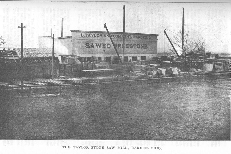
RARDEN TOWNSHIP - 397
The Forsythe Quarry
was the first quarry opened at Rarden about twelve years ago, and is now lying idle. It produces
the same quality of stone as that of The Rarden Stone Company, and a great quantity of rough
stone was formerly shipped from this quarry. It is owned by Abraham Forsythe.
The Cooper Shops
are owned and operated by The Taylor Cooperage Company. These shops were established
shortly after the railroad was built and were at first merely a stave mill owned by Guilford Marr.
Later the manufacture of barrels was begun. During its existence it has been destroyed by fire and
rebuilt three times. It has been very much enlarged and is the only establishment of the kind in
the county. It manufactures all kinds of tight cooperage and its output is 40,000 packages, worth
from $30,00 to $40,000 annually. L. Taylor and Charles S. Brown are owners and Mr. Brown is
manager.
Schools, Churches and Lodges.
The first school house stood back of the Red Men's Hall and was built of logs. Another was built
on the same spot and was burned in 1886. This year a two-story frame building was erected.
There are four departments and the schools are among the best in the county.
The Rarden M. E. Church was begun in 1887 and completed in 1897. This church dates its
organization back as far as 1820. The church cost $2,000. The minister is Rev. Phillips. The
membership is 75 and average attendance at Sunday School is 70. The present trustees are: A. B.
McBride, Charles C. Waller, Alex. Mullen, G. M. Wikoff and Charles S. Freeman.
The Rarden Christian Church was organized May 6, 1902, with 16 members and a Sunday
School of 70. Its minister is Henry Canter. The congregation has not yet built an edifice but holds
its meetings in the Red Men's Hall.
The lodges are No. 159 Improved Order of Red Men and Lodge No. 562, G. A. R.
Mt. Joy.
The region known as Mt. Joy received its name for Thomas Mt. Joy, an early land speculator
who located about 2,000 acres covering this locality. Mt. Joy never lived here, but lived near
Maysville, Kentucky. He made yearly visits to collect his rents and to look after his land. The
name is also applied to a small settlement in the north-eastern part of this tract at the head of
Bear Creek. The post office has this name also, and 0. E. Davis is postmaster. The business of
this place is carried on by H. Adams & Son and 0. E. Davis, general merchants.
The Scioto County Agricultural Society,
formerly known as the Mt. Joy Fair, was inaugurated under the auspices of the Mt. Joy Farmers'
Institute. The first fair was held August 26 and 27, 1895. Its first officers were W. A. McGeorge,
President; D. T. Blackburn. Secretary and Treasurer and they have continued as such since. The
name was changed the following year to the Tri-County Fair Association. The old Scioto County
Agricultural Society having become disorganized, by application of the managing board, to the
State Agricultural Board, this Association was recognized as the Scioto County ,Agricultural
Society in 1899.
Churches.
The United Presbyterian Church is about a quarter of a mile due west of Mt. Joy post office, and
was built about 1855. Its first minister was Rev. Bonner. The church was once destroyed_ by fire
but was afterwards rebuilt. It formerly had a very large membership, but of late years it has only
about forty, and services are conducted by Rev. Joseph C. Hamilton, of Peebles. The trustees are
W. J. Shannon, M. L. Bonner and W. A. McGeorge.
The Christian Church. - This organization dates its existence from 1854. Meetings were first held
in the Mt. Joy school house and Rev. Matthew Gardner was its first minister. In 1867 a log
church was built,. which is still
398 - HISTORY OF SCIOTO COUNTY.
standing and in use, but has been weather-boarded. It stands on west Mt. Joy, about three miles
from Rarden and the same distance from Mt. Joy. The first minister to preach in this church was
Rev. John Shelton. Its members number 125 and its Sunday School has an average attendance of
50. Rev. Henry Canter is the pastor and David Day is Superintendent of the Sunday School.
The United Baptist Church, is known as the "Hackworth" church. The organization was effected
about 1884 and a church was erected the following year on west Mt. Joy. The members number
forty and the Sunday School averages about fifty.. John Carry is Superintendent, Rev. Breech is
the minister.
Harmon Christian Church, situated in the northwestern part of the township at the head of Rarden
Creek, was built of logs about 1875 by an organization of Protestant Methodists. This
organization ceased to exist about 1887 and by permission the Christian organization uses It. Its
minister is John Q. Law. It has about 75 members and ,a Sunday School of 100.
United Baptist Church.- There are two organizations in the southern part of the township, one on
Hoffer's Hill and one on Dunlap Creek. The former was organized in 1884 and the latter in 1901.
They each have about forty members and a Sunday School of about 50. They hold their meetings
in school houses and Rev. Breech is their minister.
Schools.
When the township was taken from Brush Creek in 1891 the school districts were re-numbered.
The first meeting of the board was held at the Dry Run school-house and Nos. 1, 3, 5, 6, 7. and
13 were represented. There are seven districts well distributed over the township and the term of
school averages only three months and one-half yearly. The salary paid the teachers is uniform,
each district paying $35 per month. There are 309 pupils enumerated in 1902. Sub-district No. 1
is on East Mt. Joy. No. 2 is on West Mt. Joy. No. 3 is up Rarden Creek. No. 4 is up Dunlap
Creek and the house was built in 1899. No. 5 is on Hoffer's Hill. but was not used last year. A
new house is being erected this year. No. 6 is up Rarden. No. 7 is southwest of Mt. Joy.
Cemeteries.
The only township cemetery is the one near what is known as the Log Church on West Mt. Joy. It
is about three miles northeast of Rarden and contains one-half an acre, a part of the James M.
Scott farm. It is a commanding spot, high above the surrounding country, from which, in
summer, the succession of green hills melt away in the distance enwrapt in a misty haze. In this
spot and in the one on East Mt. Joy rest the mortal remains of more soldiers of the civil war than
are found in all the other cemeteries in Brush Creek and Rarden Townships.
The Newman Cemetery situated about one and a half miles west of Rarden in Adams County is
one of the oldest burial grounds in this locality. It was made a joint cemetery in 1899. Franklin
Township, in Adams County, and this township each pay half the expense of keeping it in
condition. It contains two acres and was formerly a part of Garrett Newman's farm. A number of
the early pioneers are buried here.
The Duke Cemetery is up the dry fork of Rarden Creek and about three miles from Rarden.
Besides the above named cemeteries there is one on Mt. Joy which contains the remains of many
of the earliest settlers. A new cemetery has recently been opened on Hoffer's Hill.
RUSH TOWNSHIP.
Rush Township is the youngest of all the townships but two, and was organized from. a part of
the territory of Union, June 3, 1867. A petition was
RUSH TOWNSHIP - 399
presented by Levi Kirkendall and others to the Commissioners praying for the formation of a new
township from the territory of Union. Another petition or remonstrance was presented by
Milburn Coe and others against this procedure. The Commissioners after due consideration
found that the petition for forming a new township had been signed by a majority of the
householders of Union Township; that the territory proposed for a new township contained 22
square miles; that the territory of Union after such division was 22 square miles; and that it was
necessary and expedient to form a new township, so it was "Ordered, That a new Township be,
and the same is, hereby laid off designated from the territory of said Union Township as prayed
for in said petition; and it is further ordered, that said new township be known by the name of
'Rush.' And it is further ordered, that the County Surveyor, or other competent surveyor proceed
immediately to survey and establish the line dividing the said new from the said old township as
nearly in accordance with the prayers of the petitioners as practicable, and forthwith report the
boundaries of said new township to this board and that the same be recorded in a book kept for
that purpose, and it is further ordered, that an election be held at the school house near the mouth
of Brush Creek in said new township on the 17th day of June, 1867, for the election of township
officers for said new township of 'Rush.' "The Commissioners appointed James Boldman,
Surveyor, in accordance with the foregoing order and further ordered that the Auditor issue an
order to James Boldman directing him to make said survey. June 3, 1867.
The township as it now stands, and no changes of any consequence have been made since the
organization, is bounded on the north by Morgan, on the east by the Scioto, on the south by
Washington and on the west by Union Township.
Surface, Drainage, Etc.
This township has much valuable farming land most of which lies along the Scioto River. Other
farm land, though not so productive, lies along Brush Creek. Pond Creek and Duck Run. Besides
this there is some terrace land along the Scioto Valley that produces well for upland. That part of
the township south of Brush Creek is very hilly, while there is much rolling land in the northeru
part, affording excellent upland farms. Though the whole township was formerly well wooded,
the timber has practically disappeared. Much of it had been shipped on the Canal previous to the
building of the Cincinnati and Eastern Railroad. Since that it has disappeared very rapidly.
Brush Creek crosses the middle of the township from west to east. Pond Creek enters toward the
southwest corner and flows across the southern end and empties its waters at the north end of the
Big Island into the Scioto River. Duck Run enters the township from Morgan and flows
southeasterly and empties into Brush Creek at Rushtown. The Ohio Canal crosses it from north
to south following the border of the hills. The Norfolk & Western R. R. crosses the township
along the valley of Brush Creek and the Ohio Canal and has tfiree stations within the township,
to-wit: McDermott, Rushtown and Wharton.
Early Settlers.
The township was named for Dr. Benjamin Rush. The first settlement must have been about
1796 or 1797 by Abraham Wykoff, who died in the township "August 11, 1799, aged thirty-eight
years." His tombstone with this inscription on it is found on the river bank about three hundred
yards north of the Bethany Brick Church. Gen. William Kendall built boats and ran a mill near
the mouth of Brush Creek. The first boat ever built inland was constructed here in 1818 by
William Lodwick. The Utts came- in 1797. Later came Samuel G. Jones, George Heroedh,
Thomas Arnold, James Wallace, Thomas Jones, William Russell, John Shultz and Daniel
Kirkendall.
Summer Resorts.
Creighton Inn is near the station on the Norfolk and Western at Rush- town and is beautifully
located in a quiet, shady and secluded spot overlooking the Scioto Valley.
400 - HISTORY OF SCIOTO COUNTY.
Camps Arlon and McCulloch are equally attractive in their rustic surroundings and are ideal
resorts for summer outings.
Valuation, Area and Rank.
The assessed value of real estate in 1902 was $142,540; personal property, $59,134; total,
$201,674. The rank among the townships outside of Wayne in each respective valuation, is tenth,
twelfth and tenth. It contains 14,300 acres and ranks fifteenth outside of Wayne in size.
McDermott
was platted July 28, 1898, by the McDermott Stone Company, James Barker and Honor Barker.
The plat contained 27 acres sub-divided into 113 lots numbered serially from 1 to 113, and is a
part of Survey No. 7,630. The chief business enterprise here is the McDermott Stone Company.
The McDermott Stone Company.
The general offices, mills and quarries of this Company are at McDermott, a thriving town on the
Cincinnati division of the Norfolk & Western Railway, ten miles northwest of Portsmouth. The
properties owned by The McDermott Stone Co. a large acreage underlaid with Ohio's best
sandstone deposit, had been operated separately, and on a small scale for more than forty years,
until the year 1897 when they were presented to the attention of William and Michael
McDermott, two successful and expert quarry operators of National reputation. After a thorough
investigation, they decided to purchase the different properties and organize them into one
Company, equipped with modern facilities, so that the Stone could be produced promptly and
shipped in large quantities. As a basis for carrying out this plan, the lands were purchased, in the
year 1897, the mills were erected and the standard gauge railroad tracks were built, connecting
the various quarries with the main line of the Norfolk & Western Railway. The property was then
taken over by the McDermott Stone Company, which was organized and incorporated under the
laws of Ohio, March 23, 1898, with an authorized and paid up capital stock of $100,000.00. The
improvements in methods and equipment have continued under the management of R. B. Eglin,
President; George A. Dickens, Vice President and John S. Smith, Superintendent, until at the
present time this Company and its product ranks among the highest In the building and
architectural trade. The mills are equipped with a special idea of quick and accurate work, all
material being handled automatically into and out of the mills and loaded on the cars ready for
shipment to the most distant points.
The gangs which do the sawing are screw feed and pipe sides of, the latest designs. The sand and
water for cutting the stone are distributed by a sand pump and conducted to their proper position
for doing the work under the steel saws without human assistance. The property is also equipped
with an electric light plant so that sawing and shipping are carried on constantly night and day,
throughout the entire season. The branch railroad which is owned and equipped by the Company
consists of over three miles or standard gauge railroad track built of 56 pound rails, with rock
ballasted road bed throughout its entire length. It is a perfect sample of railroad construction. The
motive power employed is a standard, ten wheel, Brooks locomotive, and the equipment consists
of numerous flat cars and side dump cars. In the quarries, the same complete manner of
equipment is followed, all derricks are operated by steam holsters from a central power station,
and all are of thirty ton capacity, very heavily guyed to insure strength and safety. Steam drills
and channeling machines are employed in quarrying the rock from its natural formation. A steam
shovel is used in removing the top soil which overlays the stone. Owing to the large amount of
machinery used by them they have now established a model machine and blacksmith shop at the
plant for their own use, which is prepared to do all classes of work in that line. The Company
employs a very large force of men, a majority of whom have acquired their own property and
built homes at or near the town of McDermott, giving the place a very active and thriving
appearance.
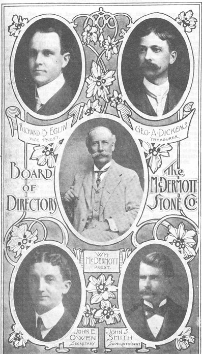
RUSH TOWNSHIP - 401
Since the quarries have been operated by this Company, the stone is known and sold from Boston
to the Missouri River and from Canada to the Gulf of Mexico. The Company has salesmen on the
road constantly, visiting new territory and increasing the demand for the McDermott Stone which
has secured an enviable reputation and has become recognized as a standard material for building
and sidewalk work. It is greatly admired for its durability and attractive appearance. Many
buildings both public and private have been built or trimmed from it, a few of which may be
mentioned as follows: The Court House at Williamson, West Virginia; The Kentwood Bank,
Kentwood, Louisiana; St. Mary's Home, Green Bay, Wisconsin; City Hall, Whitewater,
Wisconsin; Baptist Church, Portsmouth, Virginia; Insane Asylum, Topeka, Kansas; and many
others of equal importance. The quarries present a remarkably interesting appearance to the
visitor, the stone being formed in natural ledges, varying in thickness up to five feet, all of which
is overlaid by a covering of earth averaging from ten to twelve feet in depth. The heasier ledges
are sawed to size, for steps, caps, sills, etc., or shipped in rough dimension blocks to destination
where it is prepared by the stone cutters for its final position in the building. The few thin ledges
in the quarry, known to the trade as Flat Rock, are used for footing stone and similar work. The
flat rock used for the footings in the Neave Building at Cincinnati, Ohio, upon which the weight
of the ten story walls rest, came from these quarries. Over three hundred cars of flat rock used in
the stone retaining walls of the Miami Canal when it was rebuilt through the city of Cincinnati in
1901, came from McDermott. The stone is used for bridge abutments and piers at various places
along the line of the Norfolk & Western Railway between Cincinnati, Columbus and Norfolk,
Virginia. It has also been used extensively by the Cincinnati, Hamilton & Dayton and the
Pennsylvania Railroads.
Churches.
The Methodist Episcopal Church at McDermott was organized in 1899 and a church building
was erected. The membership is 25 and the average attendance of the Sunday School is 40. Rev.
W. Phillips is the pastor. F. C. Smith is Superintendent of the Sunday School. The trustees are
Mrs. C. C. Hulett, Miss Magnolia Smith and Miss Emma Dodds. In this place the women, as
elsewhere, have a monopoly of religious affairs.
A suspension foot bridge was constructed across Brush Creek near the Arnold school house for
school purposes in 1884 at an expense of $495. James M. Russell was the contractor. The bridge
is 312 feet long and 4 feet wide.
The organization of Bethany Baptist Church dates its existence from November 30, 1834. Mr.
George Heroedh built the brick church and donated it to the society. It was incorporated this year
with 127 members. Mr. Heroedh was the first Clerk. Elder Burnett was the first regular preacher.
In 1898 Rev. A. K. Murphy led a movement to build a new church. A beautiful and modern
structure was soon completed and dedicated on the second Sunday of May, 1900, costing $3,000.
The Rev. Willis is pastor.
The Methodist Episcopal Church at Rushtown was organized in 1868. J. D. Baker was the fisrt
pastor. The organization remained intact until 1895 and during that time the following is a list of
the pastors: E. V. Bing, Samuel Bateman, C. M. Pryor, C. B. Lewis, Thomas Leslie. W. F. Filler,
S. A. Crossley. William Donelson and H. Burkstresser, J. H. Rogers, Thomas Hass, J. W. Blair,
Rev. Kling and W. A. Hunter. The charge was discontinued in 1895.
Schools.
There were originally five school districts in Rush Township when it was created, and there are
now seven. The different school houses are located as follows: No. 1 is on Pond Creek; No. 2 is
on Duck Run near the old R. M. Owen place, on the Rickey farm; No. 3 is the Upper Pond Creek
school; No. 4 is the Kirkendall place; No. 5 is on Brush Creek on the George Arnold place; No. 6
is on Upper Duck Run close to the Inskeep Stone Mill, called the Hannah School House; No. 7
was originally located on Dever's Run, but now stands on the Doll farm, close to the Lucasville
bridge.
402 - HISTORY OF SCIOTO COUNTY.
Cemeteries.
The Heroedh burial ground became a township cemetery April 13, 1881. It is near the mouth of
Brush Creek on an elevated piece of ground. George Heroedh and William Russell located it and
the latter was to be the first interred therein. Russell and his son Robert died September 25, 1845,
and were both interred in the same grave. From this time on it became a general burying ground.
It contains 1.68 acres and was donated to the township by Levi and Sarah Kirkendall. On July 14,
1899, Mrs. Kirkendall deeded one additional acre to this cemetery for a consideration of $200.
The Hayman or Lucas graveyard is on Pond Creek. Some of the burials are: William Lucas, Jr.,
died October 23, 1837, aged 31 years, 7 months and 14 days; Gen. William Lucas, died
September 10, 1805, in the 32nd year of his age; Joseph Lucas, (Associate Judge), died August
12, 1808, aged 37 years; Hannah Lucas, (his wife,) died April 8, 1857, aged 82 years, 10 months
and 18 days; Elizabeth Lucas, consort of William Lucas, died August 16, 1835, aged 37 years;
William Lucas, born November 20, 1799, died March 15, 1854; Samuel Lucas, died April 4,
1885, aged 55 years, 7 months and 24 days; Sarah Noel, consort of Andrew Noel, died January
21, 1841, aged 32 years, 2 days. This burial ground is no longer used.
At the Brick Church is another burial ground.
There are three burial grounds on the Wilson farm now owned by the Crow Brothers.
UNION TOWNSHIP.
Organization and Boundary.
Union Township was one of the four original townships laid out at the house of Judge John
Collins in Alexandria on August 9, 1803. It was then the second largest township in the county
and included all that territory now belonging to the following townships; Brush Creek, Rarden,
Union, Wayne and Clay, and portions of Morgan, Nile, Jefferson, Valley, Madison, Harrison and
Porter. Its boundary was as follows:—Beginning at the mouth of Feurt's, now Carey's Run,
thence up the Ohio river to the mouth of the Little Scioto; thence up said river to old Mr.
Monroe's; thence west to the twelve mile tree on the Big Scioto; thence in a westerly direction to
strike the dividing ridge between Brush Creek and Bear Creek; thence including all the water of
Brush Creek to the county line; thence south with said county line to the dividing ridge between
the Ohio river and Brush Creek; thence with said ridge to the head of Carey's Run; thence down
the said Run to the Ohio river.
By reference to the separate histories of each of the above townships, knowledge can be had of
the successive and frequent changes in its boundary and the curtailment of its territory. From one
of the largest it has shrunk in size from the second rank to the fifth and contains at present 29,918
acres. Portsmouth was in Union Township until 1812 when it was first divided. On November 6,
1814, a part of Seal Township was attached to Union. Prior to 1878, the eastern and southern
boundaries of the township were as at present and the northern and western boundaries were the
east fork of McCullough, Brush Creek and Bear Creek and it contained' 19,118 acres. On
September 26, 1898, a portion was taken from Brush Creek Township and Union became as it is
at present. Numerous slight changes have been made to accommodate persons along the border,
for school purposes and various other reasons. It is now bounded by Rush, Washington, Nile and
Brush Creek. Assessed value of real estate, $85,390, rank fourteenth; personal property, $37,361,
rank fourteenth; total, $122,751, rank fifteenth.
Officers.
In 1809 the trustees were Perry Liston, James Norris and Peter Noel; Clerk, S. G. James; 1810,
Trustees, James Norris, Peter Noel and Benjamin
UNION TOWNSHIP - 403
Raukin; Treasurer. Benjamin Feurt: Clerk, S. G. James; Overseers of the Poor, Philip Moore and
John White; Fence Viewers, John R. Turner and Warren Johnston; Constable, William Howell.
The above are not the first officers but are the first that could be found as all the early records up
to 1873 have been lost or destroyed.
Surface, Drainage and Productions.
The surface is very much cut up by Brush Creek and its tributaries. This creek passes by a
winding course from west to east through the township and receives Bear Creek from the South,
near Henley, and McCullough Creek from the north. Before leaving the township, it makes a
tortuous bend to the north, then to the southeast and then to the southwest. This is called the
"horse-shoe bend." Bear Creek takes its rise in the southwest and flows northeast. McCullough
enters the township from the north by two branches called the east and west forks and flows
south. These tributaries tlow through narrow valleys and fiave in many places very rapid
descents. The land along them is of average productiveness and most of it is farmed. The chief
fanning region of the township is the Brush Creek Valley which has an average width of about a
quarter of a mile, passing entirely across the township. All this valley has been cleared up and
converted into farms. The soil is gravelly and loose and produces abundantly of corn, wheat, oats,
potatoes, hay, tobacco, etc. There is a region of good farm land about Lombardville known as the
"flats" which was the first portion of the township settled. This is a high region, shut in by hills
on all sides and drained by Pine Creek, a small tributary to Bear Creek. Scattered over the
township are good hill farms which are well adapted to fruit raising.
Twenty-five years ago this region was almost a wilderness of forest, and even up to the time the
Cincinnati and Eastern was built there were thousands of acres that had scarcely been touched by
the woodman's axe. The same can be said of all the region watered by Brush Creek, west of the
Scioto. The terminal of the Cincinnati and Eastern Railroad was at Henley in 1883; and the years
followlng this witnessed the conversion of the forests into lumber of all descriptions and its
shipment to foreign parts. There yet remain a few tracts of good timber in different parts of the
township, the largest of which is known as the "Peebles Tract." and lies in the southwest corner
at the head waters of Bear Creek.
The great industry for the future in this region, which is now but in its infancy, is the stone
business. The whole township is underlaid with fine sandstone suitable for building purposes,
and only lies waiting the advent of capitalists to open up the numerous quarry sites, many of
which are convenient to the Norfolk and Western Railroad. For many years this stone has been
used for local building purposes but not until 1890 was any extended effort made to open up a
large quarry. This year the Henley Stone Company was organized. It was composed of the
following: John Peebles, Robert Peebles, Richard Peebles, President; T. N. Martin, Secretary and
Charles McDonough. The quarry was opened the same year and continued in operation until
1898, when the company suspended work on account of the failing health of Richard Peebles, its
manager.
The Wellmann Stolle Company,
composed of A. J. Wellmann. President and Manager; E. M. Wellmann, Secrementary and
Treasurer: Henry Wellmann. Edward Grieve and John Baron, was organized and incorporated
under the laws of Ohio in February, 1901, with a capital stock of $25,000. This company
immediately purchased stone land and opened up two quarries northeast of Henley, about a
quarter of a mile. Though just beginning. it is working twenty ledges, ranging from one to six
feet in thickness, and is shipping very rapidly. Its channelers, drills, etc., are manufactured by the
Ingersoll-Sargeant Company, and all the latest and up-to-date methods are used in quarring. It has
for hoisting purposes, large steam derricks, controlled wholly by the engineer. This point
promises to have one of the largest stone industries in the county.
404 - HISTORY OF SCIOTO COUNTY.
Henley
is located near the junction of Bear Creek with Brush Creek, and is on the line of the Norfolk and
Western Ry. Since the construction of the railroad it has been the shipping point for lumber and
timber products of all kinds.
The first store was conducted by J. W. O'Brien in 1882. The same year Peebles, Terry & Co.,
came and opened up a general store, and dealt lumber. Deitrich & Co. came at the same time, and
had a general merchandise store. The post office was established in 1883, and J. W. O'Brien is
postmaster.
Lombardville.
The first settler in this vicinity was Benjamin Feurt, who built a still at a place called Stony Hill,
and the country around was called "Feurtls Flats." This was about 1802. William Drake entered
this land. Among the first settlers here were John McConnell and William Jewett. The place
received its present name from Francis Lombard, who located there about 1862. The post-office
was established in 1868. Julius Johnly built a cooper shop about 1870 and ran it for sixteen years.
The place was settled along in the sixties by French and Swiss people. Julius Johnly is the
present postmaster.
Other postoffices in the township are Crabtree, Comstock, Freestone and Anion. Glen Hunt,
McCullough and Anion are camping sites.
Churches.
As late as 1883 there were no churches or church organizations in the township, and the only
meetings were held at residences mostly by local preachers. At present there are five churches in
the township and several other organizations have risen and declined in that time.
St. Patrick's Roman Catholic Church was built in 1902 at a cost of $800. It is situated on the west
fork of McCullough and is about four miles from Henley. There was a former church erected in
1876 on the same site. This church has 110 communicants and services are held three Sundays
each month and Sunday School each Sunday. Rev. Joseph Mertian is the Priest.
Holy Trinity Roman Catholic Church was built in 1854. Ferrole Levrey donated an acre of land
for the location of the church and other members donated money. The house is a frame to which
has been added two additions. Its value is about $700.00. For twenty years it had no regular
minister. It is visited by a priest from Portsmouth, once a month during the summer season, and
sometimes by priests travelling. The incumbent priest is Father Joseph Mertian, who resides at
McCullough. The membership now is about twenty-four families, about one-half what it was
twenty years ago, the others having moved to the City, or gone West, principally to Illinois. The
Sunday School is under the supervision of the church directors, who appoint a teacher to teach
the children. The trustees are Eugene Cattee, Julius Simon and T. J. Vernier.
Singer Chapel, Methodist Episcopal Church was built by Rev. A. D. Singer in 1889 at a cost of
$450. The church is about three-fourths of a mile from Crabtree. The organization was effected
in 1884. Rev. Singer was the first and last pastor. The membership was at one time thirty
members.
Lombardville Methodist Episcopal Church—The building now used by this organization was
built by the Brothers of Liberty, and was later used by the Farmer's Alliance and G. A. R. It was
bought for church purposes in 1899. The first trustees were John Oney, David. M. Jewett and A.
J. Cooper. A. D. Singer is pastor and superintendent of the Sunday School. The membership
numbers 43 and the average attendance of Sunday School is about 30.
The Baptist Church on Pond Creek, organized about 1880 under the leadership of visiting
ministers, built a church on the farm of John C. Swords in 1891. The minister at that time and for
about five years was Rev. Hackworth. The building is a box frame in a fine location, put up by
the members of the congregation, some furnishing lumber and money and others doing the work.
It cost six hundred dollars. The present minister is Rev. A. J. Holly.
VALLEY TOWNSHIP - 405
Schools.
There are seven school districts in the township all with good school houses. The term of school
averages about six months in each year and a uniform salary of $35 per month is paid its
teachers. The districts are No. 1, Pleasant Hill; No. 2, Arion; No. 3, Lombardville; No. 4, Pond
Creek; No. 5, Henley, having the finest building in the township, costing about $1,000. No. 6,
Comstock; No. 7, Laurel Point.
Cemeteries.
The only township cemetery is about one mile north of Lombardville on the Thomas Garvin tarm
and was given to the township by Mary Garvin. It is probably the oldest burial ground in the
township and has interred in it some of the earliest settlers, most of whom, have only rough slabs
to mark their graves.
The Thornton cemetery is on Bear Creek, one mile southeast of Henley.
Other cemeteries are the Sword, Mershon and the Catholic Cemetery on Pond Creek. Most of the
earliest burials on Pond Creek have no headstones and are forgotten or unknown by those living
there now.
In the Mershon cemetery are interred Henry Mershon, one of the pioneers of Pond Creek, his son,
Samuel, a soldier of the Civil War, and Robert Morehouse, an Englishman and a soldier of the
Civil War.
The Holy Trinity cemetery is near the church of that name.
VALLEY TOWNSHIP.
Organization and Boundary.
It was formed June 4, 1860, from Jefferson Township and was so named on account of its
location. Its territory was originally a part of Seal Township. In 1815, Seal disappeared from the
map of Scioto County. On June 4, 1860, a petition was presented to the Commissioners favoring
a separate Township to be called "Valley." The question had been voted on in the Spring election
and the ticket favoring separation had carried, therefore on presentation Of the petition by A. F.
Miller, the following action was taken:
"It is now ordered, That a new Township be, and the same is hereby laid off and designated from
the territory of the said Jefferson Township as prayed for in said application. And it is further
ordered, That the said new Township be known by the name of and called "Valley." And it is
further ordered, That the boundaries of the said new Township be recorded in the book kept for
that purpose. And it is also further ordered, That an election be held at the tavern of John
McCown, in the town of Lucasville, in said Township, on Saturday, June 16, 1860, for the
election of Township officers for the said Township of Valley."
The boundaries were: Beginning at the Scioto river where the County line between Scioto and
Pike Counties strikes the said river; thence east on said County line between said two Counties to
the section line between sections 3 and 4 in Township 3 in said Scioto County; thence south on
said line between sections 3 and 4 and between sections 15 and 16 to the southeast corner of
section 16; thence west on the south line of said section 16, to the splitting corner on the south
line of said section 16; thence south on the north and south splitting line of sections 21, 28 and
33, in said township 3 and of sections 4 and 9, in said township 2 to the south line of said section
9; thence west with the south line of said sections 9, 8 and 7 to the Scioto river; thence north
running with the meanders of the Scioto river to the place of beginning.
Topography.
Lying as it does almost entirely in the Scioto Valley, it is without doubt the best of all the
townships for agriculture. There are no large streams
406 - HISTORY OF SCIOTO COUNTY.
except the Scioto which bounds it on the west. Millar's Run crosses it from northeast to
southwest near the center. Marsh’s Run and Davis's Run crosses the township near the southern
end. The eastern border is rough and some of the hillsides are too steep for cultivation. but the
proportion of rough lands is smaller than in any other township in the county. The Scioto Valley
contains the best corn land in the county, and seven-eights of Valley Township is of this quality
of land.
The value of the Township real estate is $283,550; personal property, $175,601, and the total
valuation is $459,151. Among the Townships it ranks eleventh in population; fourth in value of
real estate; fifth in personal property; and fourth in total value of both. It is thirteenth in size and
has an area of 15,560 acres.
Early Settlers.
Hezekiah Merritt was the first settler in Valley Township. He raised a crop of corn in the summer
of 1796. He was the first Justice of the Peace, in Valley, (then a part of Seal), Township in 1804.
Jacob Groniger came in 1798. Some others who followed in the next five years were: James O.
and Isaac N. Johnson, William Marsh, A. F. Millar, Mark Snyder, Henry Spangler. Some other
old settlers were: Leonard Groniger, James D. Thomas, Joseph Brant, Sr., Jonh L. Jones, David
Jones, Captain John Lucas, Charles T. Mastin, Reason Rouse, Benjamin Thomas, Jacob Thomas,
Joseph Corns, Abraham Miller, Doctor Finley, Adron Lucas, Robert Buckles, Henry Jeffords,
Dennis Hill (colored) and John Lancaster.
Lucasville.
In the first few years after its beginning, Lucasville promised to be a large town, thence the
population dwindled until it was predicted that the place would be abandoned. This was at the
time when the inhabitants were disappointed and disgusted at the canal being built on the west
side of the river. Lucasville is now one of the best business locations in the County. Great
quantities of lumber and cross ties are shipped from it, while the excellent farming country
around furnishes a good healthy trade for the merchants. Lucasville has an elevator owned by H.
S. Grimes of Portsmouth, a steam flour mill and four general stores: Joseph Brant's, C. J.
Moulton's, Martindale & Edmunds' and P. T. McClelland's. Mr. Brant has a stock of drugs
besides his general stock and Mr. McClelland keeps the Post Office. There are two livery stables.
W. J. Thomas keeps a hotel. It has two blacksmiths, and two wagon makers, and one undertaker.
The physicians are J. B. and C. M. Warwick and M. J. Beard. Lucasville was platted in June,
1819, by Colonel John Lucas from whom it received its name. The plat was recorded
and 32 out lots, in all 88 acres. The James D. Thomas Addition made in 1880, contains 10 lots or
2 87-100 acres. The Charles W. Thomas Addition made in Clerk, Leonard Groniger; Justices of
the Peace, John Wallace and A. F. Millar; 1898, contains 11 lots or 3 1-10 acres.
The first officers of Valley Township were: Treasurer, W. A. Marsh; August 7, 1819. There were
several houses and some business was done here before the town was platted. Colonel John
Lucas lived here until his death, of a surfeit of green corn, July 31, 1825. The original plat
contained 74 lots Trustees, Clark Galligher, Mark Snyder; Constables, A. C. Turner and John
Stewart. The first Board of Education was: Leonard Groniger, A. F. Millar, Mark Snyder, and
James D. Thomas. The present officers are: Treasurer, Charles Martindale; Clerk, W. J. Thomas;
Justices of the Peace, Adonijah Crain and Adam Turner; Trustees, Joseph Rockwell, James
Appel, J. Berntholdt; Constables, James Crain and Charles Schoonover.
Churches.
The Methodist Episcopal Church of Lucasville was organized is October, 1849, by Rev. Sheldon
Parker and Rev. L. A. Atkinson, and a brick church built the same year. The lot on which the
church was built was the gift of Doctor D. A. Belknap. His wife started the subscription for the
building and secured most of the funds. The original Trustees were: William Marsh, James O.
Johnson, and William Miller. The first Sunday School was organized in
VALLEY TOWNSHIP - 407
Lucasville in 1850. Mrs. Mary Moulton secured the money for the library, and was the first
Sunday School Superintendent. The present trustees of the Methodist Church are: J. C.
McKinley, J. W. Rockwell, J. H. Finney, J. B. Warwick, C. J. Moulton and J. H. Brant. The
membership is about 50. The pastor is Rev. John W. Morgan.
Schools.
Valley Township schools are among the best in the County. It pays fair wages to its teachers had
has from 8 to 10 months school. The Lucasville school is a sub-district bur arrangements are
made by which the principal receives better wages than the other teachers of the Township.
Pupils from districts near attend the Lucasville school after finishing the shorter terms elsewhere,
and the class is quite large for two or three months in the spring. in 1860, there were four
organized school districts. In 1878, another was added. The schools are as follows: Sub-district
No. 1, Johnson School; sub-district No. 2, Lucasville; sub-district No. 3, Cockrell School;
sub-district No. 4, Marsh School; sub-district No. 5, Millar's Run School. The principal, C. D.
Walden, receives $82.50 per month, the other male teachers receives $40.00 and the females
$35.00 per month. The average attendance is 30 pupils for each school. The school property is
worth about $4,000.
Lodges.
Lucasville Lodge, No. 465, F. and A. M. was organized October 16, 1872. The charter members
were: Leonard Groniger, A. L. Groniger, Isaac Fullerton, W. M. Thomas, Charles E. Wolf, J.
Johnson, J. W. Wakefield, Jacob Fisher, John B. Warwick, M. J. Noel and Nathan James. The
first officers were: Thomas J. Pursell, W. M.; A. L. Groniger, S. W.; J. W. Wakefield, J. W.; W.
M. Thomas, Secretary and John B. Warwick, Treasurer. The first meetings of the lodge were held
in a room over W. J. Thomas's store. In 1883, a two story hall was erected. The lower story is
owned and used by Valley Township as a townhouse. The upper story was fitted up for a lodge
room at a cost of $2,700. The membership is about 80. The officers:R. J. Smith, W. M.; Charles
Wolf, S. W.; Milton Martin, J. W.; G. L. Bricker, Secretary; Joseph Rockwell, Treasurer; C. M.
Warwick, S. D.; Jesse Pyles, J. D.; Tyler, L. J. Wood.
Reminiscences.
Charles F. Mastin kept a store in Lucasville in 1813. Peter Logan had a blacksmith shop in
Lucasville in 1815. In 1813, Dennis Hill had a large tan- yard in Lucasville. Colonel John Lucas
kept tavern in Lucasville from 1819 to 1825. In 1824, Reason Rouse kept tavern and sold liquor
in Lucasville. Abraham Miller & Son, in 1824, started a large general store which was for a time
the best in the County. In 1825-6 Joseph Corns kept a store and sold liquor. From 1820—to 1826
Henry Jeffords conducted the stage line and kept tavern at Scioto Inn near Lucasville. In 1824,
David Jones kept tavern in Lucasville. He also had a collection of fast horses, and a race track
was built and regular races were had for several years. John Lancaster, in 1829, ran a carding
machine in Lucasville.
John Dever from the west side, in 1824, rode to Lucasville and spent the day at the tavern.
During the day the Scioto river rose rapidly. Members of his family went to the ford in the
evening and waited for him to come. When he arrived they warned him not to venture. He said
that his horse could jump Big Scioto any time, and he plunged into the water when he and the
horse disappeared. The horse rose to the surface and swam out, when Dever's dead body was
seen hanging by one foot to the stirrup of the saddle on his horse.
In 1821, a man by the name of Robert Buckles got into a dispute with Doctor Finley at Rousels
Tavern. Buckles had been drinking and Finley being quick tempered struck him with a chair and
followed up the blows after he had fallen, until his head was crushed to jelly. Finley was charged
with murder, arrested and bound over to appear at the next term of court to answer the charge. J.
0. Johnson and others were bondsmen for him. When released on bail he Went to Texas, leaving
his bondsmen to settle the score.
408 - HISTORY OF SCIOTO COUNTY.
Before 1824, Abraham Miller and John Miller were engaged rather extensively in the distilling
business near Lucasville.
In 1842, Mrs. Thomas, mother of James L., John and Jacob Thomas, was burned to death at her
home below Lucasville. When the tire was discovered, all the family left the building. Mrs.
Thomas, thinking of some money which was kept upstairs, returned intending to save it. The fire
cut off her retreat by destroying the stairway and it was impossible to rescue her. Near ner
charred remains in the wreck of the building, was found a mass of melted silver weighing 28
pounds. A monument marks the spot where she met her death. It stands near the railroad and to
the right of the pike going north to Lucasville.
Lucasville Cemetery.
A few of the inscriptions taken from the gravestones are as follows: "In memory of Colonel John
Lucas, who died 1825, aged 38 years." Was Colonel in the war of 1812. "In memory of Captain
William Lucas, who departed this life, July A. D. 1814, in the 72d year of his age." (A
Revolutionary Soldier.) "Susannah Lucas, wife of William Lucas, who departed this life May A.
D. 1809, aged 64 years." "Rachel Kendall, wife of General William Kendall, departed this life in
1820."
A Remarkable Tree.
On the south bank of Millar's Run and immediately on the east side of the Norfolk & Western
Railroad track, at the point where it crosses this Run, there stood at the incoming of the
nineteenth century, a sycamore of probably two centuries growth. One might probably have
searched in vain for another of such immense proportions east of the Sierras and the Cascades,
"the land of the monster sequoia." When first discovered by white men, this tree was in a state of
decay, with an immense cavity in the trunk extending from the root up into the diverging forks. It
measured at the base twenty- one feet in diameter and sixty feet in circumference, and tapered
abruptly upward. At a point tive feet from the ground it measured forty-two feet in
circumference. The opening of the cavity at the base was ten feet wide. at the height of five feet it
was seven feet wide, and the top of the opening was nine and one-half feet above the ground. The
fork was about eight feet from the ground. This enormous tree stood on the farm originally
owned by Abraham Miller, later by Thomas Dugan, and at a point about two hundred yards
above what is known as Dugan's Grove. It was a natural curiosity often visited by travellers and
was the wonder and admiration of all the surrounding country. Many visitors inclined to literary
d,iversion wrote accounts and descriptions of it for publication. One of these articles published in
an old Cincinnati Almanac in 1810 tells of a party of fourteen on horseback making a visit to this
prodigy of nature and testing the capacity of its cavernous trunk, by all attempting to ride within.
One after another rode in until it came the turn of the last of the fourteen. It was said that he
could have found room, but his horse, being a tittle capricious, could not be induced to enter.
This took place June 5, 1808. Those who composed the company were: E. W. Hall and wife,
William Trimmer and wife, William Headley, Elizabeth Miller, John Hayes and wife and
Cornelius Millar. James Lane remained outside the tree with his skittish horse. The rest of the
party were children who came with their parents. This tree stood until the farm fell into Thomas
Dugan's hands. One of the large forks was broken off at the time of the incident related above.
Dugan had it chopped down and a few years afterwards had the stump removed.
VERNON TOWNSHIP
is in the southeastern part of the County, It was organized in 1818, from land which had formerly
been Upper Township. It is bounded on the north by Bloom Township, on the east by Bloom
Township and Lawrence County, on the south by Lawrence County and Green Township, and on
the west by Green
VERNON TOWNSHIP - 409
and Porter Townships. The first settlements were in Pine Creek Valley. Some of the first settlers
were Shadrack Chaffin, David Salladay, Reuben Chaffin, Nathan Searl, Reuben Smith, Lemuel
Cadot, Claudius Cadot, Timothy S. Hayward, Richard Malone, Edward Barklow, Francis Duteil,
James Thompson and Lawrence DeLouder.
Officers.
The first Township officers were: Clerk, Reuben Smith; Treasurer, Moses Hayward; Justice of
the Peace, James Thompson; Trustees, Edward Barklow, Reuben Smith and James Thompson;
Supervisors, Richard Malone, William Munyon and Richard Sheldon; Constables, William
Smith and Lawrence De- Louder; Overseer of the Poor and Fence Viewer, Richard Sheldon and
Robert Thompson; Lister, William Smith.
Surface, Drainage, Etc.
The Township has considerable mineral wealth, but it is undeveloped. More than two-thirds of
the land is tillable although the greater part of the township is hilly. Pine Creek. enters the
township from Bloom and runs nearly south across it east of the center. In the valley are found
some fine farm lands, equal to any in the County. There are also some good farms in Lick Run
and Turkey Foot Valleys.
Area, Valuation and Rank.
The area of the township is 22,026 acres. The value of real estate is $114, 930, the value of
personal property is $43,015, and the total valuation is $157,945. It ranks eighth in area,
fourteenth in population, eleventh in real estate, thirteenth in personal property and twelfth in
total value of both.
Schools.
Amazah Welcher taught the tirst school in Vernon Township in a log school house near Chaffin's
Mill before 1817. The school house had slab seats, puncheon floors and greased paper windows.
Vernon Township has at present six schools with an average attendance of forty pupils, and the
term of school is six months, and the salary of the teachers is $35 per month. 'the schools are as
follows:—District No. 1, Chaffin's School; District No. 2, Vernon School; District No. 3, Clinton
Furnace School; District No. 4, Empire Furnace School, District No. 5, 6 and 7 are abandoned;
District No. 8, Kettle's School; District No. 9, Upper Lick Run School.
Churches.
Rufus Chaney preached at Vernon in December, 1818. Eli Chesley arso preached there the same
winter. Cadot Church, (the old Howard Furnace M. E. Church) was organized by Henry
Berkstresser in 1880. It has a membership of about twenty-five. The pastor is Rev. H. K. Wishon.
The Chaffin's Mills Free Will Baptist Church (Antioch Chapel) was organized in 1875 by Revs.
Searl, Chabot and Swain. It has a membership of about seventy-five. Rev. John Sheppard is the
pastor.
The Union Free Will Baptist Church was organized September 19, 1857, by Revs. David
Topping and Jordan Nye. It has a membership of about fifty. The pastor is Rev. John Sheppard.
The Vernon Regular Baptist Church was organized in 1841 by Rev. John Kelley and J. Bennett.
It has a membership of about twenty-five. Rev. Wilson is the pastor.
The Mt. Hope Free Will Baptist Church was organizeed in 1864, by Revs. Jordan Nye and Isaac
Fullerton. It has a membership of about 100. Rev. Isaiah Smith is the pastor.
St. John the Baptist Church. The Catholic people, who lived at Harrison, Scioto and Bloom
Furnace, with Rev. Father Karge of Portsmouth as pastor, in 1861, built a frame church costing
$800.00. It was located on Tick Ridge on the farm of Mr. Philip Dill. Ten years after, a parsonage
was built beside the church. The members of the building committee were Xavier Shepherd,
Benedict Seidel, Lawrence Karl and Joseph Spitznagel. This Church
410 - HISTORY OF SCIOTO. COUNTY.
which is called that of at John the Baptist, Lilly, P. 0., had a resident pastor a few years. It has
been and is now attended by the priest from Wheelers- burg.
Mills and Furnaces.
John Shope built the first mill in 1816, which remains standing to the present time. It was owned
by Henry Summer in 1819, by Thomas Burke in 1820, by Timothy S. Hayward in 1823 and
Reuben Chaffin in 1830 and remained in his possession for thirty-three years, hence its name. It
passed to Dearborn Emory, Willis Newland, Aaron Hollenshed, Jacob Newland, J. C. Cadot, and
is now owned by the widow of Dearborn Emery.
The old Clinton Furnace Company started the first store in 1832. There are no public works or
factories in the township.
Cemeteries.
The Turkey Foot Township Cemetery is well cared for. The first interment here was Mrs.
Lucinda Perry, died April 27, 1840, aged 35 years, 7 months.
The Cadot private Cemetery lies west of the Cadot homestead, while south of it are five
cemeteries, (Clinton, Patton, Mt. Hope, Duteil and Cable.) The Newland Cemetery also lies near
the 'Cadot farm. This farm alone has four cemeteries.
Mt. Hope Cemetery contains about one acre. It is public, but not a township cemetery.
Duteil Cemetery contains one acre and is about one-half mile from Mt. Hope Church.
Patton Cemetery contains aboue one acre, and is in sight of Duteil and Cable cemeteries.
Cadot Cemetery. Some of the burials are: Cinthian, wife of Claudius Cadot, died May 21, 1841,
aged 25 years; Nancy, died August 25, 1827, aged 5 years; Nancy B. wife of Claudius Cadot,
died June 9, 1835, aged 36 years; Juliet Cadot, daughter of Claudius Cadot and Nancy Cadot,
died November 6, 1858; Sophronia Cadot, died August 26, 1827; Claudius Cadot a soldier of
1812, died May 16, 1875, aged 82 years, 4 months.
Newland or Hayward Cemetery is abandoned, but many graves are to be seen and some of the
stones are standing. Several, old pioneers are buried here. The only records are: Moses Hayward,
died Nov. 30, 1838, aged 39 years, 1 mo; Moses Hayward, senior, died October 2, 1862, aged 94
years, 4 days; Moses Hayward, died 1840, aged 1 year, 5 months; Lucy Hayward, died November
21, 1835; Hannah, wife of Moses Hayward, died August 2, 1834, aged 63 years, 3 months, 3
days; Horace, son of Moses Hayward, died October 6, 1882, aged 15 years 2 months; Orange
Hayward died October 1, 1822; Elizabeth, wife of Philip S. Hayward, died January 21, 1827,
aged 20 years, 1 month.
WASHINGTON TOWNSHIP.
Organization and Boundary.
Though not organized until 1814, Washington was one of the first townships settled. Alexandria
was one of the first three settlements in the county and among the first along the Ohio. There is
only a few months between the settlements at the mouth of the Little Scioto, the French Grant
settlement and this one.
A petition for a new township to be formed from parts of Nile and Union came before the
Commissioners in August, 1814. The petition was granted and it was ordered that the new
township be bounded as follows: "Beginning at the mouth of Turkey Creek; thence up the Ohio
river with the meanderings thereof to the mouth of the Scioto River; thence up the Scioto river to
the mouth of Pond Creek; thence a westerly course with Thomas Wil-
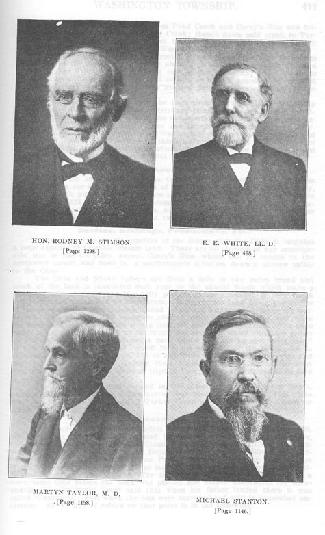
WASHINGTON TOWNSHIP - 411
coxon's line to the dividing line between Pond Creek and Carey's Run and following said ridge to
the head of Stony Creek; thence down said creek to Turkey Creek: thence down Turkey Creek to
the Ohio river; and it is further ordered that said township be called Washington."
When the Ohio canal was constructed it was found necessary to change the mouth of the Scioto
up the river about a mile. This alteration threw a part of Wayne Township on the west side of the
Scioto and there being no bridge between the two parts, the land owners so cut off, asked to be
included in Washington Township, which was granted by the following order of the County
Commissioners;
"It is therefore ordered that the boundaries of Washington Township be so changed that all the
portion of territory lying west of the present termination of the Ohio canat and east. of the old
mouth of the Scioto river, and between the old bed of said Scioto river and the present course of
said river be stricken off from the township of Wayne. and attached to the township of
Washington. and that the Auditor of this county issue a copy of this order to the Clerks of each of
the townships aforesaid, and make the necessary record thereof in his office." December 6. 1842.
and holds ninth place in the aggregate of both. The value of the real estate Though the smallest
among the townships outside of Wayne, it takes eighth rank in the separate valuation of its real
and of its personal property,
Valuation, Area and Rank.
in 1901, was $223.460; of personal property. $77.234; total, $300,694. It includes within its
territory 14,235 acres, with a population of 1,269, the same as Harrison Township. which has
almost twice the area
Surface, Drainage, Productions, Etc.
Situated as it is. at the juncture of the Scioto with the Ohio, it contains a large expanse of
valuable bottom land. There are no streams of any considerable size in the township, except
Careysis Run, which has its source in the northwest corner, and flows in a southeasterly direction
down a narrow valley to the Ohio.
The Ohio and Scioto valleys are from a mite to two miles broad and much of the land is
inundated each year by the annual floods which leave a heavy deposit of alluvium. The hilly
portion of the township, is very rough and stony and not suited to cultivation. Some terrace land
along the border of the Scioto valtey affords good upland farms and a pleasant locality for
residences. The whole Scioto valley isl planted with corn each year and when the flood dots not
come at the wrong time the harvest is bounteous. The Ohio valley is not flooded so much as the
Scioto and excellent wheat crops are grown as well as corn. For several weeks each winter and
spring the "west side." as this is commonly called. is cut off from the east side of the Scioto, by
an expanse of warer reaching from hill to hill. irom two to three miles wide and twenty to thirty
feet deep. During these times the inhabitants of the west side, who make many and frequent trips
to Portsmouth, are compelled to take to boats.
The first tract of land entered in the township was by Larkin Smith, number 475. August 3. 1787.
The survey was made November 21, 1787. The tract lay just above the mouth of Turkey Creek
and was afterward owned by Major John Belli.
Alexandria.
The tract upon which Alexandria was platted was Survey Number 508, containing six hundred
acres, located by Alexander Parker for his brother, Col. Thomas Parker. of Frederick County,
Virginia. August 3, 1787. The survey was made by John O'Bannon. Deputy Surveyor. John
Williams and Sylvester Murroney. Chainmen: Thomas Parker, Marker. It is said that a part of the
land on which Alexandria was laid out had been partly cleared and cultivated rn corn by the
Indians. The site seems to have been chosen for a town some time before the town was platted
and named Alexandria for Alexandria. Va. Benjamin Feurt said that when his father landed there
it was called Alexandria. Just when the lots were surveyed and sold is somewhat uncertain. All
we find of record on that point is in the following:
412 - HISTORY OF SCIOTO COUNTY.
"I hereby certify that this plat contains the in and out lots in the town, of Alexandria, laid out by
me, and laid down by a scale of twenty poles to an inch, done by order of Col. Thomas Parker of
Frederick County, Virginia.—E. Langham. Alexandria, June 3, 1799."
We find on the same plat the following: "I do hereby certify that the plan contains the in and out
lots in the town of Alexandria, which I sold as such, for Col. Thomas Parker, of Frederick
County, Virginia, situated in the County of Adams in the Territory northwest of the Ohio.—A.
Parker."
"Sale of the lots in Alexandria will commence at 12 o'clock, at the corner on the river, of Thomas
Street, lot No. 19.
"Filed in the Recorder’s office, June 4, 1799.—John Belli, Recorder."
When and by whom the first settlements were made by permanent inhabitants here is uncertain,
but that it was settled before the above dates is beyond all doubt. There were eighty-eight lots,
numbered serially from 1 to 88 and 35 out-lots numbered from 1 to 35. A copy of this plat is
recorded in Plat Book 1, page 33, Scioto County Record of Plats. The streets running back from
the river ran north 58 degrees west and were named, beginning on the northeast side and going
down the river: Scioto, Thomas, Middle and South Streets. Those running at right angles and
with the Ohio river were Water, Second, Third, Fourth, Fifth and Sixth. There was a tier of
twenty lots along the river front and another tier of lots numbered from 69 to 88 back of Sixth
street. The remaining lots were arranged in a double tier on the northeast side of Thomas street,
with an alley between them, and another double tier on the southwest side of Thomas street, with
no alley between them. This last group was in the eastern corner of the town and between Second
and Fourth streets. All the rest of the town was outlots.
First Inhabitants.
Among the first inhabitants in Alexandria were Judge John Collins, William Russell, John
Russell, Joseph Parrish, John Logan, William Lowry, Stephen Smith, James Munn and William
Brady. These settled in the town and James Edison, James Hamilton, John Worley, Anthony
Worley, John West, Philin Moore, Peter Noel and Martin Funk landed at Alexandria and located
wrthin eight miles of the place.
Between 1801 and 1804, David Gharky, John Simpson, Elijah Glover, William Jones and
Samuel G. Jones settled in the place. Dr. Thomas Waller, John Simpson, Stephen Carey, William
Carey, Patrick Timmonds, and Samuel Gunn, settled in the township between the same dates.
Growth and Decay.
When the town flourished at its height those' who owned houses were: David Gharky, who
owned a two-story house with a cabinet shop attached; Fletcher had a dwelling house and
blacksmith shop; this was burned in 1806; Stephen Smith built and owned a stone house
completed in 1815; E. Langham owned a one-story. frame house afterwards converted into a
warehouse; Judge John Collins kept a place of entertainment and accommodated travellers; Silas
Cole owned a two-story double log house; Captain Samuel Gunn owned a two-story frame
dwelling. The school house stood back of Alexandria at the foot of the hill. Barlow Aldrich
owned a two-story wooden building; Patrick Timmonds lived in a large two-story house, before
which he hung out a sign with a green tree painted on it. Hare he kept a hotel. There were a few
other buildings but these were the most prominent.
Up to the time Portsmouth was laid out and for some time after, Alexandria held the undisputed
claim of being the business center of the county. Here the first court was held. The first
county-seat and the tirst postoffice were here. The post office was established in 1805 and
William Russell was the first postmaster. His first report was dated June 30, 1805. Three years
afterward, the post office was abandoned and one was established at Portsmouth. John Collins,
one of the first Associate Judges, lived here. The last Indian was ,killed by John McDonald. or
his brother, near John Craig's, a mile below this place. One of the first, if not the tirst, grist mill
built and put in service was built by Stephen Carey on Carey's Run. Vats were afterward sunk
and some
tanning was done. This was the first tannery in the county.
WASHINGTON TOWNSHIP - 413
The first ferry was established across the mouth of the Scioto in 1809 by Stephen Smith. On
Christmas Day, 1808, the water was 37 inches deep in the houses, making two floods in that
month.
From the first and in the very nature of things the fate of the place was sealed, its destiny was
manifest. The floods came up each year and invaded the settlers' houses, compelling the inmates
to flee to the hills. After a few repetitions of this ordeal, it was seen to be impossible for a town
to grow and prosper under such conditions and one by one, they moved over to Henry Massie's
town, now Portsmouth, a mile above the mouth of the Scioto, until by 1810, Portsmouth had •
gained the ascendancy and Alexandria gradually dwindled away, until nbt a vestige of it is left at
the present day.
Mill and Distillery.
The grist mill at Union Mills was built in 1834 by Lemuel Moss; William Waller and Samuel
Coles rented it and operated it until 1838 when it was destroyed by fire. They rebuilt it near the
old site and continued to manage it until about 1851, when it was sold to L. N. Robinson. who
conducted the business until 1860. Then George Davis became proprietor and owned and
operated it till his death. Since then it has been destroyed.
The distillery at this place was built in 1857 by David Gibson, L. N. Robinson, Louis Robinson,
Joshua Robinson and Joseph Cheesman, who operated it until 1859, when it was purchased by
George Davis. He owned and operated it, in connection with the mill and cooper shops, until the
organization of the Cattle Feedersl Trust.
Stone Industry
The site of the first stone quarry is disputed. From a quarry, on the land originally owned by Levi
Moore, but now owned by Michael Gazele, was furnished stone Tor the construction of toe
canal. soon afterwards another was opened on Hygean Run, the stone from which was used for
the same purpose. Another early quarry on the land owned by W. C. Brouse furnished stone for
building a dam in the Licking River. From the same stone quarry, stone was used in the
construction of one of the court' houses in Cincinnati. It was opened by Joshua and Silas Phillips.
At present the Carey's Run Freestone Company supplies building and paving stone for a good
portion of Ohio. Indiana. Kentucky and West Virginia. In the years 1898 and 1899 about 50,000
cubic yards of stone were sent from these quarries to be used in the construction of the Cincinnati
Water Works. The quarries are situated up Carey's Run and yield as good stone as is found in the
County. Their flagging and dimension stone are sawed at the Reitz Mill in Portsmouth, Ohio.
The whole township is underlaid with this sandstone.
Tempevale
is more of a name than a town, although there have been two additions made to it. It is located on
lower Carey's Run and was first platted by Roswell and Ora Crain January 28, 1834. The plat
contained 38.1 acres, sub-divided into eight lots and three outlots. The first addition was platted
by Roswell Crain February 25. 1848. This plat contained 3.23 acres sub-divided into eight lots.
The third addition was platted by Crane. April 14, 1851, and contained 4.9 acres sub-divided into
12 lots. There are a few houses here but no business is carried on.
The Davis and Nauvoo Tract
was platted May 8. 1895. by A. T. Holcomb. Administrator of George Davis, deceased. by an
order of the Probate Court of Scioto County. The plat contained 29 lots. This is a little hamlet of
about seventy-five souls, and lies just back of Bertha postoffice. Cornelius H. Barbee is the
post-master.
An addition called Rappls Addition was platted by John S. and Elizabeth Rapp December 31.
1900. The plat contains 60 lots and 1.39 acres.
The Portsmouth Dry Dock and Steamboat Basin Company.
The Portsmouth Dry Dock and Steamboat Basin Company opened its books at No. 5, Pine street,
New York, May 20, 1839, at 11 a. m. The Ports-
414 - HISTORY OF SCIOTO COUNTY.
mouth directors were John Craighead, 'John Glover, Thomas Gibbons, James Lodwick and E.
Hamilton. It was organized for trading purposes and a large warehouse was built near the Cotton
Woods, which stood until the war. A town was platted containing 7.1 acres sub-divided into 83
lots. The company built a wooden bridge across the Scioto which was later blown down.
The Great Fraud of Scioto Heights,
Platted June 3, 1890, by George A Slough, consisted of two plats. The first consisting of 911 lots
numbered serially from 1 to 911. The second contained 351. The land platted is a part of Survey
No. 13,513 and contains 166.9 acres. The name "Scioto Heights" has become proverbial and
synonymous with the word "swindle." A veritable Eden for "suckers" and "land sharks," and an
inevitable disappointment to the purchaser in good faith. The site is a wilderness and so high that
those' who should so far lose their mental equilibrium as to ever build there would be compelled
to use a balloon and parachute to get to and away from their retreat! Both sides of the town could
be farmed, as it stands on edge—the economy of nature! A house built there would have to be
anchored to prevent its tumbling down the hill. Many persons from other parts have been induced
to buy here by unprincipled land agents.
Churches.
The Old Town M. E. Church organization dates its existence back to 1837 when the first edifice
was erected. The first board of trustees were: George Graves, John D. Smith, Philip Moore.
Isaiah Smith, Charles Hunt, Thomas Williamson and Isaac Williams. The building was destroyed
by fire in 1853, and a new building was erected that year an dedicated by Bishop Clark. The
church was remodeled in 1897. John M. Chandler is the pastor and the board of trustees is as
follows: George Williamson, Leroy Smith, George Salladay, Dr. G. W. Osborne and David
Lewis.
The Bethel Methodist Episcopal Church dates its beginning in 1870, and the first pastor was Rev.
William Bateman. A new edifice was constructed in 1897 and dedicated by Rev. H. S. Alkire.
The pastor is John M. Chandler. The trustees are John M. Vaughters, W. C. Brouse, John R.
Foster, Charles H. Morris, and Frederick Becker.
Morris Chapel is a Mission Station of the First Baptist Church of Portsmouth and was built in
1894. It is situated at Union Mills and cost $1,500. It was remodeled in 1902 and has a seating
capacity of 225. It is a model country church building with excellent baptistry and disrobing
rooms. Sunday School and church services are held on Sunday afternoons. The membership
numbers fifty and the Sunday School averages 75. Rev. W. C. Stevenson, Pastor of the First
Baptist Church of Portsmouth has charge of it.
Schools.
The Washington Township schools are among the best in the county. It employs the best teachers
and pays them well. The term of school averages eight months in the year. The township enjoys
the distinction of having had a school within its borders so early as 1800. This was taught by one
William Jones. Capt. Samuel Green taught a school back of Alexandria, at the foot of the hill,
shortly after this. Other early teachers who followed them were Andrew McClaren, Samuel
Williamson, Traverse Reed, Joshua Nurse and Abraham Barnes.
Sub-district No. 1 is known as the Dry Run school. The first building erected here was about
1839 on a lot purchased of Joseph Williamson. This lot was exchanged for a new one and a
two-roomed building was constructed on it in 1890. There are two teachers with salaries of $45
and $40 per month respectively. Enrollment 75.
Sub-district No. 2 is known as the Hygean School from its location. This is a commodious
two-room building erected on land purchased from George Davis in 1869. The teachers have
salaries of $45 and $40 per month. Enrollment 75.
Sub-district No. 3 is on Lower Carey's Run. A school lot was was purchased of Roswell Crane in
Tempevale, March 7, 1834. The present building
WASHINGTON TOWNSHIP - 415
recently erected stands on a lot bought of Anna Becker, August 3, 1895. The teacher has a salary
of $45 per month. Enrollment 31.
Sub-district No. 4, commonly known as "Sugar Grove" is in the lower end of the township near
the river The first house was built in 1854 on land donated by Andrew Brouse. A new and
mOdern structure was built in 1895. Thomas L. Bratten was the first teacher in this building. The
teacher has a salary of $45 per month. The enrollment is 35.
Sub-District No. 5, known as Upper Carey's Run erected a building on land purchased of James
Andrews in 1839. A new stone house was constructed in 1893 on land bought of Chris Grumme.
This is the only stone school house in the county. The salary of the teacher is $45 per month.
Cemeteries.
This locality being the most ancient in the county naturally contains some of the most ancient
burial grounds. There are three township cemeteries. all of which have some of the early notables
interred in them, as a glance over the following will show.
The Carey's Run Cemetery was given to the township by Alexander Parker April 8, 1816, and it
is situated on a point near the Infirmary. The following are some of the inscriptions: William
Pyles, born Sept. 27, 1802, died March 11, 1853; Roswell Crain, born Oct. 3, 1816, died March
2, 1853; Hor- ace Crain, Born Oct. 3, 1816, died May 15, 1892; John G. Gharky, born May 27,
1808, died April 26, 1889; David Gharky, born February 13, 1775, died Aug. 9, 1850; William
Journey, died August 1, 1883, aged 73 years, 2 months, 2 days; Thomas Waller, born September
17, 1774, died July 19, 1823; John F. Smith died August 21, 1846, aged 53 years, 6 months, 2
days: Stephen Smith died October 22, 1861, aged 43 years, 6 days; Otho D. Foster, born August
18, 1836, died December 16, 1894.
Vaughters' Cemetery. The Vaughters Cemetery was bought of William Vaughters August 15,
1878. It is located near the residence of J. M. Vaughters. The following are some of the
inscriptions: James Edison, died January 21, 1828, aged 87 years; Aaron Hall, died Oct. 16,
1845, aged 53 years, 7 months; Isaac Worley, born April 16, 1792, died March 29, 1839; John
Worley, died January 16, 1840; aged 72 years, 4 months; Joshua Nourse, died August 10, 1823.
aged 79 years; Samuel R. Nourse, died July 29, 1845, aged 75 years; John A. Brouse, died May
10, 1858; aged 68 years, 3 months, 1 day; William H. Vaughters, born August 9, 1817, died July
26, 1880.
Turner's Cemetery near Union Mills was a private burial ground until 1884, when it was bought
of William Turner for $110. The following are some of the inscriptions: Hugh B. Calvert, born
June 22, 1808, died August 1, 1879; Caleb Wilcoxon, died July 9, 1849, aged 59 years, 3
months, 13 days; Philiu Moore. died September 4, 1823, aged 62 years. On this grave stands a
twenty inch locust tree; Jemima Moore. died December 26, 1826, aged 62 years.
In addition to these there are a number of soldiers of the Civil War buried here. Besides the
above named township cemeteries there are a number of private burial grounds. One of these is
on the Intirmary farm; another is on the farm of George Williamson, and has been used since
1849. Another is on the east bank of the canal near Dry Run. Among those buried here are: Ruth
Wilcoxon, wife of John Wilcoxon, born January 21, 1770, died August 21, 1828; Rebecca M.
Smith, died February 19, 1849, aged 69 years, 2 months, 25 days; William P. Oard, died October
9, 1845, aged 39 years, 8 months; Thomas H. Wilcoxon, died June 17, 1824, at New Orleans,
was interred there and afterward re-interred here April 22, A. D. 1828, aged 34 years, 8 months, 2
days; Sarah, wife of Thomas H. Wilcoxon, died December 27, 1828, aged 29 years, 8 months, 21
days; Joseph Oard, died March 29, 1838, aged 57 years, 1 month, 12 days; Joel W. Smith, died
February 4, 1826, aged 49 years; Joseph Williamson, died September 16, 1812, aged 47 years.
A Remarkable Prize Fight.
George Beedle Mershon was born May 1, 1825, in Adams County near Locust Grove. His
father's name was Henry Mershon, born in Flemingsburg, Kentucky. His grandfather was
Timothy Mershon. His mother's maiden name was Cassie Ann Hibbs.
416 - HISTORY OF SCIOTO COUNTY.
On the 8th of April, 1853, Mr. Mershon fought with Larkin Hammond, who was from Kentucky,
for one hundred dollars at the old stone house. Hammond weighed 177 pounds and Mershon
weighed 188. They stripped to the waist, greased their bodies with butter, and fought for fifteen
minutes. Mer- shon won, but Hammond gouged his left eye until it fell out on his cheek. Captain
Smith put it back, but he has never been able to see out of it since. Mershon chewed all of
Hammond's fingers off and also tore his eye out. Three hundred people witnessed the scene.
WAYNE TOWNSHIP.
This is the richest and most densely populated Township in the County, since it contains the City
of Portsmouth. It was organized in April, 1809. It was bounded on the south by the Ohio river, on
the north by the present north line of Clay Township and on the east by the present line of Porter
Township. Its years of importance were from 1809 to March 1, 1815, when the town of
Portsmouth had no existence.
First Officers.
The trustees elected at its organization were William Huston, Uriah Barber and Josiah Barbee,
Trustees; Elijah Glover, Lister; Isaac Overaker, House Appraiser; Aaron Kinney and William
Lawson, Overseers of the Poor; John Brown, William Price, Caleb Hitchcock and George
Bowers, Supervisors; William Brady and Martin Funk, Fence Viewers; Jacob Offnere, Treasurer
and George W. Clingman, Clerk. James Black, Caleb Hitchcock and Charles T. Mastin were
Justices of the Peace.
Extracts from Clerk's Record.
The first meeting of the trustees was held April 15, 1809. $112.92 was• levied at that meeting for
roads. Jacob Moore, James Dawson and William McDonald were the first Constables.
The Trustees met March 5, 1810, and found they had expended In the previous year $664.57.
At the spring election in 1810, Capt. Josiah Shackford, John Simpson, grandfather of Mrs. T. T.
Yeager and Isaac Bonser were elected Trustees. The Supervisors were Isaac Noel, Jesse
Hitchcock and Samuel Burt. The Lister was Elijah Glover and the House Appraiser, Thomas
Morgan; William Lawson and Aaron Kinney were elected Overseers of the Poor, quite an
important office in those days, as there was no County Poor House and they had to warn all
objectionable people out of the Township. It required men of nerve and good sense to exercise
that office, and hence, they were selected. Jacob Offnere was re-elected Treasurer, but refused to
serve, and General Kendall was appointed in his place. Nathan Glover was elected Clerk, and the
Fence Viewers were John Brown and James Cochran. John Brown is well known to local fame in
Portsmouth, a small man, with a fiery temper, who married his two daughters to Militia Generals.
Oblivion has secured Thomas Cochran. The Township spent $26.05 this year.
In 1811, the Trustees levied $64.221/2 and spent $34.951h. The April election was held at the
house of Martin Funk, where all the early elections were held. This was on the site of the brick
residence near the William Micklethwait home.
In this year Robert Lucas, the doughty Militia General and Great Apostle of Jacksonian
Democracy, was elected Lister. Thomas Morgan, the old keel-boat man, was still after the job of
House Appraiser and got it. Martin Funk and Sanders Darby were the Fence Viewers. William
Kendall was elected Treasurer. John Brown, Isaac Bonser and Philip Noel were Supervisors.
In 1813, the township election was held at the home of Martin Funk. Hugh Cook was elected
House Appraiser, but this year there were two and William Swords was the other. Captain Josiah
Shackford was elected Treasurer and Ezra Osborne, Justice of the Peace. Ezra Osborne was fond
of that office and liked it better than Presiding Judge of the Common Pleas Court,
WAYNE TOWNSHIP - 417
which he afterwards held for seven years. Salma Keyes ancestor of Milford Keys, was one of the
Supervisors that year.
On May 4, 1813, the tirst road in the Township was laid out. William Lawson, Aaron Kinney and
Samuel B. Burt were the viewers. John Buck was petitioner and John Russell, surveyor. Prior to
this roads were made by those who wanted them, or by general consent. The road was one mile
and six rods long and led to two fractional sections in the Big Island.
March 7, 1814, the Trustees met at the home of Martin Funk for the last time. After that, they
met at the house of Henry Sheeley, in Portsmouth. He was the step-father of Moses Gregory.
Martin Funk was elected Fence Viewer, as "usual. He was the only one ever elected to that office
who performed its duties and took an earnest view of it.
Aaron Kinney refused to serve as Overseer of the Poor this year and John H. Thornton was
elected in his place.
In 1815, David Gharky was made a Trustee, and no doubt he made it in- teresting for his
associates, Samuel B. Burt and George W. Clingman. Jacob Offnere, John Brown and Jacob
Noel, three of the best citizens, were Super- visors. The road tax levied this year was $144.32.
In 1816, Gabriel Feurt appears as a Trustee; Nathan Wheeler as Clerk; and William Lodwick as
Treasurer. Martin Funk was still Fence Viewer, and was one of the most useful men in the
Towship. John Simpson was his as- sociate.
In 1817, John Noel was elected Justice of the Peace, John Brown, Gabriel Feurt and Samuel B.
Burt were elected Trustees. Jacob Offnere was con- tinued as Supervisor, because he believed in
good roads. Ezra Osborne who was always on the lookout for a little job, took that of House
Appraiser. The road tax levied this year was $174.85. Jesse Hitchcock was elected Justice of the
Peace.
In 1818, Jacob Abbott and Ezra Osborne tied on the vote for House Appraiser. It does not appear
how the matter was settled.
In 1819, Jacob Offnere was Township Clerk, and Captain Shackford, Treasurer. John Smith was
elected Justice of the Peace. In this year the lot owners of Portsmouth were first taxed on their
lots for township purposes. From 1815 to 1819 only 53 township orders had been issued.
In 1820, Hugh Cook was elected Overseer of the Poor and refused to serve, for which he was
fined. William Lawson was elected Fence Viewer, refused to serve and was fined. Only nine
orders were issued in this year and they amounted to $45.66.
In 1821, 88 voters participated in the Township election. Simon DeLong was elected Constable.
This was his first appearance in public office, for which he appeared to hunger and thirst. He also
carried off the office of Lister. William Kendall was elected Township Treasurer and gave bond
in the sum of $500. William Oldfield was elected Justice of the Peace July 7, 1821. John Smith,
Justice of the Peace and Township Trustee, died August 16, 1821. He was the father of L. P. N.
Smith and Charles S. Smith. On August 21, 1821, Constable James B. Andrews was ordered to
warn Thomas Ireland out of the Township. This was a favorite amusement at that time. If any
one did not like his neighbor, he had him warned out of the Township. The theory was the person
warned might become a township charge, but the fact was, this was done to show ill will and
spite. The expenditures of the township for the year 1821 were $222.42 1/2.
In 1822, there were 122 electors at the Township election. Daniel Corwine and John Peebles
were elected Overseers of the Poor. Simon DeLong was remembered and secured the office of
Lister. At this election 83 persons voted for a Special School District and 9 against it. As a
consequence on April 12, 1822, Wayne Township was divided into two school districts.
In 1823, there were 132 votes cast at the Township election. Jacob Offnere was elected Township
Treasurer and re-elected in 1825, and every year thereafter until 1835. In 1835, Havillah Gunn
had 32 votes for that office and Jacob Offnere, 28. In 1836, John Smith had 71 votes for
Treasurer and Jacob Offnere 15. In 1837 the Township electors regained their senses and
re-elected Jacob Offnere Treasurer, and re-elected him in 1838. 1839, 1840 and 1841, when he
refused to serve any longer. In 1842, William G. Whitney was elected to
418 - HISTORY OF SCIOTO COUNTY.
that office. Dr. Offnere was a very useful man,—more reliable than the bank of England, and was
in great demand for an office like Treasurer.
In 1824, James Lodwick was elected a Trustee. This was his first appearance in his long career
before the public in Portsmouth. He was a good Democrat and always ready to hold any public
office.
He was not a native born Virginian but came very near being. His sister next older than he, was
born in Virginia, but he inherited the Virginia taste for offrce from his father, Col. John Lodwick.
In 1826, 129 persons voted at the Township election. Cornelius McCoy appeared on the scene,
for the tirst time, and was elected Overseer of the Poor. John Peebles was elected House
Appraiser and John H. Thornton, Lister. A township duplicate was made each year. In this year
the township taxes were $288.921/2. William Lodwick was the largest land owner in the
Township, and Henry Massie next.
In 1826, 113 votes were cast at the Township election. The receipts of the township for the
previous year were $161.40 1/2. John M. McDowell appears, officially, this year as an Overseer
of the Poor, as was John Peebles. William Peebles and John R. Turner were elected Fence
Viewers. This shows that at that time they were regarded as the principal citizens of the
Township.
On May 20, 1826, our friend, John Brown, Senior, tried for the office of Justice of the Peace. He
had 48 votes, but Ezra Osborn who was always ready for an office, received 71 votes and was
elected.
On June 26, 1826, John Peebles and Samuel M. Tracy were appointed Township Trustees in
place of Asa A. Andrews and Gabriel Feurt who had been set off into Clay Township. Samuel G.
Jones was made Supervisor in place of Samuel C. Briggs, set off into the new township of Clay.
In 1827 there were three school districts with householders as follows: first, 38; section 43; third,
13. In this year, Giles S. B. Hempstead was made Supervisor. as W. Cole and Levi C. Barker
were Overseers of the Poor.
In 1828, there were 87 electors at the Township election. Samuel M. Tracy, John Peebles and
Havillah Gunn were elected Trustees. On December 28, 1828, Edward Hamilton was elected a
Justice of the Peace. There were 110 votes cast. Hamilton had 59 and John Noel, 51.
On April 6, 1829. 69 votes were cast at the election. Wm. Hall and Enos Gunn were elected
Fence Viewers. This was simply to remind them that they were mortal. This office, except in the
case of Martin Funk, was 'always conferred on some one who did not want it and would not have
it. In 1830, John H. Thornton and Ezra– Osborn had it; in 1831, M. B. Ross and Samuel Huston;
in 1834, Henry Buchanan had it; in 1837, John Waller, and B. F. Conway; in 1838, Joseph Riggs
and Elias Barber.
In 1830, John Peebles, Samuel M. Tracy and Washington Kinney were elected Trustees. They
served a number of years before and after that.
In 1831, 89 votes were cast. Simon DeLong was elected Constable this year and a number of
times before and after. He liked the office and was fitted for it. He was a butcher by trade and
never failed to make an arrest.
In 1835, the township expenditures were $320.
In 1836, 132 votes were cast.
In 1837, John C. Ashley, who has a picture and sketch herein, was elected a Trustee. William
Jones, the first school teacher, was elected Clerk.
In 1837, John C. Ashley and Jacob P. Noel were elected Justices of the Peace. The budget for
this year was $873.65.
In 1838, our old Irish friend, Lorenzo C. Goff, was elected Justice of the Peace. It was a
specimen of his mode of administering justice which induced Hon. W. A. Hutchins to locate in
Portsmouth.
In 1839, there were four school districts in Wayne Township. The budget was $1,225.97.
In 1840, George H. Gharky and Thomas Burt were elected Constables. They refused to serve and
were fined $2.00 each. J. V. Robinson was one of the trustees elected at this election.
In 1841, the Budget was $717.66.
In 1842, Robert Montgomery, Wilson Gates and L. C. Goff were elected Trustees. Joseph W.
Glidden was elected Supervisor and John Armstrong, As-
sessor. John P. Terry and Cornelius McCoy were elected Fence Viewers. The latter were elected
simply to remind them they should honor the lowest offrce in the land.
In 1843, Cornelius McCoy was elected Justice of the Peace for the first time. This was the
beginning of his long career in that office. He was enamoured of the office and was a candidate
for it at all times.
In 1845, the budget was $901.61. In this year William Kendall was elected Justice of the Peace
for the Township and John L. Ward and Thomas Kendall, two of the trustees.
In 1846, Cornelius McCoy was re-elected a Justice of the Peace. In this year there were three
Assessors elected in Portsmouth for three wards, James Lodwick, Washington Kinney and Isaac
Kirby.
In 1847, the budget was $1,092.11. There were 358 men of military age in the Township.
In 1848, the township election took two days Cornelius McCoy again secured the place of Justice
of the Peace.
In 1850, the budget was 573.96. John L. Ward, S. S. Fuller and R. B. Alford were elected
Trustees. Conrad Overturf was Assessor and Wash White and Giles Gilbert, Jr., were elected
Constables.
In 1851, the budget was $1,353.56.
In 1855, Moses Thompson was elected Justice of the Peace. On July 18, 1855, Cornelius McCoy
was elected a Justice of the Peace at a special election.
In 1858, Wm. H. Raynor was elected Treasurer and Henry Hope, Clerk. The latter resigned June
26, 1858.
As Portsmouth had become a City in 1851 and had about absorbed Wayne Township, the latter's
affairs became uninteresting. ' Fernando C. Searl was elected a Justice of the Peace October 19,
1859. He signed February 4, 1861, to accept the Probate Judge's office. On April 1868, all of
Wayne Township was annexed to the City of Portsmouth by a .nit of 1,370 for, to 20 against.
|