CHAPTER I.
THE CITY.
Topography, Geology and Boundaries—On the north bank of the Ohio River in Hamilton County is situated the city of Cincinnati, the greatest of all the cities in the Ohio Valley, and within the extreme southwestern portion of the State of Ohio. It is midway, by river, between the cities of Pittsburgh and Cairo, being 480 miles from the former and 550 from the latter. Its latitude is thirty-nine degrees six minutes thirty seconds north and in longitude eighty-four degrees twenty-four minutes west. From New York City it is nearly 744 miles ; 610 miles from Washington, D. C., and about 300 miles from either Chicago or St. Louis. Columbus, Ohio, is 110 miles distant ; Cleveland 250 miles north. Doubtless the determining point as to its location as a city was the fact that it was exactly opposite the mouth of the Licking River. It is in the center of a territory extending two hundred miles in any direction, which for its fertility is not to be excelled even by the famous Nile Valley of Africa. Cincinnati is also the center of the Miami Valley so well known everywhere.
The business portion of the city lies on two narrow plateaus, which are surrounded on the northeast, north and northwest by high hills, but none so elevated as to thwart the plans of modern transportation lines. On the surrounding hills are situated the numerous handsome suburban towns and cities, all going toward making what has recently come to be known as "Greater Cincinnati." The business streets are about five hundress feet above sea-level, while the highest surrounding hills are about four hundred feet higher. The low-water mark in the Ohio River is four hundred and thirty-two feet above the sea.
At the date of pioneer settlement, the country was traversed by numerous small streams, which
found their way into the Ohio, or first into Mill or Deer Creek. Deer Creek, along whose banks occurred so much of the interesting history of early days, has almost entirely disappeared forever, and now through Eggleston Avenue sewer the waters empty into the Ohio. At one time Deer Creek was practically the eastern limit of the community.
The first published account of Cincinnati was by Dr. Drake, in 1810, in which he says :
Its site is not equally elevated. A strip of land called the Bottom (most of which is undulated by extraordinary freshets, though the whole is elevated several feet above the ordinary high-water mark), commences at Deer Creek, the eastern boundary of the town, and stretches down to the river, gradually becoming wider and lower. It slopes northwardly to the average distance of eight hundred feet, where it is terminated by a bank
4 - GREATER CINCINNATI AND ITS PEOPLE
of glacis, denominated the Hill, which is generally of steep ascent and from thirty to fifty feet in height. In addition to this there is a gentle acclivity for six or seven hundred feet back, which is succeeded by a slight inclination of surface northwardly, for something more than half a mile, when the hills or real uplands commence.
These benches of land extend northwardly (the upper one is constantly widening) nearly two miles, and are lost in the intervale ground of Mill Creek. The whole forms an area of between two and three-quarter miles—which, however, comprehends but little more than a moiety of the expansion which the valley of the Ohio has at this point. For on the southern side, both above and below the mouth of the Licking River, are extended, elevated bottoms.
The hills surrounding this alluvial tract form an imperfectly rhomboidal figure. They are between three and four hundred feet high; but the angle under which they are seen, from a central situation, is only a few degrees. Those to the southwest and northwest, at such a station, make the greatest and nearly an equal angle. Those to the southeast and southwest also make angles nearly equal. The Ohio enters at the eastern angle of this figure, and, after bending considerable to the south, passes out at the western. The Licking River enters through the southern, and Mill Creek through the northern angle. Deer Creek, an inconsiderable stream, enters through the southern side. The Ohio, both up and down, affords a limited view, and its valley forms no considerable inlet to the east and west winds. The Ohio is five hundred and thirty-five yards wide from bank to bank, but at low water is much narrower. No extensive bars exist, however, near the town. Licking River, which joins the Ohio opposite the town, is about eighty yards wide at its mouth. Mill Creek is large enough for mills, and has wide alluvions, which, near its junction with the Ohio, are annually overflown. Its general course is from northeast to northwest, and it joins the Ohio at a right angle. Ascending from the valleys the aspects and characteristics of the surrounding country are various. No barrens, prairies, or pine lands are to be seen near the town.
In the early times these two plateaus above-named were known as Hill and Bottom. Much controversy was had in pioneer years as to the best method to employ in treating the descent from the hill to the bottom lands, many favoring a distinct terrace and others a gradual slope, which latter plan obtained largely, so that today the rise in the city is gradual in an easy incline from the river to about Third Street, and from there by a slightly more precipitate ascent to Fourth Street. From Fourth Street north the level is fairly maintained with a slight rise until the base of the hills is reached at the north and east. By the gradual grading of the streets and hillsides, in all directions, the higher banks have disappeared almost entirely.
The chief business section of the city today is within the original lines of the first settlement, although the great factories are outside--some many miles out from the postoffice. Along the entire southern portion of Cincinnati flows the Ohio River in a very meandering course, The frontage along the river extends more than a dozen miles. The charming hills surrounding all but the southern portion, afford such a panorama of natural scenes as is not found in many other American cities. The beautiful environments of the "Queen City" include the river, the mighty suspension bridge built in 1864-65, the old Kentucky hills, and the nestling villages at their foot, and the city of Cincinnati itself. The river
THE CITY - 5
at this point flows gently at a rate of about three miles an hour. It is about six hundred yards wide and its every turn and bend is replete with history of both the White and Indian races. This river has great variation in its stages of water. Its highest stage was in February, 1844, when it was almost seventy-two feet above low-water mark. On September 18, 1881, it fell to one foot and eleven inches—the lowest ever.
The unusual irregularity of the outline of the plattings of Cincinnati has been caused by the various annexations as a result of the growing population of the neighborhood. After the settlement became assured, the growth developed along the Ohio River eastward until connection was made by way of Pendleton with Columbia and westward along the base or the hills until Sedamsville, at Bold Face Creek, and Riverside, just beyond, became important points. The line of Mill Creek was another point of settlement and here at Ludlow's Station, later Cumminsville, and Camp Washington and Fairmount gradually developed a large population.
At the head of Main Street, above Liberty, there branched to the northwest the road to Hamilton (now McMicken Avenue). Still later along the line of road running to Carthage was established the settlement of Corryville, beyond Mount Auburn, the first hill suburb. Hence it will be observed that the city formed itself along the lines of the least resistance, that is, along the valleys and the roads. Later the hills were settled, the principal ones being Price Hill, Fairmount, Clifton, Corryville, Mount Auburn, Avondale, Walnut Hills and Mount Adams. Also on the east Tusculum and Mount Lookout. The following was written concerning the finer residences being located on the beautiful heights around the business and older portions of Cincinnati, in an historical work published in 1904, known as the "Centennial History of Cincinnati," by Charles T. Greve :
Many of the suburban hills are occupied by residences of very great beauty, placed in the midst of large grounds improved by the highest degree of landscape art. The tendency to remove the residence portion of the city to the hills seems to be growing each year and as a result the basin, or original plateau, has been almost entirely surrendered to business uses and residences of the cheaper class. Many of the superb mansions that were the glory of the early days in the history of the city still remain in East and West ends, but they have been given over to offices, hospitals, hotels and private institutions of all sorts. The central point of the business life of the city is in the neighborhood of Government Square, Fountain Square and Fourth Street, from Main to Race. All the traction lines from the surrounding parts of the country, including those from Kentucky, passed through this section. The principal structures are in this general neighborhood, and it is here that activities of the city are most easily observed. The appearances in this respect are somewhat deceptive, however, for the immense manufacturing establishments which constitute so much of the wealth and importance of the city are scattered in all directions along the river, in the East and West ends, through the Mill Creek Valley, and even upon the nearby hills and in the suburbs beyond them not yet incorporated in the city. It is true of Cincinnati as, of course, it is of all large
6 - GREATER CINCINNATI AND ITS PEOPLE
cities, that one who has been a resident of it for a lifetime may pass years of his life in active business in the city and be utterly unconscious of many of the principal streams of activity going on all about him. It is only when an observer makes an effort to get a comprehensive view of the life of such a city that he begins to realize, even in a small way, the breath of that life and its multifariousness. In Cincinnati almost every department of human activity is represented and well represented. Its professional life will compare favorably with that of any city. It has contributed in the past and contributes today some of the leading men of authority to the professions of law, medicine and of the church. Its educational system, including the public schools and private institutions, the high schools and the University, afford opportunities to the poorest of its inhabitants which make it unnecessary for any to seek elsewhere for an education of the highest type, nor are these opportunities confined to a general education alone, but they extend to a specialization in law, medicine and theology. The artistic and musical side are no less represented. Cincinnati's musical festivals and her schools and colleges of music have given her a position preeminent among the countries of American in things pertaining to music. Her art school and art museum afford opportunities for development in this line unsurpassed on the continent.
Again it was said of Cincinnati by Judge Hoadly, many years ago, that it would be "a city fair to the sight, with a healthy public spirit, and high intelligence, sound to the core ; a city with pure water to drink, pure air to breathe ; a city not merely of much traffic, but of delightful homes ; a city of manufacturing, wherein is made every product of art—the needle-gun, the steam engine, the man of learning, the woman of accomplishments ; a city of resort for the money-profits of its dealings and the mental and spiritual profit of its culture—the Edinburgh of a new Scotland, the Boston of a new New England, the Paris of a new France."
Annexations of the City —Down to April, 1902, the annexations to the original city were as follows : In 1819, when the place was incorporated, the boundaries were Liberty street and a line continuing that street to the river, the river on the east and south and Mill Creek on the west, which included an area of three square miles. April 14, 1849, there were added to this territory the tract bounded on the south by Liberty Street and on the east by Hunt Street and the Lebanon Turnpike or Reading Road, and on the west by Mill Creek, extending as far north as McMillan Street ; this territory included two and one-fourth square miles. The "City Directory," published in 1819, shows a platting map giving in the last-named section a few small lots lying mainly to the east and west of Vine Street, as continued beyond Liberty, to the point where the street connects with the Hamilton Road, now McMicken Avenue, and another line of lots lying along the west side of Hamilton Road south of its junction with Vine Street. Parallel with Vine was New Street, now Bremen, and cutting through New Street were Green Street, then running north-westwardly, and North Street, now West Elder. To the east of Vine were indicated Poplar (now Huber) and Elder Street, running east and west, and north and south Pleasant Street (now Hamer). To the southwest of Hamilton Road, and running parallel, was Back Street, now continued to
THE CITY - 7
Walnut, where Moore Street joins the two just south of McMicken Avenue.
The plat of Northern Liberties was dated March 31, 1837, but this section had long been known as a sub-division of Mill Creek Township. In a plat fixed in map fashion in a directory of 1834, were shown two more short streets, Hughes, running north and south, and Williams (now Schiller), parallel to Liberty Street, lying east of Main Street, and the Dayton Road, west of Sycamore Street and north of Liberty. The upper waters of Deer Creek were shown as flowing through this tract. In those days the Dayton Road from the head of Main Street at the corporation line (Liberty Street) to the northeast, making an angle of sixty-seven degrees with Hamilton Road, now known as McMicken Avenue.
Included in this same territory was the village lying north of the original town site and to the west of Vine Street, known as Mohawk. It was at this point, then a striving village along the Hamilton Road at the base of Mount Auburn, that Mrs. Trollope first set up her household in 1829. She describes it "a little village about a mile and a half from the town, close to the foot of the hills formerly mentioned as the northern boundary of it." This village was never platted legally, but the name has been preserved to this time in Mohawk Bridge, as well as, in Mohawk Street.
Brighton included that part of the present city reaching from Mill Creek to Freeman Avenue. Here the stockyards were formerly kept, and here for many years stood the Brighton House, a noted stock-raiser's hotel and resort. Ernst Station, afterwards Brighton Station and Fairmount, were within this suburb.
Texas was in the southwestern part of the city, while Bucktown lay to the east of Broadway in the Deer Creek bottoms.
Another extensive annexation was made to Cincinnati by act of the Legislature passed March 22, 1850, when territory in Section Seven of the Third Township of the Second Fractional Range, bounded on the west by Reading Road, on the south by Liberty Street, on the east by the west line of Fulton, and on the north by McMillan Street, including three-fourths of a square mile. By ordinance this became the Eleventh Ward, March 29, 1850.
In 1854 another annexation was effected by adding a strip including a square mile, and then called the Seventeenth Ward. This extended along the Ohio River north and east from the line of Liberty Street to the village of Pendleton and was styled the village of Fulton, which embraced nearly all of Fulton Township. The village of Fulton was made up of a single long street, extending eastward between the hills and the river, and formed the connecting link with the old city of Columbia. A goodly number of people settled there at an early time. The principal
8 - GREATER CINCINNATI AND ITS PEOPLE
occupation of the residents then was boat-building and it was at the Fulton Landing that the explosion of the "Moselle" occurred in 1835.
Other noted annexations were effected in 1869. The first included the territory three and one-eighth miles in area, known as Storrs Township, extending from Mill Creek on the east to the river on the south and Liberty Street on the north and west of the section line. In this tract were included the villages of Sedamsville along the river bank and Price Hill along the hills. A small portion of the township was in the village of Riverside, which was not included. Sedamsville took its name from a Revolutionary officer, Col. Cornelius R. Sedam, who later was with the famous St. Clair campaign and received two wounds. He bought a large acreage of land in Sections 34 and 35, where he built his house in 1795. The exact date of the ordinance authorizing the annexation of Storrs Township to Cincinnati was September 10, 1869. In November the same year, came the annexation of a two and one-half square mile tract in Spencer Township, bounded on the north by Linwood Road and Observatory Avenue, on the east line by Section Line 26, the village of Columbia and by Crawfish Creek to the Ohio River, and on the south line by the Ohio River, and including the village of Pendleton to the former western line of the former village of Fulton, and on the west by said line and the east line of the village of Woodburn. The following year, on March 5, 187o, there were annexed the villages of Walnut Hills, Mount Auburn and Clintonville, including Corryville and Vernon Village, constituting two wards. Also on September 21, 187o, was added a large strip of land on the west—five and one-eighth square miles in area—known as election precincts of Camp Washington, Lick Run and Mill Creek Township, including Mount Harrison, West Fairmount, St. Peters, Lick Run, Clifton Heights and Camp Washington, west from Clifton Avenue and from Mill Creek and north from McMillan Street to the Liberty Street line. This territory was then made into Ward Eighteenth.
The village of Columbia, including the oldest settlement in the Miami country, in area one and one-eighth mile square, was added to Cincinnati December 13, 1872. Cumminsville, the original seat of the Ludlow family, was annexed March 12, 1873. This territory embraced two and three-eighths square miles, which later became known as the Twenty-fifth Ward in Cincinnati, continuing as such until the Code of 1902 became effective.
March 29, 1873, the village of Woodburn was added to the city ; this included one square mile and it was added to Ward First.
The Zoological Garden and adjacent territory was added to the city December 7, 1888 ; its territory embraced only one-fourth of a square mile.
The Legislative act of April 13, 1893, annexed to the city the villages of Avondale, Riverside, Clifton, Linwood and Westwood and their school districts. This annexation was approved of by the voters of the city and
THE CITY - 9
villages and the terms thereof were determined by the Board of Annexation Commissioners, consisting of Judge C. D. Robertson, W. B. Melish and L. C. Robinson. The annexation went into effect December 31, 1895, at midnight, and thus were added eleven square miles to the territory of Cincinnati.
April 28, 1902, there was added Section Six and the east half of Section Twelve of the Third Township in the First Fractional Range, being one and sixty-nine hundredths square miles lying west of Price Hill.
The original area of Cincinnati at the date of its incorporation was but three square miles. Its area in 1902 was 39.09 square miles ; in 1925, 71,245. More recent annexations are taken up in detail as the various communities are described, the following being the list alphabetically : Bond Hill, November 16, 1903; California, August 28, 1909; Carthage, July II, 1911 ; College Hill, May 22, 1911 ; Delhi, July 13, 1910; Evanston, November 19, 1903 ; Fernbank, November 12, 1912 ; Hartwell, November 12, 1912 ; Hyde Park, November 18, 1903 ; Kennedy Heights, July 23, 1914; Madisonville, August I, 191 ; Mt. Airy, July 26, 1911 ; Mt. Washington, May 15, 1911 ; Oakley, January 14, 1913 ; Pleasant Ridge, November 12, 1912; Sayler Park, June 5, 1911 ; Winton Place, November 18, 1903.
Topography and Geology —The geological formation underlying the city of Cincinnati and its near about vicinity is quite simple. The strata forming the Cincinnati Hills consists of alternations of limestone layers and clay shales. The mineral composition and the structure of these strata show that they were formed in a wide sea stretching from the Appalachian highland westward, as far, perhaps, as the backbone of the Cordilleras. This sea swarmed with animal life. The remains of these animals, falling upon the floor of the sea, formed the layers of limestone. At times the currents swept along their waters surcharged with fine sediment brought from distant shores. This settling slowly down, formed the clayey shales, in which the remains of the creatures of long by-gone ages are often beautifully preserved.
For the principal material facts found in this article the writer is indebted to Mr. John M. Nickles, of Cincinnati, one well posted in the subjects herein discussed when he wrote twenty odd years ago concerning it. He goes on to say :
From the great thickness of stratified deposits formed in this Mississipian sea, of which the present Gulf of Mexico is a much reduced vestige, we may infer that the sea bottom was slowly settling down. After this sinking had continued long enough to permit the accumulation of strata two thousand or more feet in thickness, a contraction of the earth's crust produced a gentle fold which brought above the surface of the sea a long, rather narrow island, extending north and south. This uplift has been called in geological history the Cincinnati anticline, as the strata dip gently away from the crest of this island eastward and westward.
The rocks of the Cincinnati period comprise three stages, the Utica, Lorraine and
10 - GREATER CINCINNATI AND ITS PEOPLE
Richmond. All of the Richmond and part of the Lorraine have been eroded away from Cincinnati and vicinity. A small part of the Trenton period, about fifty feet vertically, is exposed in the south bank of the Ohio River from West Covington to Ludlow. A much greater exposure is found between New Richmond and Point Pleasant, Ohio, about twenty miles east of Cincinnati, as the axis of the anticline passes here in its north and south trend. The Trenton contains with its shale much good building stone. In the early days of Cincinnati, stone was quarried from the south bank of the Ohio. The name "Low River Quarries," still survives. A large amount of stone was also formerly quarried from the Trenton in the vicinity of Point Pleasant.
The lower parts of the hills around the city exposes the Utica. This formation consists mainly of shale. Some of the limestone layers would make building stone suitable for cellar work, but nowhere can it be profitably quarried. The thickness around Cincinnati is about two hundred and sixty feet.
Overlying the Utica and forming the upper part of the Cincinnati Hills is the Lorraine, which has altogether a thickness of about three hundred feet, but at Cincinnati, only the lower two hundred feet are shown. All above has been carried away. It is in these beds that the quarries have been opened which have supplied foundation work for the residences of Cincinnati citizens. Several of the churches and other buildings show that the stone can also be very tastily employed for architectural purposes. Formerly a large amount of lime was burned from this stone, but of later years better grades brought into the city have displaced the home-made article except for cellar work.
Fossils are very prolific about Cincinnati. From the earliest times when the "blue limestone" began to be quarried by the hand of pioneers, Cincinnati was noted as one of the finest fossil collecting grounds in the world. Many collectors have brought to light a wealth of animal remains. More than eight hundred specimen or species have been described from this Cincinnati period, and two or three hundred more are now known to await full description.
After the Cincinnati anticline had brought to the surface the now-born island, it became the prey of the elements, which are unceasingly at work tearing down the land surface and transporting the debris to the seas. Many millions of years have elapsed since rain, frost and running water began their work on this new surface. These elements work very slowly, but in the long ages that have elapsed since they began their work they have brought about great changes in the appearance of the land. Originally the surface was almost level, but soon drainage channels were established which were cut deeper and deeper. We do not know how much the surface of this old island has been worn down, but probably on an average it has lost between three and four hundred feet vertically.
It is a very interesting study to trace the old drainage channels through which this great mass of rock and shale was carried seaward in the form of mud. Only a beginning has been made. It would seem that it ought not be difficult, and it would not be, had it not been for a most surprising event in geological history. This was the advance from the north in comparatively recent times, geologically speaking, of a great thick sheet of ice, an immense glacier, which covered over the face of the land, filled up the hollows, planed off some of the eminences and swept around others, blocked the rivers and often compelled them to carve out for themselves new channels. When the ice sheet melted away, it left undisturbed over hill and hollow an immense amount of wastage in the form of gravel and sand, silt and bowlders. The valleys around Cincinnati generally show this glacial debris and some is found even on some of the hilltops.
By this ice invasion which had its southern limit only a short distance south of Cincinnati, the drainage of this region was profoundly modified. The ancient drainage was obliterated, though here and there was left its traces. The Ohio, at least as far down as Lawrenceburg, Indiana, is a young river, occupying mainly the channels of several very
THE CITY - 11
old streams; in some places, at Cincinnati for example, it has carved out for itself a new channel.
What are called hills are not really hills, but only the escarpments of a rolling table land in which the Cincinnati-Covington-Newport basin has been hollowed out to a depth of about three hundred feet below the general level of the country. The western part of the basin is occupied by the broad Mill Creek Valley, which continues north and northeast. Several miles west of the Mill Creek is a high ridge running from the Ohio River north through Westwood and Chevoit. From this ridge several spurs extend eastward. The one at the north is quite wide. It is occupied by Price Hill. That between Fairmount and North Fairmount is comparatively narrow. The Fairmount Valley drained by Lick Run, now changed into sewer, and the North Fairmount Valley and their side valleys illustrate finely the amphitheatres which occur at a certain stage of the normal erosion. So also does the valley of the West Fork, west of Cumminsville. In fact, most of the small valleys about Cincinnati are of this shape. It is easily seen that from Mill Creek west was a table land, which, as the result of erosion, has become a series of ridges and valleys.
The high land on the north of the basin forms a watershed from which several short streams in rainy weather flow down into the basin, or rather did before they were deflected into sewers. Ravine Street and Vine Street occupy two such small water courses. Deer Creek, in the valley between Mount Auburn and Eden Park, was another The high ridge has been utilized in part for McMillan Street. The north side of this water-shed, occupied by Burnet Woods, Clifton, Avondale, Idlewood and Hyde Park, sends its drainage streams off to the north and northwest and eventually their waters find their way into Mill Creek. Walnut Hills occupies the broad eastern end of this high ridge.
The present topography of Cincinnati region presents more instructive features which serve as clues to the ancient drainage. These are some of them: The very wide valley of the Mill Creek with such an insignificant stream flowing in it ; the valley of the Little Miami River for several miles above its mouth much wider than that of the Ohio from this point down; a broad, low valley extending from the Little Miami at Red Bank westward to the Mill Creek, in which are situated the suburbs Madisonville, Norwood and Bond Hill.
The explanation of these peculiarities is that in pre-glacial times a stream known as Old Limestone, heading somewhere in the vicinity of Maysville, Kentucky, and Manchester, Ohio, and occupying what is now the channel of the Ohio from Maysville down, flowed for several miles through the channel of the Little Miami northwardly, then westwardly through the low valley just mentioned, to the neighborhood of St. Bernard. At that point it was joined by the Licking River, which flowed northwardly through the lower part of the valley of the Mill Creek. With its volume much augumented by the water of the Licking, Old Limestone continued on up the Mill Creek Valley to Hamilton, Ohio. Geologists here differ as to the course of the stream from that point. Generally speaking, it is believed that the river continued its course through a now abandoned channel from Hamilton southwestward into the valley of the White Water near Harrison, Ohio; thence through the lower part of the White Water to its junction with the Great Miami River not far from Lawrenceburg, Indiana.
Walnut Hills was directly connected with the highlands in Campbell County, Kentucky, lying east of Newport, Kentucky. Price Hill was continuous with the hills of Kentucky lying to the south. When the ice sheet advanced from the north, it blocked the Old Limestone, the stream flowing north in Mill Creek Valley to Hamilton, damming its waters into a lake until they rose high enough to cut across the lowest parts of the old ridges at Walnut Hills and Sedamsville, thus beginning the present course of the Ohio at Cincinnati. During the time that has elapsed since this event, the Ohio has cut down
12 - GREATER CINCINNATI AND ITS PEOPLE
these gaps to their present level. The steep slopes of the hills abutting on the Ohio in the First Ward of Cincinnati, and the Twentieth Ward, Sedamsville and Riverside, are noteworthy and in very great contrast with the general slopes of hills carved out of the same kind of rocks which have been subject to normal erosion during long geological ages.
Nearly all of the world's great cities have been built on or very near a river. Among the influences which determined the fitness for the site of Cincinnati were, of course, its streams. The Big and Little Miami, the Licking and the Mill Creek had two values only. Their valleys furnished natural thoroughfares for travel and a rich alluvial soil for agriculture. But in addition the Ohio (the river beautiful) was a navigable stream. In the present age of railroads and airships it is hard for us to realize the significance of that fact ! Who could over-estimate the importance of the Nile to Alexandria ; the Euphrates to old Babylon ; the Hudson to New York ; the Mississippi to New Orleans ; the Allegheny and Monongahela to Pittsburgh? What service may come in the future of the earth's streams on which her cities are built no one can tell, but certain it is that the Ohio River did actually play a great part in the selection, founding and early prosperity for Cincinnati. Then we must hasten on to recording more than a passing notice of the wonderful Ohio.
It is the greatest arm of the Mississippi, in many ways. United States records show the discharge of the waters from the Ohio are 158,000 cubic feet per second, while that of the Missouri only averages 120,000. It takes its source where mingle the waters of those majestic streams, the Allegheny and Monongahela rivers, with Pittsburgh its first great business center. A straight line from Pittsburgh to Cario, Illinois, where it forms junction with the Father of Waters, measures 615 miles, but its meanderings measure 975 miles. Along its historic banks stands Steubenville, Wheeling, Marietta, Parkersburg, Pomeroy, Point Pleasant, Gallipolis, Huntington, Ironton, Portsmouth, Maysville, New Richmond, Covington, Cincinnati, Lawrenceburg, Madison, Louisville, Evansville, Paducah. These are the larger cities along the Ohio, but there are a score of lesser places all long having been regular bee-hive business centers in a local and smaller way. The waters of this stream flow on toward the sea at the average rate of three miles an hour, but in high flood times rises to as high as seventy feet above low-water mark. The Ohio drains in excess of 200,000 square miles, while with its tributaries, it has fully 5,000 miles of navigable waters. These accurate, yet cold, dry figures but feebly indicate the immensity of the region styled the Ohio Valley. These things all had to do with the selection of the site of a great commercial center to be known as Cincinnati.
CHAPTER II.
THE MOUND BUILDERS AND INDIANS HEREABOUTS.
The following paragraphs are from the pen of Dr. Drake, in his "Picture of Cincinnati," published in 1815. As a scientific observer, no man before, or even after his day and generation, can in anyway compare with him for graphic expression and accuracy of every statement made.
The Prehistoric Inhabitants —The first white man that came to the site of Losantiville, could hardly have failed to notice the indications of the numerous presence at this point of an earlier people. The Indian, as he has been known within historic times, left little or no trace of his occupancy of any part of the land, but on the small table-lands that constituted the site of Losantiville were structures which were unmistakably the remains of a different race and whose name, character, history and antiquity are left entirely to conjecture. In the excitement of the chase the dangers that encompassed the pioneers who first must have seen these remains, their presence aroused little or no attention. But after the settlement had located itself there were men who not only became inquisitive as to the peculiar structures, but made a record of them. The earliest of these records of any importance is that contained in the work of Dr. Drake, as already noted in language as follows :
"No objects in the State of Ohio seem to more forcibly arrest the attention of travelers, nor employed a greater number of pens, than its antiquities. It is to be regretted, however, that so hastily and superficially have they been examined by strangers, that the material for a full description have not yet been collected. The former have too often contented themselves by copying from each other ; and the latter have commonly substituted wonder for examination.
"Before proceeding to examine the remains which are termed ancient, it may be advantageous to distinguish them, if possible, from those which are evidently modern. In several places are to be found the sites of Indian villages, which are indicated by hearths of flat stones ; by ashes, charcoal and calcined earth ; and by vast quantities of the broken bones of those animals on which the inhabitants subsisted. About the same spots, but not confined to them, are found various articles fabricated of clay, coal, grit, flint, granite and other hard stones ; and which from their form are denominated hatchets, axes, chisels, arrow-heads, pipes or ornaments. Fragments of earthen-ware, also, are picked up, which exhibit in their composition pounded mussels and other river shells ; and on its surface, many ornamental lines, either straight and parallel, or curved ; always formed by indentation or incision. None of it appears to
14 - GREATER CINCINNATI AND ITS PEOPLE
have been glazed ; but most of the fragments have, it is obvious, been subjected to a strong heat. All which I have seen were parts of vessels, and are unquestionably a manufacture of some species with that carried on by some of the Southern tribes of Louisiana at the present time. The remaining works of a modern date are stone and sometimes earthen tumuli, which are distinguishable from the ancient by their diminutive size, and from being disconnected with any extensive fortifications, or other remains. I have seen three of these Indian graves examined. They were situated on the top of a high ridge in Kentucky, where none of the common vestiges of ancient population exist. Two of them were composed of stone, the other of earth. In the latter the dead bodies had been laid on the surface of the ground, and were surrounded by ashes, calcined loam and fragments of charred wood. They were covered with flat limestones, surrounded by others set edgewise. Over the whole had been erected a mound in circular form of little convexity, being thirty-six feet in diameter, and not more than three in height. The others had nearly the same internal construction ; but their framers chose to bring the stone from the creeks two hundred feet below, rather than erect a mound of earth ; and when we take into consideration the tools which they must have used for the latter purpose, their preference of the former cannot excite much surprise.
"Having premised these remarks, we are better prepared to understand what relates to the works which are more ancient. Among these there is not a single edifice, nor any ruins which prove the existence, in former ages, of a building composed of imperishable materials. No fragments of a column ; no bricks, nor a single hewn stone large enough to have been incorporated into a wall, has been discovered. The fabrics of wood must have long since mouldered away ; and the only relics which remain to inflame curiosity and excite speculation, are composed of earth with which rude and undressed masses of stone have sometimes been combined. These vestiges consist of mounds, excavations, and embankments or walls, of various forms and dimensions. Cincinnati affords specimens of each. They are extensive and complicated, but not conspicuous, and have, therefore, attracted less attention than the relics at some other places. The principal wall or embankment encloses an entire block of lots and some fractions. It is a very broad ellipsis ; one diameter extending eight hundred feet east from Race Street, and the other about six hundred feet from Fifth Street. But its figure is not mathematically exact. On the east side it had an opening nearly ninety feet in width. It is composed of loam, and exhibits, upon being excavated, quite a homogeneous appearance. Its height is scarcely three feet, upon a base of more than thirty. There is no ditch on either side. Within the wall the surface of the ground is somewhat uneven or waving; but nothing is found there that indicates manual labor. On each
MOUND BUILDERS AND INDIANS HEREABOUTS- 15
side of the gateway, or opening, exterior and contiguous to the wall, there is a broad elevation or parapet of an indeterminate figure. From one of these may be traced a bank, not more than twelve inches in height, on a foundation nine times as great. It extends southerly about one hundred and fifty feet, till it reaches within one or two rods of the border of the upper plain or hill, when it turns to the east and terminates in a mound at the junction of Main and Third streets, distant nearly five hundred feet. From the parapet of the opposite side no wall of this kind can be traced ; but immediately north of it, and at a short distance, are two other shapeless and insulated elevations more than six feet high, which it seems probable could not have been formed on an alluvial plain, but by the hands of man. Upwards of four hundred yards east of this, between Broadway and Sycamore streets, there is another bank, of nearly the same dimensions with the one last described. It can be traced from Sixth to the vicinity of Third Street ; and is evidently the segment of a large segment of a very large circle, the center of which would lie within or immediately south of that already described. From near the southern end of the segment to the river, a low embankment, it is said, could formerly be traced ; and was found to correspond in height, direction and extent, with another, more than half a mile distant, in the western part of the town ; but neither of these are now visible. In Fifth Street, east of all that have been described, there is a circular bank enclosing a space of six feet in diameter. It was formed by throwing up the earth from the inside. It is not more than a foot high, but twelve to fifteen in horizontal extent. In the northern part of the town, between Vine and Elm streets, at the distance of four hundred yards from the ellipsis first described, there are a couple of convex banks seven hundred and sixty feet long, less than two feet high.
"They are exactly parallel and forty-six feet asunder, measuring from their centers, for two-thirds of their distance, after which they converge to forty. In the southern of these banks, about the point where their inclination to each other commences, there was an opening thirty feet wide. The directions of these elevations, as ascertained by the compass, does not vary two degrees from a true line east and west. The site of our town exhibits many other inequalities of surface, which are no doubt artificial ; but they are too much reduced, and their configuration is too obscure to admit of their being described. It is worthy of notice that the plains on the opposite side of the river have not a single vestige of this kind.
"Of excavations we have but one. It is situated more than half a mile north of the figure first described, and it is not perceptibly connected with any other works. Its depth is about twelve feet ; its diameter measuring from the top of the circular bank formed by throwing out the earth is nearly fifty feet. Popular speculation could not fail to make it a half filled well, but no examination has ever yet been undertaken.
16 - GREATER CINCINNATI AND ITS PEOPLE
"The mounds or pyramids found on this plain were four in number. The largest stands directly west of the central enclosure so often referred to, at the distance of five hundred yards. Its present height is twenty-seven feet, and about eight feet were cut off by General Wayne, in 1794, to prepare it for the reception of a sentinel. It is a regular ellipsis, whose diameters are to each other nearly as two to one. The longer runs seventeen degrees east of north. Its circumference at the base is four hundred and forty feet. The earth for thirty or forty yards around it is perceptibly lower than the other parts of the plain, and the stratum of loam is thinner ; from which it appears to have been formed by scooping up the surface ; which opinion is confirmed by its natural structure. It has been penetrated nearly to the center, and found to consist of loam gradually passing into soil, with rotten wood. The fruits of this examination were a few scattered and decayed human bones, a branch of a deer's horn, and a piece of earthen ware, containing mussel shell. At the distance of five hundred feet from this pyramid, in the direction of the north eight degrees east there is another about nine feet high, of a circular figure, and nearly flat on top. This has been penetrated to the center of its base without affording anything but some fragments of human skeletons, and a handful of copper beads, which had been strung on a cord of lint.
"Northeast of the last, at the distance of a few hundred yards, is another of the same figure, but not more that three feet in height ; which, upon being partly opened, has been found to contain a lot of unfinished spear and arrow heads of flint.
"The mound at the intersection of Third and Main streets has attracted most attention and is the only one that had any connection with the lines which have been described. It was about eight feet high, one hundred and twenty long and sixty broad. It was of an oval figure, with its diameters lying nearly in the direction of the cardinal points. It has been mostly obliterated by grading Main Street. Its construction is, therefore, well known. Whatever it contained was deposited at a small distance beneath the stratum of loam which is common to the town. The first artificial layer was of gravel, considerably raised in the middle ; the next, composed of larger pebbles, was convex and of a uniform thickness ; the last consisted of loam and soil. These strata were entire, and must have been formed after the deposits in the tumulus were completed. Of the articles taken from thence, many have long since been lost ; but the following catalogue embraces the most curious.
"1. Pieces of jasper, rock crystal, granite and some other stones—cylindrical at the extremities, and swelled in the middle ; with an annular groove near one end.
"2. A circular piece of cannel coal, with a large opening in the center, as if for an axis ; and a deep groove in the circumference, suitable for a
MOUND BUILDERS AND INDIANS HEREABOUTS - 17
band. It has a number of small perforations, disposed in four equidistant lines, which run from the circumference towards the center.
"3. A small article of the same shape, with eight lines of perforations ; but composed of argillaceous earth, well polished.
"4. A bone ornamented with several carved lines, supposed to be hieroglyphical.
"5. A sculptural representation of the head and beak of a rapacious bird, perhaps an eagle.
"6. A mass of lead ore (galena), lumps of which have been found in some other tumuli.
"7. A quantity of isinglass (mica) plates of which have been discovered in and about other
mounds.
"8. A small ovate piece of sheet copper with two perforations.
"9. A larger oblong piece of the same metal, with longitudinal grooves and ridges.
"10. A number of beads, or sections of small cylinders, apparently of bone or shell.
"11. The teeth of a carnivorous animal, probably those of a bear.
"12, Several large marine shells, belonging, perhaps, to the genus buccinum; cut in such manner as to serve for domestic utensils.
"14. Several copper articles, each consisting of two sets of circular concavo-convex plates ; the interior one of each set connected with the other by a hollow axis, around which had been a quantity of lint ; the whole encompassed with the bones of a man's hand. Several other articles, resembling this, have been dug up in other parts of the town. They all appear to be made from pure copper, covered with the green carbonate of that metal. After removing this incrustation of rust from two pieces, their specific gravities were found to be 7.545 and 7.857. Their hardness is about that of the sheet copper of commerce. They are not engraved or embellished with characters of any kind.
"15. Human Bones—These were of different sizes ; sometimes enclosed in rude coffins of stone, but oftener lying blended with the earth—generally surrounded by a portion of ashes and charcoal. The quantity of these hones, although much greater than taken from the other mounds of the town, was small in proportion to what was expected—the whole tumulus not having contained perhaps more than twenty or thirty skeletons. With a view of comparing these bones with those of present Indian tribes, I endeavored to collect and preserve them. They were, however, generally in such a state of decay that nothing more could be inferred, than a sameness in the height of the two races. At length I was so fortunate as to procure the skull, nearly entire, of a middle-aged man ; and have compared it with that of a Wyandot Indian—presented to me by John Johnston. The facial angle of the ancient, which may be termed
Cin.-2
18 - GREATER CINCINNATI AND ITS PEOPLE
the fossil, is 74 degrees—that of the Wyandot 76 degrees—and in their length and breadth there is but little difference. On placing and examining them, however, in the manner directed by Blumenbach, it is seen that a section made through the forehead and the occiput would exhibit in the fossil skull almost a regular oval ; in the Wyandot, the figure of an egg cut lengthwise, after being flattened at its smaller end. The face of the Indian head, moreover, is shorter and broader than that of the fossil ; the upper jaw projects less and the cheek bones are more distant, broad and prominent. Those of the fossil skull are, however, of greater height than the cheek bones of most European faces. But what little reliance is to be placed on a single comparison, appears from this—that the upper part of another skull found at this tumulus exhibits the same horizontal section with the Wyandot, except that the forehead is remarkably convex, instead of being flattened. The fossil teeth, which I have seen, were generally sound, and had nothing peculiar in their figure.
"No earthen vessels or vases were found in the Main Street tumulus but a small one, composed in part of pulverized mussel shells, was lately dug up and broken to pieces, about five hundred feet from that mound. Other vessels have been discovered in similar situations in the country. A comparison of these, as to form, composition and ornament, with vases made in later times or by distant nations, might lead to interesting results. But the bigotry of Spain in the sixeenth century seems to have been more destructive to the historical paintings of Mexico, than the indifference, negligence or idle curiosity of many of her citizens are to these interesting relics."
Probably the final conclusion up to this date (1927) is best summed up by an old-time resident of Cincinnati, Judge Force, who said : "The mystery which enveloped the builders of these mounds and earthworks is now largely dispelled and it is generally accepted that they were tribes of Indians differing little from the sedentary and fortified tribes which inhabited the country of the St. Lawrence and the lakes in the time of Cartier and Champlain, or from the tribes which now inhabit the pueblos of New Mexico and Arizona".
It may be said, in conclusion, that the matter of the age of the Cincinnati earth works has been as much a mystery as the race or character of the builders. The one word, conjecture, seems to cover the whole matter to the present time. But before passing from this topic the writer deems it best to give the opinion held by General W. H. Harrison, who in an instructive, interesting address before the Historical and Philosophical Society of Ohio in 1837, had this to say :
"When I first saw the upper plain on which the city stands, it was literally covered with low lines of embankments. I had the honor to attend General Wayne two years afterwards, in an excursion to examine them. We were employed the greater part of a day, in August, 1793. in
MOUND BUILDERS AND INDIANS HEREABOUTS - 19
doing so. The number and variety of figures in which these lines were drawn, was almost endless, and, as I have said, almost covered the plain —many so faint, indeed, as scarcely to be followed, and often for a considerable distance entirely obliterated ; yet, by careful examination, and following the direction, they could again be found. Now, if these lines were ever of the height of the others made by the same people (and they must have been to have answered any valuable purpose), or unless their erection was many years anterior to the others, there must have been some other cause than the attrition of rain (for it is a dead level) to bring them down to their then state. That cause I take to have been continued cultivation ; and, as the people who erected them would not themselves destroy works which had cost them so much labor, the solution of the question can only be found in the long occupancy and the cultivation of another people, and the probability is that that people were the conquerors of the original possessors. To the question of the fate of the former, and the cause of no recent vestige of settlements being found on the Ohio, I can offer only a conjecture, but one that appears to me to be far from improbable."
The general thought the occurrence of tremendous floods, like those of 1793 and 1832, might be sufficient to drive off the builders, "not only from actual suffering, but from the suggestions of superstition ; an occurrence so unusual being construed into a warning from Heaven to seek a residence upon the smaller streams."
Indian Occupancy and Military Forces —When the first explorers entered the West, towards the end of the seventeenth and beginning of the eighteenth cntury, they found that the greater part of the Ohio region was the hunting ground of the Iroquois Indians, known at that time as the Five Nations. This family of Indians stood foremost among the American savages in the exploits of war and in cultivation, if such a word can be employed in such a connection. At one time or another these Indians were the conquerors of half the continent and included within their sovereignty the choicest hunting grounds, covering the most fertile valleys and the densest forests in the region between the mountains and the Mississippi. Although much attention was devoted by some of the tribes to agriculture, their chief means of subsistence were the game of the forest and plain and the fish of the waters of the numerous rivers. As a result it became usual for the stronger nations to hold large tracts of forests for their special demesne. The divisions of these tracts among the tribes was well recognized and although it might be possible to pass from one end to another of any of them without coming across an inhabited spot or meeting with friend or foe, the right of property was well understood by the Indians. As one race became predominant over its neighbors, its hunting grounds extended and any one who entered upon them did so at the peril of his life.
20 - GREATER CINCINNATI AND ITS PEOPLE
The Indians that occupied the Western and Middle States two hundred and more years ago belonged chiefly to the two great families of the Iroquois and the Algonquins. In the Ohio Valley, while the influence of the first named nation was very great and its title to the land a matter of much subsequent discussion, the natives with whom the settlers, in the main, came in contact, belonged to the Algonquin family. The Iroquois at one time or another extended their conquests from Canada to the Carolinas and from the Atlantic to the Mississippi, and although not present in large numbers in the Ohio Valley, their quasi-sovereignty was to some extent recognized by all the other tribes. They are supposed in some measure to owe their triumphs to their home within the central part of the State of New York, where the great rivers and lakes, large and small, offered opportunities for roving throughout the lands adjacent to them. They consisted of five tribes or nations, the Mohawks, Oneidas, Onondagas, the Cayugas, and the Senecas, to whom in 1714 were joined the Tuscaroras, after which the Five Nations became known as the Six Nations. Each of these tribes had a separate organization with their sachems and chiefs, but all matters of foreign policy were deliberated upon and decided in the general assembly in a great council house in the Onondaga Valley. By reason of this clannish system, as a result of which the same clan had branches in all the families of the confederacy, they formed a very united body and their system of descent through the female line, constantly transferring the power of the sachem to the collateral branches of his family, prevented any one family from obtaining too great a power or influence among them. In the Algonquin family, the descent was through the male line.
The Five Nations from time to time swept the country, practically exterminating their enemies. Their process of extermination was complete. A large number of their captives were destroyed by the most terrible torture at the stake, and the remaining ones were distributed among the different tribes of the conquerors, husbands and wives and parents and children being entirely separated, so that the family identity was completely lost. In this way the losses of the conquerors in battle were repaired and the unsuccessful opposing nation was wiped out of existence.
At the beginning of the eighteenth century, the country now known as Ohio was distributed in a way among the following nations : That part about the Muskingum and along the upper Ohio and Allegheny was occupied by the Mingoes, who were wanderers and outlaws of the Five Nations, chiefly Senecas and Cayugas. The Wyandots who had seated themselves about Detroit had sent large bodies along the Sandusky River as far as Scioto, and at the time of the tour of Christopher Gist (175o), their chief village was on the Tuscarawas, near its junction with the Walhonding. Near the Ohio and along the Muskingum and Scioto were
MOUND BUILDERS AND INDIANS HEREABOUTS- 21
the Shawnees with their chief town at both sides of the Ohio at the mouth of the Scioto. To the west, extending from the Wabash to the two Miamis, were certain tribes of the Miamis, known as Tightwees and the Piankeshaws and Weas. Their principal fort and town at the time of Gist's visit was Pickawillany. Among the Mingoes and Shawanees and Wyandotts were scattered Delawares.
In theory the tribes just described had been admittd to this region with the consent of the Five Nations, who by right of conquest claimed the entire control of this territory. The victories of the Iroquois already related were supposed to have made them masters over all the country north of the Ohio and as far west as the Mississippi River. This matter became important in the subsequent claims which the different European powers put forward as to the country out of which Ohio was formed. The steady growth of French feeling and French population in this region finally attracted the attention of the English cabinet and it became necessary to invent some sort of a theory upon which England could lay claim to this land. By the treaty of Utrecht in 1713, the Five Nations had been recognized by France as subjects of Great Britain, and of course all their lands were supposed therefore to belong to that country. Sir William Johnson and Governor Powell therefore shrewdly advanced the position of the conquest of the Five Nations of the Western lands referred to, which position, if correct, would naturally vest the title of these lands in England. This proposition was not conceded by the Indians, not even the Mingoes, who were the off-shoot of the Five Nations. It was claimed by the tribes that the land was theirs not by permission of the Five Nations, whose conquest was disputed. The two distinguished Englishmen also referred to, as well as Dr. Franklin and others, regarded the rights of the Five Nations to all the hunting grounds of the Ohio Valley, "as thoroughly established by their conquest in subduing the Shawanees, Delawares, Twightwees, Miamis and Illinois, as they stood possessed thereof at the peace of Ryswick in 1697." On the other hand such authorities as General Harrison and Dr. Drake and many others disputed entirely such a position, and General Harrison later gave us his conclusions, after reviewing the proof, that without any reasonable doubt "the pretensions of the Five Nations to a conquest of the country from the Scioto to the Mississippi are entirely groundless."
General Harrison supposed that the Miamis had been in immemorial possession, from the Wabash to the Scioto where he found them, and it was on this supposition that he based his theory. It seems to be the fact, however, that there had been a conquest extending to the Mississippi, but at the end of the seventeenth century a combination of the Miamis, Shawanees and other nations of the Northwest, incited by La Salle and his lieutenant, Tonti, had driven the Iroquois back to their original lands. La Salle had been permitted by his allies to build a fort
22 - GREATER CINCINNATI AND ITS PEOPLE
on the Illinois, in the winter of 1682 and 1683, and the Indians had used this as a rallying place. This aroused the indignation of the Iroquois and during the absence of La Salle in France, in March, 1684, the Iroquois attacked the fort and besieged it for six days. They were unsuccessful, however, although they made three assaults, and finally withdrew, carrying with them a large number of prisoners. They were pursued by the Miamis and their confederates, the Illinois, and most of the prisoners were regained. This was the first serious rebuff that the Iroquois received and they never again went so far west. The Miamis and the Shawanees and other tribes gradually worked their way eastward until peace was made at the great convention of Indians at Montreal in 1701. From this time, as a matter of fact, the Five Nations lost their control of the country west of the Muskingum and their claim of title by conquest and the claim of the English depending upon it were mere fictions. The Miamis in the meantime had moved into Ohio and settled at the points where they were subsequently found by Celoron.
Burnet's Notes, page 222, reads as follows :
Indian Chieftains —The most famous chief of the Miamis was Little Turtle (Me-che-cun-na-qua). He had been educated in a Jesuit school in Canada and was remarkable for his mental vigor and great common sense as well as for his skill and bravery as a military leader. He commanded the Indians at the time of the expeditions of Generals Harrison and St. Clair in 1790 and 1791 and was also present in the fight at Fallen Timbers at the time of the Wayne expedition in 1794, but was not in command. He is supposed to have urged the Indians not to go into action at this time but to accept the proposition of peace. "We have beaten the enemy twice ; we cannot expect always to do this. The Americans are now led by a chief who never sleeps. The day and the night are alike to him. I advise peace." He was among the chiefs who signed the treaty at Greenville and took a most important part in the proceedings, which he opened on behalf of the Indians. His text was to the effect that the treaty of Fort Harmar was not a valid treaty as it had been made by some of the younger men of the tribes who were irresponsible. He resented the carving out of the Indian erritory by the English and Americans without any consideration for the Indians and gave the former boundary of his tribe as follows : "The prints of my ancestors' houses are everywhere to be seen in this portion. It is well known by all my brothers present, that my forefather kindled the first fire at Detroit ; from thence he extended his lines to the head waters of the Scioto ; Ohio to the mouth of the Wabash ; and from thence to Chicago on Lake Michigan. I have now informed you of the boundaries of the Miami Nation where the Great Spirit placed my forefather a long time ago, and charged him not to sell, or part with his lands, but to
MOUND BUILDERS AND INDIANS HEREABOUTS - 23
reserve them for his posterity. This charge has been handed down to me.
Any one who follows the great discussion at the council of Greenville cannot fail to be impressed by the eloquence of the Indians, particularly by that of Little Turtle, who certainly, as far as the mere presentation of facts was concerned, was fully the equal of Wayne. He finally, with other chiefs, signed the treaty and is said to have adhered to it ever after. He visited President Washington at Philadelphia in 1797 where he was much made of. He met Volney, the celebrated French philosopher, and became quite intimate with him. Volney, in conversation with him concerning the origin of the Indians suggested that they had come from the Tartars in Asia, to which Little Turtle responded, "Why may not the Tartars of Asia have come from the Indians ?"
Little Turtle died at Fort Wayne, Indiana, strangely enough of the gout, on July 14, 1812.
Joseph Brant Thayendanegea, the celebrated chief of the Mohawks, was born on the banks of the Ohio in 1742. His father was a full-blood Mohawk of the Wolf tribe, and his grandfather one of the five sachems who attended the court of Queen Anne in 1710. Sir William Johnson, whose relations with his sister are too well known to need rehearsal here. took a great interest in him and sent him, in 1761, to the school at Hanover, New Hampshire, under the charge of Eleazer Wheelock, subsequently Dartmouth College. While here he translated portions of the New Testament into the Mohawk language, and at a later date he translated the Book of Common Prayer into the same tongue. Later in his life he became a consistent believer in the Christian religion and collected funds for the purpose of building a church on the Indian reserve on the Grand River in Canada. This was the first church erected in Upper Canada. He died on his estate at the old Brent mansion, Wellington Square, Canada, November 24, 1807, and rests under a handsome mausoleum near the church which was built by the inhabitants of the vicinity in 1850. A monument to the memory of Brant, the main feature of which is a statue of heroic size, was erected in Brantford, Canada, in 1886. Thirteen bronze cannons were given for the statue by the Canadian Government.
Other Indians who were conspicuous for their acquaintance with the whites in their early days were Blue Jacket, a Shawnee, Cornstalk, one of the best Indians ever born in Ohio Valley ; White Eyes, Mesass, a Chippewa, and Tarkee the Crane, of the Wyandot.
White Eyes is said frequently to have come near Fort Washington and viewed it from the neighboring hills. The wife of Colonel Strong, who was an officer at that fort, told Mr. Mansfield that she had "often met and conversed with White Eyes and other Indian chiefs. White Eyes told her he had often watched what was going on at the old fort
24 - GREATER CINCINNATI AND ITS PEOPLE
from what has since been the site of the old Cincinnati Observatory. On the brow of the hill, Mount Adams, there was then a very large oak tree which I have myself seen. It was in the branches of this tree that White Eyes concealed himself, looked down upon the fort and saw all that was going on."—These words are from page 21, of "Mansfield's Memories."
Tecumseh belongs by right in any list of great men among the Indian tribes. He was a chief of the Shawanees, born near the city of Piquatown in 1768. His first experience in war was said to have been at the age of twenty years in a fight with the Kentucky troops ; he ran at the first fire. He afterward took an active part and showed great courage. He was in the campaign which ended in the treaty of Greenville. About 1805 he started upon the scheme of confederating the Western Indians together for exterminating the white people. His brother, the Prophet Ellskwantawa, born in 1775, had acted as chief of about one thousand warriors of various tribes located near the confluence of the Tippecanoe with the Wabash. His administration was a complete failure but Tecumseh at this time took the reins of government, acting, however, in the name of his brother the Prophet. Tecumseh and his brother visited the tribes from the lakes to the Gulf of Mexico arguing and discussing the right of the Indians to the lands. He was warned to desist by General Harrison, then the governor of the Northwest Territory, and in August, 1810, near Vincennes, in company with four hundred fully armed warriors, he had a quiet talk or conference with the governor. He was full of promises, but proceeded with his schemes. He made an address to the Creek nation gathered to the number of five thousand in Alabama, and told them that as an evidence of his might upon his return to Detroit he would stamp upon the ground and shake down every house in their country. Strangely enough about the time he should arrive at Detroit, came the earthquake of December, 1812, which convinced the affrighted Creeks of the truth of his statement. He had announced to them that the time to begin the war would be shown by the appearance of the arm of Tecumseh stretching across the heavens like fire. The appearance of the comet which had been foretold to him by the British completed his argument. He was not present at the terrible battle of Tippecanoe, but his brother the Prophet superintended the battle from a safe distance. In the War of 1812, he commanded the Indian allies of the English and was finally made a brigadier-general in the royal army. He was killed in the battle of the Thames October 5, 1813, where he fought most desperately, feeling from the beginning that he must fall. The manner of his death is unknown to any degree of certainty. A Canadian historian attributes to old Tecumseh the preservation of Canada to the English. The Prophet continued to live in Canada until 1826 when, accompanied by a son of Tecumseh, and others, he settled beyond the Mississippi. The date of his death is unknown to the author.
MOUND BUILDERS AND INDIANS HEREABOUTS - 25
Red Jacket was also a Seneca of the Wolf tribe. He was born near Geneva in 1751. His name was given to him because of a brilliantly embroidered scarlet jacket which had been presented to him by an English officer shortly after the Revolution as the reward for his fleetness of foot. His Indian name was Sagoyewatha. His great influence with his people came from his eloquent tongue as his activity on the war path was never remarkable. Brant said that he was a coward and gave him the name of cow-killer and considered him not always honest. He took an active part at the treaty of Fort Stanwix where he established his fame as an orator. Throughout his whole career Red Jacket remained a thorough Indian. His hostility to Christianity never ceased and he regarded a missionary as the most serious enemy of his race. He not only despised the white people but their dress and language and everything that belonged to them. He was tall and dignified in appearance, with fine eyes and majestic demeanor. In 1792, at the conclusion of the treaty between the United States and the Six Nations, Washington presented Red Jacket with a medal of solid silver, seven inches in length and five inches in breadth. On the reverse was engraved the arms of the United States and on the obverse a device showing Red Jacket receiving the pipe of peace from Washington. This medal he prized very highly and with the scarlet jacket he wore it until the time of his death.
In 1810 he gave valuable information to the Indian Agents of the plots of Tecumseh and the Prophet and in the war that followed he kept the Senecas on the side of the Americans. In his later years he became a confirmed drunkard. He sank into mental imbecility and was finally deposed by twenty-six of the leading men of his nation. He died in Seneca Village in 1830. His remains were removed to Forest Lawn Cemetery near Buffalo in 1884. He has been called the last of the Senecas.
John Logan was a chief of the Cayugas and bore the Indian name Tahgahjute ; his English name was taken from that of the secretary of William Penn. Logan was brought up in friendly intercourse with the whites, with whom he became very popular. He was finally chosen by the Mingoes as their chief. In 1770 he moved to the Ohio where he became much addicted to drinking. Four years later came the massacre of his family which resulted in the celebrated speech of Logan, which is still regarded as one of the best examples of Indian eloquence. In revenge for this outrage on his people he took the war path in person and for several months committed fearful barbarities upon the whites. He himself took thirty scalps during the war. After the war was ended he became very intemperate and in a fit of drunkenness knocked his wife down; supposing he had killed her he fled. He was followed by a troop of Indians who overtook him on the southern shore of Lake Erie. Mistaking their friendly purposes for a desire to avenge the death of his
26 - GREATER CINCINNATI AND ITS PEOPLE
wife, he attacked them and was killed by his nephew in self-defense, at a point near Sandusky, in 1780.
Pontiac, the chief of the Ottawas, was born on the Ottawa River in 1720. He was the son of an Ojibwa woman and became the chief of the three tribes, Ottawas, Ojibwas and Pottawattamies. His celebrated conspiracy is described at length in other sections of history. It was probably the most skilfully managed conspiracy of wide extent ever entered into against the whites by the Indians. Pontiac was killed in 1769 in Cahokia, Illinois, by another Indian who had been bribed for the purpose.
Indian Treaties —The treaties which the English entered into with the Indians, which in later years became of vast importance, in Western lands, can be briefly enumerated. It must be remembered that throughout the entire course of negotiations the Iroquois conquest of the western tribes was taken for granted and the Five Nations did not hesitate to sell nor the English to buy the title held by so vague a right.
Whatever may be the justness of the claim it seems clearly established that this confederacy pretended to own the whole country now embraced in Kentucky and Virginia north of the Cherokee claim and all of what was subsequently the Northwest Territory except a small portion of Ohio and Indiana and Southwestern Illinois belonging to the powerful Miami Confederacy.
It was in 1609 that Champlain made the fatal mistake of introducing the knowledge of gunpowder to the Iroquois in an attack in which he accompanied the Hurons against their ancient enemies. The French people never overcame the feeling of resentment felt by the Iroquois at what they considered their unjustifiable part in the battle and at all times thereafter, the natural sympathies of this great confederacy were with the English.
As early as 1684 Lord Howard, Governor of Virginia, is said to have held a treaty with the Five Nations at Albany at which time they placed themselves under the protection of the British Nation. They also made a deed of sale to the British Government of a vast tract south and east of the Illinois River and extending across Lake Huron to Canada. The cession of 1701 is described later.
Again in September, 1726, the Senecas, Cayugas and Onondagas entered into a treaty with the English at the same place by which they confirmed this cession and also granted a strip of land sixty miles wide along the southern bank of Lake Ontario including the post at Oswego and extending to the modern Cleveland on Lake Erie. These lands were conveyed in trust to England, "to be protected and defended by His Majesty, to and for the use of the grantors( and their heirs." It would be a matter of curious interest, although of little practical importance,
MOUND BUILDERS AND INDIANS HEREABOUTS - 27
to know what the unfortunate Indians supposed this language to mean. There never was any question that the English assumed that the best way to protect these lands for the use of those for whom they held them in trust was to use them for the benefit of the trustees.
Another treaty was made between the Six Nations and the Colonists at Lancaster, Pennsylvania, in 1744. At this conference all the confederated tribes were represented except the Mohawks and there were commissioners from Pennsylvania, Maryland, and Virginia. The conference lasted from June 22 to July 4. The celebrated interpreter Conrad Weiser acted for the English and the no less celebrated Madame Montour for the Indians. By this an indefinite extent of land west of the Alleghanies was ceded to the English as well as the right to build a great wagon road from Pennsylvania through Lancaster and York to the Potomac at William's Ferry, then up the valley of Virginia to Winchester, from which it was to follow an old Indian trail still farther south. In 1748 at the same place the Twightwees for the first time entered into an alliance with the English.
After the treaty was made, at Logs Town, a trading post seventeen miles below the forks of the Ohio near the present town of Economy, according to arrangement, Christopher Gist, Captain Trent and George Croghan and other representatives of the Ohio Company met the Indians on June 9, 1752. The Indians most prominent at the meeting were the Shawanees and Mingoes and the purpose of the conference was to get these tribes to confirm the cession made at Lancaster. At first, although they recognized the treaty of Lancaster and the authority of the Six Nations to make it, they denied any knowledge of the Western lands being conveyed to the English by that deed and refused to have anything to do with the treaty of 1744. "However," said the savages, "as the French have already struck the Twightwees, we should be pleased to have your assistance and protection" ; they therefore asked that the English build a fort at the forks of the Ohio. The reference was to Lang-lades' attack on Pickawillany. The influence of Croghan and Montour, a son of the famous Madame Montour and a chief among the Six Nations, finally induced the Indians to sign a deed confirming the Lancaster treaty in its full extent and consenting to a settlement southeast of the Ohio.
In the following year William Fairfax had a conference at Winchester, Virginia, with representatives of some of the Indian tribes. The treaty was concluded but such was the feeling of the Indians that Fairfax did not dare to mention either Lancaster or the Logs Town treaty.
The conference held in Carlisle, in September, 1753, between representatives of the Six Nations, the Delawares, Shawanees, Twightwees, and Wyandots on the one hand and the commissioners of Pennsylvania including Benjamin Franklin, was more satisfactory. In reply to the
28 - GREATER CINCINNATI AND ITS PEOPLE
Indians' complaint that their friendship for the English had brought upon them the enmity of the French, the English agreed to fortify trading stations at the forks of Logs Town and at the mouth of the Kanawha. A speech of one of the Indian chiefs at this time is worth quoting:
Your traders [says he] bring scarce anything but Rum and Flour. They bring little Powder and Lead, or other Valuable goods. The Rum ruins us. We beg you would prevent its coming in such Quantities by regulating the Traders. We never understood the trade was to be for Whisky and Flour. We desire it may be forbidden, and none sold in the Indian country; but that, if the Indians will have any, they may go among the inhabitants and deal with them for it. When these Whisky Traders come, they bring thirty or forty Cags, and put them down before us, and make us drink, and get all the Skins that should go to pay the Debts we have contracted for Goods bought of the fair Traders, and by this Means we not only ruin ourselves, but them too. These wicked Whiskey Sellers, when they have got the Indians in Liquor, make them sell the very Clothes from their backs. In short, if this Practice be continued, we must be inevitably ruined. We most earnestly, therefore, beseech you to remedy it. (Western Annals, page 149.)
By the treaty of Easton with the Pennsylvania Delawares in the autumn of 1756, an agreement was reached that settlers should not pass the mountains. The spaces beyond the Alleghanies were to be kept sacred for the hunting grounds of the red men and no one should occupy them except with the permission of the tribes themselves. At this very time three millions of acres of this land had been sold to different companies. At Fort Pitt, in 176o, leave was obtained to build posts within the Indian country, each post to have enough ground about it to raise corn and vegetables for the use of the garrison.
After the siege of Detroit was raised in 1764, a treaty was made at the council held there in which took part the Ottowas, Ojibwas, Pottawattamies, Miamis, Sacs, and Wyandots, which was simply a treaty of peace and to relinquish the title to the English post and the territory around them for the distance of a cannon shot and recognized as the sovereignty of the English.
The celebrated peace made with Bouquet, the tribes of the West entered into a treaty with Sir William Johnson at the German Flats, New York. The Indians at this time desired to fix the western boundary at the Allegheny River, but Johnson pleaded lack of authority and the controversy remained unsettled.
The treaty at Fort Stanwix, in 1768, was probably the first to fix boundaries with any definiteness.
The treaty of Lochavar, made two years after the Stanwix treaty, recognized a title in the Southern Indians to certain lands covered by the grant made by the Northern Indians but this did not serve to bother the settlers, whose conscience was quieted by the alleged Iroquois title. The
treaty of Camp Charlotte, in 1774, practically concluded Dunmore's war.
The treaty of the Watauga branch of the Holston River, in March,
MOUND BUILDERS AND INDIANS HEREABOUTS - 29
1775, was with the Cherokee Indians and transferred certain lands south of the Ohio to the Transylvania Company. This included about one-half of the present state of Kentucky and part of Tennessee lying near the southerly bend in the Cumberland.
A conference with the Western Indians attended by the Delawares, Senecas and Shawanees was held at Pittsburgh, October, 1775. The Indians were divided in their views with relation to the dissension of the Americans and English and at this time one of their chieftains, Captain White Eyes, ever a friend of the Americans, asserted the independence of the Delawares and denied the claim of the Iroquois to rule his people. The English faction was led by the celebrated Captain Pipe.
The Delawares, however, headed by White Eyes, Pipe and Kill-Buck, negotiated a treaty of peace at Fort Pitt in September, 1778, with the Virginians.
At Fort Stanwix, in 1784, the Six Nations, under leadership of Corn-planter and Red Jacket, met Richard Butler, Oliver Wolcott, and Arthur Lee. This was the first recognition by the Indians of the new Republic. Despite the reluctance of the Indian chiefs, the treaty was signed, which virtually extinguished the Indian title to the lands lying north and west of the Ohio, both in Pennsylvania and in New York.
The pretension of the Six Nations to sell these lands over which they had, in fact, had no control for years, angered the Western tribes and it became necessary to quiet them. This was accomplished by the treaties made at Fort McIntosh near the mouth of Beaver Creek, thirty miles below Fort Pitt, where the American commissioners, George Rogers Clark, Samuel H. Parsons, and Isaac Lane met representatives of the Wyandots. Delawares, Chippewas, and Ottawas. By the treaty, which was agreed upon January I, 1785, a section was reserved for the Indians in the northwestern part of Ohio and all the lands east and south and west of the lines bounding this section were acknowledged by the Indians of the conference to belong to the United States.
The Shawanees on the Scioto had kept aloof from the treaty at Fort McIntosh and for their benefit a conference was held at Fort Finney at the mouth of the Great Miami. The commissioners here were General George Rogers Clark, General Richard Butler, and General Samuel H. Parsons. January 31, 1786, a treaty was concluded here by which the Shawanees agreed to practically the same terms as those incorporated in the treaty at Fort McIntosh. The Shawanees agreed to confine themselves in the territory between the Great Miami and the Wabash. From this time until actual settlement in the Ohio country the Indians avoided making any further treaties.
St. Clair, in the summer of 1788, made an effort to negotiate a treaty and finally succeeded in gathering the warrior chieftains at Fort Harmar in September. Negotiations were delayed by the slowness by which the
30 - GREATER CINCINNATI AND ITS PEOPLE
representatives of the tribes came in. Among the Six Nations Brant and McKee used all their influence to prevent a conference ; however, St. Clair succeeded, in January, 1789, in negotiating two treaties. The first was with the Six Nations, except the Mohawks who had withdrawn with Brant to Detroit, and confirmed the cessions made at Fort Stanwix in 1784. The other was with the Wyandots and other Western tribes and confined their grants at Fort McIntosh and Fort Finney, in 1785. These treaties of Fort Harmar were the most important to the settlers, as they assured to them the lands just opened by the grants from Congress northwest of the Ohio. It was the delay in the negotiations at Fort Harmar that on the one side kept Symmes so long at Limestone and that on the other occupied the attention of the Indians so that there was comparatively little annoyance from them at the time of the landings at Columbia, Yeatman's Cove and North Bend.
On September 27, 1792, Rufus Putnam having reached Vincennes, met thirty-one chiefs including the various tribes of Miamis and Illinois Indians, and concluded a treaty of peace which, however, the Senate refused to ratify because of its guarantee to the Indians of their lands.
The treaty of Greenville, in 1795, came as the conclusion of Wayne's campaign and practically reaffirmed the former treaties of Fort Harmar.
The treaties after Greenville were quite numerous and as a result, little by little, all claim of the Indians to any of the land now in the state of Ohio was surrendered.
The Miamis, by the Greenville treaty and a treaty later in 1809, ceded their lands between the Wabash and Ohio State line. They did not join the alliance proposed by Tecumseh but did finally enlist against the Americans in the War of 1812 and attacked a detachment of General Harrison's army commanded by Lieutenant-Colonel Campbell. They were defeated and sued for peace in a final treaty which was concluded with them September 8, 1815, by which time their numbers had very much decreased as a result of their wars and their great drunkenness.
CHAPTER III.
EARLIEST WHITE PEOPLE OF THIS VICINITY.
From 1673 to 1763 this was one vast wilderness—a green glad solitude unknown to white men. Therefore we must now begin to trace a long, complicated series of events which began to take place as far back as 1673, by which the Middle West was fitted for the abode of white men and for a central community from which the influences of the new civilization should finally radiate. To do this intelligently, we must keep in mind the vast illimitable extent of territory, and be prepared to co-ordinate events occurring anywhere and everywhere between the Alleghanies and the Mississippi ; the Cumberland River and the Great Lakes on the north. From 1673 on, the French people had almost exclusive control of this section and held sway for near a century. Those times were rich in romance and historical events well worth while to preserve. However, only a few passing notes can here be recorded, those which have directly to do with the founding of Cincinnati and its environs.
May 17, 1676, Marquette and Joliet began that memorable journey which resulted in the discovery of the Mississippi. Down this majestic stream they floated until they reached the Arkansas River, on the 17th of June of the same year they began their return by way of the Illinois, thus passing through the western edge of that region which is the object of our present investigation, but learning little if anything about it.
In 1682 Robert La Salle commenced his celebrated voyage on which he completed the work of Joliet by passing down the Mississippi River to the far away Gulf of Mexico and there planted the fleur-de-lis, claiming the vast region by reason of discovery. The French government regarded this as being a safe and good title and hence took possession and soon came hither adventurers in great and rapidly increasing numbers. In 1687 Joliet founded a colony at St. Louis. The Wabash Valley was occupied in 1700; Detroit, Vincennes, Kaskaskia and other trading posts were established in the same period. The Indians, who numbered from twenty to thirty thousand, were treated kindly and became the staunch friends of the Frenchmen whose influence was soon exerted over the entire region. No attempt was made to settle and colonize, for barter with the native hunters was the only thought except to make the Indians serve as a buffer between themselves and the English. In carrying out their plans they manifested wonderful sagacity.
It was not until 1748 that the first settlement was made by the English-speaking people on western waters, on Draper's Meadow. on the New River, a branch of the Kanawha in Virginia, and the same year Thomas Walker, with a company of Virginia hunters, forced his way
32 - GREATER CINCINNATI AND ITS PEOPLE
into Kentucky and Tennessee. This seemingly a small event toward final settlement proved to be one of much importance. It was during 1748 that "The Ohio Company" was organized, consisting of thirteen Marylanders with one London merchant, formed to speculate in the Western lands, and secured a grant of 500,000 acres in the Ohio valley, to be located mainly between the Kanawha and the Monongahela.
The French held this vast wilderness in peace for a long period, but finally they were disturbed by the conflict styled King George's War in 1749. Having beaten the French along the Atlantic Coast the English pushed forward to conquer more territory in the western country. Even prior to that date they had worked their way into Pennsylvania and with Virginians had made settlements at the foot hills of the Alleghanies. Men had even ventured out from Connecticut and began to break through into New York and take possession of the Susquehanna. But now was to begin an impressive movement in history ; the movement of an irresponsible, unorganized mass of rough adventurers extending over hundreds of miles along the sparsely populated western fringes of the colonies, into unexplored wilderness. It was in 175o that Christopher Gist was sent by these far-sighted men to examine and report upon their holdings, and the account of his expedition is the first one concerning this region, by men of the English-speaking race. The year following, Gist went down the southern side of the tract and found the entire region occupied by Indians and a few roving and reckless Scotch-Irish traders.
In 1753 the Marquis Duquesne dispatched a strong military force to seize the head waters of the Ohio, a master stroke in a game that was being played by the French against the intruding English. These hardy soldiers built Fort Venango at the junction of French Creek and the Allegheny, thus fastening a secure rivet in the barriers with which they were determined to surround their precious possession. This was an act too bold to be overlooked by the English, and Governor Dinwiddie, of Virginia, sent a company of soldiers (piloted by Christopher Gist), to remonstrate against it. The bearer of his message was a young Virginian by the name of George Washington, and he presented it so convincingly that Le Boeuf, the commander of the French, felt called upon to ask time to communicate with the government at Montreal.. This treatment of his remonstrance did not suit the taste of the irate governor and he sent Washington back to construct a fort at the forks of the two great rivers whose junction forms the Ohio. Under the existing circumstances it was not possible to do so, but the frontier men of the region, dissatisfied at failure, undertook to accomplish the deed themselves. The difficulties were greater than they imagined and they also were compelled to desist by the French, who finished the structure begun by their enemies and made out of it the most strategic stronghold in the entire country.
From a place so important it was necessary that the French be dis-
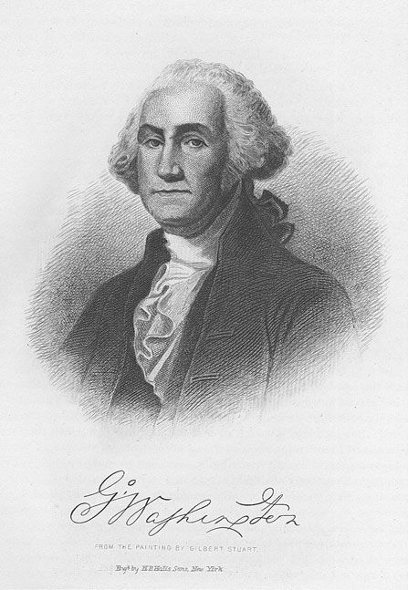
EARLIEST WHITE PEOPLE OF THIS VICINITY - 33
lodged, even at the expense of war, and Governor Dinwiddie acted promptly. He sent Washington to accomplish its conquest or destruction but furnished him so insufficient a force that the brave young soldier succeeded in escaping the horrors of the battle of "Great Meadows" only with the honors of war. His discomfiture and retirement left the French in absolute control, and in that dark moment not an English flag was waving in the whole northwest. The English government immediately planned a counter stroke by organizing a larger army, placing it under command of General Braddock, a soldier of renown, who took Washington onto his staff, but ignored his advice, hence was cut to pieces as an army and himself slain. "We shall know better next time in dealing with the Indians," were the words from Braddock's lips before he died.
Still another expedition must be had in order for the English to capture this stronghold. This was organized in 1758 and it set out determined to succeed at whatever cost it might be. General Faber was placed in command and he easily won by reason of the temporary absence of the Indians from the encampment. This was fatal to the French. The fort was captured ; its name was changed from Fort Duquesne to Fort Pitt and it became the defense and hope of the entire frontier.
In 1763 terminated the "Seven Years War" between Austria, England and France. In that far away city of Paris a few pen strokes transferred the sovereignty of the French Empire in America to the absolute control of the English. "America was to be English—not French," said Carlyle.
Under King George III —October 7, 1763, King George issued a proclamation concerning the government of all the other territories ceded to England by the Treaty of Paris, excepting this particular region in North America. The King desired to hold this territory for crown lands in order to exclude the inhabitants of the colonies from settling upon it.
For the benefit of the home government through the revenue derived from a fur trade with the Indians, this entire magnificent region was to be closed to the innumerable home seekers who were waiting to clear it, plow it, inhabit it, and turn it into a paradise.
Next came on the Pontiac War-1763. At first the colonists believed because the French had been conquered that they could safely make settlements in this splendid domain. But the Indians resented the manner in which the English had settled with France and were hostile toward the British. The French had been friendly to the savages and politic in their treatment toward the red man, while the English were harsh and unfair. Finally the Indian rose in his might and under that wonderful leader, Pontiac, the chief of the Ottawas, who rallied the various tribes in the whole region and with a master hand waged a war in which he caused to fall, one by one, the fortresses such as St. Joseph, Fort Ontario
Cin.-3
34 - GREATER CINCINNATI AND ITS PEOPLE
(now Lafayette, Indiana), Fort Presque Isle and Bedford, Pennsylvania. Bouquet was successful and through his efforts, beginning at Burley Run, twenty-five miles east of Fort Pitt (Pittsburgh), he swept in swift marches to recover the lost forts, one after another, this being one of the finest military campaigns seen in America. His work reestablished the English power.
The much disputed territory had been conquered in a fair fight—now what was to be done with it? The country must be defined and then subjugated. This was no easy task. Three years were consumed in earnest and sometimes heated discussion between the representatives of the two powers. At last, however, a satisfactory treaty was arranged and signed, in 1768, at German Flats and Fort Stanwix in far away New York.
Another strife of short duration was Lord Dunmore's War, which ended in the autumn of 1774 ; this was a war against the Indians. The results of this white man's victory were great, for it kept the Indians silent during the first two years of the oncoming Revolution, and as well gave settlers a chance to locate in Kentucky. The forts at Vincennes and Kaskaskia were captured from the English in 1778-79 ; and soon invasion was effected in Tennessee, where the Indians were routed and subjugated and such men as "Old Daniel Boone, the Hunter of Kentucky," made their record as heroes.
Division of Territory of the Northwest —The military conquest of this vast region was only a phase of the problem of its final occupation. It was not only conquered but divided. What parts should fall to the various states which had contributed to its conquest was a matter of great perplexity—as well as of the greatest importance. There were many minor difficulties ; but these were all overshadowed by the larger fact that some portion of the region belonged to individual states and not to the new nation which had come so recently into existence. Three of these, Virginia, Connecticut and New York, still more earnestly devoted to themselves, as states, than to that newer and greater political unit, the Federation, clung so tenaciously to their rights as to threaten the very existence of the national government itself. After long struggles between New York and the others the former surrendered her claims and Virginia and Connecticut soon followed, with a small reservation—the fertile tract of land known as the Western Reserve.
Ordinance of 1787 —"That immortal document known as 'Ordinance for governing the Northwestern Territory,' was passed in 1787. With the wisdom which characterized the political activities of the founders of our government, the men who gave the ordinance its final form provided, strange as it may seem, for every important emergency that actually arose in the complicated struggle to subdue, populate and govern a vast
EARLIEST WHITE PEOPLE OF THIS VICINITY - 35
wilderness over which still roamed bands of savages from whom it finally had to be seized by force of arms. Wise, interesting and important as were all the provisions of this great document, there was a single one so remarkable there and so significant afterward that, although they passed by in silence, it must never be permitted to go without a word of praise. The others are political. It was ethical. By it, human slavery, in this region sacred to the highest uses of humanity, was forbidden then and ever more."—From the pen of Rev. Charles Frederick Goss, author of "The Queen City."
CHAPTER IV.
THE NORTHWEST TERRITORY.
The first important addition to the original thirteen Colonies of the territory of the United States was that part northwest of the Ohio River and was known as the Northwest Territory. From the land within its limits was subsequently formed the States of Ohio, Indiana, Illinois, Michigan and Wisconsin. Not the least important element in the subsequent development of this vast region was the character of the men who were the officers of its first government. Although the population was small the contact of the settlers with the governing officials made a great impression upon the people whom they served. The vast territory which had for so long a time been a wilderness given over to the savages and wild beasts and which had enjoyed practically no government when under French or English occupation was impressed from the outset with the fact that it was an organized community to be governed under the forms of law and that the period of irresponsibility had passed. Much of this was due to the personality of the officers, all of whom were men of very high standing and of good education. Five of the six men originally chosen for the important offices of the territory had received a college education. General St. Clair had been educated at the University of Edinburgh ; Sargent and Parsons were graduates of Harvard ; Varnum was a graduate of Brown ; Armstrong had been a student at Princeton and Symmes, who was appointed in his place, was a man of education, who had served for many years in many responsible positions, including twelve years as a judge. Men of this character were fully convinced of the importance of a well-ordered government and it is largely due to their strict adherence to their ideas of duty that the territory over which they presided became from the first a law-abiding community.
Territorial Officers —Arthur St. Clair, the newly appointed Governor, was a Scotchman. He was born in Thurso, in 1734, and was educated at the University of Edinburgh and studied medicine under the noted Dr. Hunter, of London. Inheriting a large sum of money from his mother, he bought a commission of ensign in the English Army and came to America in 1758. He participated in the capture of Louisburg and had distinguished himself under Wolfe at Quebec. In 176o he married, in Boston, the half-sister (or niece) of Governor Bowdoin. He resigned his commission in 1762, and in 1764 he settled in the Ligonier Valley, Pennsylvania, where, with his inherited wealth and the fortune brought to him by his wife, he purchased a large quality of land and built large mills and had a handsome dwelling in Westmoreland County, Pennsylvania. In time he owned i i,000 acres of land. He held offices such as
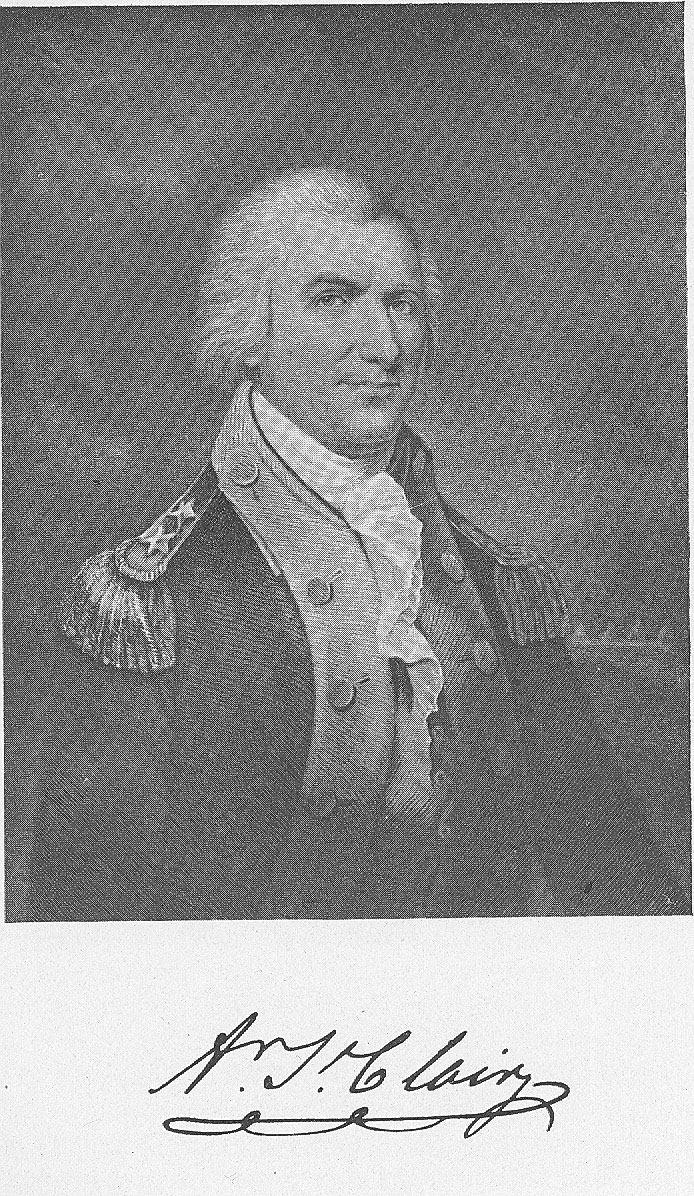
THE NORTHWEST TERRITORY - 37
surveyor, Justice of the Court of Common Pleas, member of the Governor's Council, recorder of deeds, and was one of the most prominent men in the community in which he resided. Governor Penn said of St. Clair : "Mr. St. Clair is a gentleman, who for a long time had the honor of serving His Majesty in the regulars with reputation, and in every station of life has preserved the character of a very honest man." St. Clair became a colonel of the militia in 1785 and accompanied the commissioners to negotiate with the Indians at Fort Pitt, as their secretary. He served in Canada in 1776, and in August was made a brigadier-general. He joined Washington's army in November. In 1777 he was in command at Ticonderoga, which he had to evacuate July 4, on account of the great forces of Burgoyne. He was a member of the court marshal which tried Major Andre, and with others had to vote upon him the death penalty. He was in command at West Point during part of 1780. Later he joined Washington and participated in the capture of Cornwallis. The Revolutionary War left St. Clair an impoverished man. He was elected as a delegate to Congress and became president of that body in 1787, resigning the position to accept the Governorship of the Northwest Territory.
Other officers associated with St. Clair in the Northwest Territory were : Winthrop Sargent, who was secretary. He died in New Orleans in 1820.
Samuel H. Parsons, born in Connecticut in 1737, graduated at Harvard in 1756 ; was a brigadier-general in the days of the Revolutionary struggle, and in 1779 succeeded General Putnam as commander of the Connecticut line. He became major-general and was later one of the commissioners in making treaties with the Indians. He settled in the territory and was accidentally drowned in the Big Beaver River, November, 1789.
James Mitchell Varnum, born in Massachusetts, 1748, graduated at Brown University in 1769. Was made a brigadier-general in 1777, resigned two years later and was made major-general of militia, which office he held at the date of his death. He served in the Continental Congress from 1780 to 1783, and again in 1786-87 ; he was very eloquent. He moved to Marietta in 1788, and held his office until his death in 1789.
John Armstrong, who declined the appointment of territorial judge, was born in Pennsylvania, 1758. Was a student at Princeton in 1775 and became a volunteer in a Pennsylvania regiment and rose to the rank of major. He is best recalled as being the author of the "Newburgh Addreses," written at the close of the Revolution to induce the army to make such demonstrations as would require Congress to do it justice. After the war he was Secretary of State and adjutant-general of Pennsylvania, and in 1784 conducted operations against the settlers in the Wyoming Valley. He married and settled in New York, from which State he
38 - GREATER CINCINNATI AND ITS PEOPLE
was elected as United States Senator, serving from 1800 to 1804, and resigned to be a Minister to France. In 1812 he was made brigadier-general and the same year became Secretary of War in the cabinet of President Madison. The failure of the operation against Canada and the capture of Washington in 1814 made him so unpopular that he resigned and retired to private life, dying April I, 1843.
Marietta Settlement —Sometime prior to the appointment of the officers on August 29, Dr. Cutler met the directors and agents of the Ohio Company once more at the "Bunch of Grapes Tavern" in Boston and reported to them that he had made a contract with the Treasury Board for a million dollars' worth of land at seventy-five cents an acre, and on the following day the plat of the proposed city on the Muskingum was settled upon and proposals for saw mill and corn mill sites invited. Rufus Putnam, chosen as the leader of the pioneers and boat carpenters from Danvers were sent ahead, and by the last of January, 1788, they had reached the Youghiogheny. Putnam and the main party with the surveyors and engineers joined them February 14, 1788. They found no boats and no boards to build any, no person able to hollow out a canoe, the saw mill frozen up and smallpox prevailing. However, they set to work and by April 2 the "Mayflower," a forty-five ton galley, first called the "Adventure," floated out upon the stream. April 7 this historic boat, accompanied by the "Adelphia," a three-ton ferry, and three log canoes reached the Muskingum. Here they were greeted by the garrison at Fort Harmar, which had been built there in 1785 for the protection of the surveyors and was, with Fort McIntosh at the Big Beaver, one of the two stations then held by the government north of the Ohio River. Among those who greeted them was the famous Captain Pipe fresh from participation in the burning of Colonel Crawford. The site selected for the town was a level plain, thirty feet above the Muskingum River, on the eastern side of the stream opposite the fort, at the point where the mound builders had left so many of their remains. The name of the town, selected in Boston, was Adelphia ; but at the first meeting of the directors held on the ground, July 2, the name Marietta was adopted in honor of Marie Antoinette, the friend of the struggling Colonies. Here the land was cleared and one hundred acres planted with corn and huts were built, as was the pioneer custom, from the planks that had made their boats. On the top of the ancient fortification of the mound builders, whose parapets, twenty feet high, still remain, was built a stockade, including a building two stories in height, with blockhouses at the angles ; this was called the Campus Martius. In the spring the changeable quality of the climate, an entire novelty to the settlers, manifested itself. There was intense heat and much insect life, followed by cloudbursts, which deluged the rivers rise, before never seen so high. A sudden fall in temperature made them fear the approach of winter in the mid-summer; however,
THE NORTHWEST TERRITORY - 39
their crops leaped into life and the game which was at hand furnished them with f00d and plenty. Emigrants began to arrive and in considerable numbers. In May came Col. John May, the first journalist of the Colony, and in June two of the judges, Parsons and Varnum, arrived.
Lieutenant Denny, whose diary has been quoted from before, joined the forces of Fort Harmar May 29. He was much impressed with the character of the settlers, "many of whom were of the first respectability—old Revolutionary officers." July 4, Independence Day, was celebrated, when venison, bear and buffalo meat regaled the appetite and Judge Varnum delivered a patriotic address, in the course of which he referred to the expected visit of the Governor. "We mutually lament that the absence of his Excellency will not permit us, upon this joyous occasion, to make those assurances of sincere attachments, which bind us to him by the noblest motives that can animate an enlightened people. May he soon arrive. Thou gently flowing Ohio, whose surface, as conscious of thy unequalled majesty, reflecteth no images but the grandeur of the impending heaven, bear him, oh bear him safely to this anxious spot. And thou beautiful, transparent Muskingum, swell at the moment of his approach, and reflect no objects but of pleasure and delight."
The great episode of the arrival of the Governor took place five days later. On this day intense excitement prevailed throughout the settlement and at the fort on the opposite bank. The officers assumed their newest uniforms and the soldiers' muskets and trappings were polished to the highest degree of cleanliness. The distinguished citizens collected about the Campus Martius awaiting the arrival of their hero. General Harmar and his officers, proceeding to the landing, were amidst the ruffling of drums and the booming of the Federal salute of fourteen guns ; they received the Governor as he stepped from the twelve-oared barge of state. He was accompanied by Major Doughty, of the artillery ; Judge Parsons, and Secretary Sargent. The party proceeded in solemn state to the fort, where it was to remain until the formal opening of the civil government.
Civil Government Set Up —Tuesday, July 15, 1788, civil government was established in the territory west of the Ohio River. General St. Clair, attended by Judges Parsons and Varnum and Secretary Sargent, made his public entry into the city of Marietta, being escorted across the river in a barge of state to the accompaniment once more of drums and guns. A handsome bower had been erected, under which he was received by General Rufus Putnam and all other citizens with the most sincere and unreserved congratulations. He was escorted by the townspeople to the Campus Martius, whereupon all took their seats in solemn array. After a short period of silence his Excellency arose and addressed himself to the assembly in a concise but dignified speech. He expressed his great pleasure at meeting them upon so important an occasion and informed
40 - GREATER CINCINNATI AND ITS PEOPLE
them that he had brought with him a most excellent constitution for the government of the territory, to which he invited their attention. The Governor's address was followed by the reading of the Ordinance by Secretary Sargent, and also of the commissions of the various officers. After this formality had been concluded the Governor spoke at length of the importance of g00d government ; of his desire to administer the trust confided to him in such a manner as to merit their approbation ; of the relations of the Northwest Territory and the general government, and of the opening of a new county under such favorable auspices and of the importance of cultivating friendly relations with the Indians. "Endeavor to cultivate a good understanding with the natives without much familiarity ; treat them on all occasions with kindness and the strictest integrity; run not unto their customs and habits, which is but too frequent with those that settle near them, but endeavor to induce them to adopt yours. Prevent, by every means, that dreadful reproach, perhaps too justly brought by them against all the white people that have been acquainted with, that, professing the most holy and benevolent religion, they are uninfluenced by its dictates and regardless of its precepts. The present situation of the country calls for attention in various places, and will necessarily induce frequent absence, both of the judges and myself, from this delightful spot ; but at all times and places, as it is my indispensable duty, so it is very much my desire to do everything within the compass of my power for the peace, good order, and perfect establishment of the settlement ; and as I look for not only a cheerful acquaintance in, and submission to necessary measures, but a cordial cooperation, so I flatter myself my well-meant endeavors will be accepted in the spirit in which they are rendered, and thus our satisfaction will be mutual and complete."
At the conclusion of the Governor's address, Gen. Rufus Putnam congratulated him on his safe arrival in a few appropriate remarks and presented to him a formal address on behalf of the citizens.
Immediately after the conclusion of the formalities, Governor St. Clair and the two judges who were present entered upon the duties of their office and set to work forming a code of laws for the government of the territory. The Ordinance provided that the laws should be selected from the statutes of the thirteen original States ; the judges, however, did not strictly follow this practice, but whenever they could not find laws suited to the condition of the territory, they supplied the want by enactments of their own framing. This system was acquiesced in by Governor St. Clair, but with considerable reluctance on his part. The laws which were not selected from the statutes of the States finally failed to receive the approval of Congress, but with two exceptions were continued in force because necessary until the second grade of the Government was
THE NORTHWEST TERRITORY - 41
established in 1795, when the Governor and council formally enacted a code of laws.
The first law created providing for the organization of the militia was prepared by Judges Varnum and Parsons and presented to Governor St. Clair for his approval. The beautiful harmony which had hitherto obtained comes to an end at this time, that of the first official act in the Northwest Territory. St. Clair submitted with great deference some observations to the two judges which he thought might appear to them worthy of consideration. If these observations left anything of the original law without criticism, it is not apparent. Thereupon the judges submitted a law relating to real estate, which brought forth an elaborate veto from the Governor. Fortunately, despite the warmth of the correspondence, the personal relations between the Governor and the judges remained of the most cordial nature. The laws which were finally approved by St. Clair and the two judges, were ten in number and related to the establishment of a militia ; establishing General Courts of Quarter Sessions and of the Common Pleas, and for the appointment of sheriffs ; establishing a Court of Probate ; fixing the terms of the General Court ; describing the forms of oaths of office and respecting crimes and punishments ; regulating marriages ; fixing fines for infraction of militia rules ; creating the office of coroner ; and limiting the time of civil actions and for instituting criminal prosecutions.
The signature of John Symmes appears on the law of August 3o, establishing a Court of Probate, but on no other. This must have been signed by him at the time of his visit to the Western country in the summer preceding the settlement between the Miamis. This law took the place of the code of laws which, in the absence of constituted authority, were drawn up by Col. Return Jonathan Meigs, father of the judge of that name.
The laws which were adopted at this time had been regarded, so far as those relating to crimes and offenses are concerned, as very strict and even cruel. As there was no jail, minor offenses were punished by fines, whipping and confinement in the stocks. This latter emblem of terror remained in use in Ohio until 1812. It may as well conclude the matter of State Judiciary down to the time of the sessions of the first Territorial Legislature. As soon as a sufficient number of States had ratified the Constitution of the United States and Washington had assumed the reigns of government thereunder, it was thought to be the duty of the executive to issue new commissions to officers whose commissions, having been issued by the Continental Congress, were held to have expired with that government. For that reason President Washington, in a letter dated New York, August 18, 1789, nominated Arthur St. Clair and Winthrop Sargent, Samuel Holden Parsons, John Cleves Symmes and William Barton as Governor, secretary and judges, respectively, of the
42 - GREATER CINCINNATI AND ITS PEOPLE
Northwest Territory. The nominations were confirmed by the Senate, but Mr. Barton declined appointment, and George Turner was appointed in his place. Turner seems to have made but little impression upon his time and served until his removal from the State in 1796, when he resigned.
Return Jonathan Meigs, Jr., was a son of the first law-giver of Ohio and was born in Middletown, Connecticut, in 1765. He graduated at Harvard at the age of twenty and studied law in his native State, coming to Ohio in 1788. Of his peculiar name ex-Judge Force used to relate the following explanation : "His grandfather, Jonathan Meigs, courted an attractive Quakeress, near Middletown, Connecticut, and suffered a non-suit on two occasions. He was a persistent suitor and pleaded earnestly for a new hearing and a reversal of judgment. Again unsuccessful, he had turned from the presence of his idol and mounted his horse and was slowly riding away, when the Good Spirit moved the heart of the gentle Quakeress to set aside the judgment thrice decreed, and grant the prayer of the petitioner. Hastening to the cabin door, she shouted, 'Return Jonathan ; return Jonathan !' The happy lover returned, a marriage followed, and 'Return' prefixed to his own good Bible name 'Jonathan,' was applied to their first born at his christening and descended with manifest family pride to the second generation and some of the collateral branches. Few men in the annals of Ohio, or the Northwest Territory, occupied a position of dignity, responsibility and usefulness equal to that maintained by the Meigses, father and son."
Vincennes the Seat of Justice —There appears no record of any public acts of the Legislative Council in 1789. The following year the council, consisting of Sargent, the secretary and the acting Governor, and Symmes and Turner sat at Vincennes during the summer. In November St. Clair t00k Winthrop Sargent's place, and the council sat at Cincinnati. In 1791 the council published at Cincinnati seven acts approved by them during the summer, and in 1792 the sessions were again at Cincinnati. In 1795 the council, sitting at Cincinnati, revised the code of laws, eliminating those to which Congress had objected, and published the revision as certified to by the Governor, Arthur St. Clair and Judges Symmes and Turner. This publication was printed by William Maxwell, printer, at Cincinnati, and is known as the "Maxwell Code." It is regarded as the first book printed in the city. The council met again at Cincinnati in 1798 and enacted a number of new laws, which were the last legislative acts of the Territorial Council.
Washington County Erected —July 27, 1788, Governor St. Clair, by proclamation, erected the county of Washington, which embraced the eastern half of the present Commonwealth of Ohio. Within the next few days he commissioned justices of the peace, judges of the Court of
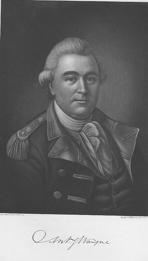
THE NORTHWEST TERRITORY - 43
Common Pleas and the Court of General Sessions for the county of Washington. He also appointed officers of militia and a Judge of Probate. Thereupon, October 2, 1788, there was held at Marietta the first duly appointed Court of Common Pleas, with Generals Rufus Putnam, Benjamin Tupper and Archibald Crary sitting as judges. The population on the Ohio at this time had increased to one hundred and thirty souls, most of whom seemed to have received commissions either in the military or civil government. The event was one of great interest and was attended with much pomp and formal ceremony. The citizens, including the Governor, territorial officers and the militia from Fort Harmar assembled on the point and a procession was formed, at the head of which marched Ebenezer Sproat, sheriff, with his drawn sword and wand of office, "with all the dignity and impressiveness of his prototype, the sheriff of Middlesex at a Harvard commencement." A path was cut through the forest to the hall, the northeast blockhouse of the Campus Martius. General Force later remarked, "The parade was marked with interest by the Indians of the neighborhood and it is recorded that the same Indians were more impressed by this event than by any losses in battle that they had suffered for many a year."
When all were assembled in the hall the solemn services were opened with prayer by the Rev. Manasseh Cutler. The court was organized by reading the commissions of the judges, the clerk and the sheriff, after which the latter, by proclamation, declared it open for business. The court was opened by Colonel Sproat in these words : "Oyez, a court is opened for the administration of even-handed justice, to the poor and the rich, to the guilty and the innocent, without respect of persons ; none to be punished without trial by their peers, and then in pursuance of the laws and evidence in the case."
A week later the first Court of Quarter Sessions was opened in the residence of Colonel Battelle, in the southeast blockhouse. Colonel Meigs read the commissions to the sheriff. Colonel Sproat once more commanded the solemn attention of all. Generals Putnam and Tupper were the justices. They were assisted by aids in the persons of Isaac Pierce, Thomas Lord and Colonel Meigs, the son. At this term of court Paul Fearing, the first lawyer admitted to the bar in the Northwest Territory, presented a certificate, received from Judges Parsons and Varnum, and took the oath as a member of the bar. He was appointed court counselor for the United States in the county of Washington. Attorney Fearing was born in Massachusetts and graduated at Harvard. He arrived in Marietta in June, 1778. He was not exactly a ready speaker and his first argument in the Supreme Court has been many times requoted : "May it please your honors—may it please your honors—I have forgotten what I intended to speak." He improved, however, and became a successful lawyer and was Judge of Probate and later Associate
44 - GREATER CINCINNATI AND ITS PEOPLE
Judge, member of the Ohio Legislature and elected to a seat in Congress in 1801.
The "Governor's Mansion" —The blockhouse was appropriated for the use of the Governor and his family and there was much entertaining. The directors of the Ohio Company gave a dinner to the Governor and the officers of Fort Harmar on August 20. The Twelve-oared Barge, the solemn vessel of State, conveyed the party from the fort to the landing on the other side of the river, where the guests, including a number of ladies, were received with the greatest of courtesy. At this dinner were served the greatest variety of game, fish, vegetables and fruits, among them peaches grown from pits planted by Major Doughty when he erected Fort Harmar in 1785, "very fine and lucious."
Treaty of Fort Harmar —The great historic event in the autumn and winter, after the settlement at Marietta, was the treaty of Fort Harmar. The Indians were restless under the occupation of the white men and their attacks upon the settlers were continued. One of the greatest inconveniences resulting from these attacks was the fact that the surveys had to be practically abandoned. Governor St. Clair, in writing to Parsons in September, speaks of this as being necessary because of the disturbance in the minds of the Indians on the subject of lands. General Harmar, in October, felt obliged to detach a captain's command, with Captain Hutchins, the geographer, for his protection to the mouth of the Scioto, in order to survey the exterior lines of Messrs. Cutler and Sargent's purchase. The importance of this matter of survey made all inter-. ested in the enterprise of settling the Northwest Territory very anxious, especially as they were now in active competition with the State of Kentucky for settlers.
General Harmar, in writing from his fort, December is, 1788, to the Secretary of War, speaks as follows : "My calculation is that before Christmas the two exterior lines of Messrs. Cutler and Sargent's purchase will be completed. The geographer is at present at Fork Pitt sick. If he was able to come down and take the latitude of the northern corner of the Tenth Township of the Seventh Range, Mr. Ludlow, who is a smart young fellow, could run the northern boundary ; the purchase money could then be paid, that business finished, and in the spring the next affair would be to take up Judge Symmes' purchase. Several chiefs of the different nations arrived at this post the day before yesterday. The inhabitants of Kentucky, I am informed, have it in contemplation to declare themselves not only independent of the State of Virginia, but of the United States altogether."
The reference in the last sentence of the above paragraph was concerning the efforts of one Connolly at Louisville. Connolly was upon the
THE NORTHWEST TERRITORY - 45
half-pay list of England, but at that time was tampering with the people of Kentucky, endeavoring to induce them to throw themselves in the arms of Great Britain for protection and support, or if that could not be brought about, to induce them to accept the hospitalities of the Spaniards, or in any manner to cause a breach with the new Nation. At this time the Spaniards were offering one thousand acres of land gratis to every American who would move into the West of Florida and Colonel Morgan, who obtained a grant on the Spanish side, opposite the mouth of the Ohio, was endeavoring to induce the Kentuckians to avail themselves of the Spanish grant. Fortunately the schemes of Connolly and Morgan failed.
In the meantime the warrior chieftains were beginning to assemble at Fort Harmar for the purpose of holding the conference. They began coming as early as September 19, but it was not until December 13 that they arrived in any great numbers. On the 14th there was a meeting in the council house to welcome each other and on the 15th the council was opened. On the 29th the Indians' cause was stated by the old Wyandot chief, Shendatto. He described the origin of his race and how the thirteen fires had gotten possession of his country. In two instances by treachery, the first he said was in a bargain made with them "for just as much ground as an ox hide would cover—merely to build one fire upon. The Americans cut the hide into strings and claimed all the ground they could encompass therewith. The second case was a bargain for such an extent of country in a certain direction as a white man would travel to and back in one day. A surprising walker was found who went as far and back again the same day as any of the swiftest men could do in two." He insisted that the Ohio River was the proper boundary and presented a large belt of wampum with a black strip running through the middle representing the Ohio River. January 16, the Governor stated his side of the case and explained to the Indians just how they had forfeited their country. He had always insisted, upon the treaties of Fort Stanwix and Fort McIntosh, that they had taken up the hatchet against the United States in the late war. The English had ceded to the United States the country south of the lakes and the Indians by their actions had forfeited their rights. The United States wanted peace, but if the Indians wanted war they should have it. The views of St. Clair prevailed and the treaties were agreed to on the 9th and signed on the 11th. On the 13th the goods were given out to the different nations of Indians and in the afternoon the officers of the fort attended the funeral of Judge Varnum. The treaty was proclaimed by St. Clair on January 24, 1789, and it was supposed to be to the satisfaction of all concerned. It was soon learned, however, that Brant had not lost his influence and that the Indians of the Northwest, particularly the Shawanees, were by no means satisfied.
CHAPTER V.
EARLY LANDINGS AND SETTLEMENTS.
On September 22, 1788, a large company of Kentuckians with Colonel Patterson and Filson, otherwise named, at their head, arrived on the ground and were there met by Judge Symmes, who with Israel Ludlow (who was the chief surveyor of the party) Denman and Stites, came down from the Limestone. The exact date is stated by Judge Symmes himself in his letter to Dayton, written from Limestone, Kentucky, October 12, 1788, in which he says : "On the 22d ult. I landed at Miami and explored the country as high as the upper side of the 5th range of townships."
The spot on which the two parties, now numbering some sixty people, are supposed to have met, is reported to have been where now is the Public Landing of Cincinnati. There took place the public dedication of the lands in accordance with Filson's plat. September 22, 1788, therefore, can be accepted as the first definitely fixed historic date in the history of Cincinnati.
The immediate platting of the lots could not proceed, so the survey of the donation lots was postponed until the first of the next year. The survey could not be commenced nor Denman's section fixed, until the twenty-mile point of the river referred to in the agreement with Congress was ascertained.
Ludlow immediately entered upon the determination of this point and in a few days he and Denman took the meanders of the Ohio from the mouth of the Little to the mouth of the Great Miami and also up the Great Miami about ten miles from the Ohio, showing by his measurement that Denman was within the line. He, with Denman and a number of the party returned on the third day and camped on the ground, where possibly the old block-house erected by Colonel George Rogers Clark, in 178o, was still standing.
Filson is said to have spent a day or two in running the lines of the streets, marking their courses with notches on the trees. After this Judge Symmes, accompanied by Patterson and Filson, and a large number of Kentuckians, rode up the country for the purpose of acquainting themselves with the lay of the country. His purpose was, starting from the front of the Ohio, opposite the Licking, to go north through the central portion pretty well back towards what by calculation was supposed to be the limit at the north of the area of the grant, and then go over to the Great Miami and take its meanders to the mouth. Others were to go down to the same point taking the courses of the Ohio. He reached the point variously stated at from twenty to forty miles inland. On the
EARLY LANDINGS AND SETTLEMENTS - 47
banks of the Great Miami they came upon an encampment of Shawanees, and the Kentuckians, without any hesitation, proposed to attack. Symmes was most anxious to preserve peace with the Indians, and had sent out every possible assurance to that effect, and therefore he restrained the disorderly company with him. As a result many of them in disgust deserted the party and went off homeward to the camp. Symmes relates the incident in a letter to Dayton, of May 18, 1789:
"After this, the greater part of them deserted me when about forty miles up the Miami, where I had ventured on their promises to escort me down that river, meandering its courses ; which so disobliged me that I have been very indifferent ever since whether one of them came into the purchase or not, as I found them very ungovernable and seditious ; and not to be awed or persuaded. To the disobedience of these men, I impute the death of poor Filson, who had no rest afterwards while with me, for fear of the Indians, and at length, attempting to escape to the body of men I had left on the Ohio, he was destroyed by the savages."
Filson's Death —As a matter of fact no one knows to this day the fate of Filson, except that on the reassembling of the parties, he could not be found. Dr. Jones, in his "Early Days in Cincinnati," says : "Whether killed by savages immediately or carried far away into the interior to suffer all tortures of savage barbarity, or bewildered and lost, and perished in the wilderness, can now never be known. It is, however, a singular, indeed a remarkable fact, that although the settlers' intercourse with all the tribes of Ohio and the Northwest, from the time of the first settlement until their final removal from the state, no tidings could ever be gained of the fate of Filson ; and from this fact it might be conjectured that he was not murdered by the Indians, but lost in the wilderness and perished from hunger and exposure, and his body devoured by wild beasts, or, perhaps, may have been drowned in the Great Miami. Filson was a surveyor, and was to lay off the proposed town, as well as to act as general agent for Denman and Patterson. His loss, therefore, was a serious impediment to the enterprise, and necessitated the employment of another surveyor."
One feature of sadness over the death of this brave pioneer surveyor, not generally known, is brought out in Clarke's collection, found in the Ohio Historical and Philosophical Society of Cincinnati, in an original letter written by Filson from Lexington, May 27, 1788, to his brother Robert, in which, after discussing his affairs at some length and the advisability of his brother's coming to Kentucky, he says : "I have supported a good cfedt here, and have enough to support me. I renewed my studies last winter and greatly advanced my Latin and this spring have begun to study physic with Doctr Slater in this place, an eminent physician who came here from London last year. Two years I study. as
48 - GREATER CINCINNATI AND ITS PEOPLE
soon as my study is finished, I am to be married which will be greatly to our advantage. Stand it out 2 years my dear brother. You shall have Negroes to wait of you."
This letter may serve to explain Filson's enthusiasm about land speculation. The practice of medicine involving as it did, at least two years delay may have seemed not sufficiently promising for the fruition of his hopes. History does not record the name of the young woman who was to bring so much happiness to Filson and his brother, including Negroes to "wait of" them. The same letter throws a side light on the conditions in Kentucky at that time :
"The Indians are very troublesome, a few days ago Col. Joseph Mitchell, who lived at the Springs of Potowmack, and his eldest son, fell a prey to the savages near the falls of Ohio. We are all warriors here, when will our troubles end I know not. Four of our boats were taken from us this spring by the Indians."
The same brother wrote on the last page of a book owned by him, the following words : "This book was given to me by my brother John Filson, who was killed by the Indians on the North Side of the Ohio October 1st, 1788, about five miles from the Great Miami River and twenty or twenty-five miles from the Ohio."
Colonel Patterson, in the case between Joel Williams and the City of Cincinnati, in 1807, testified that :
"When it became certain that John Filson would never return, they found it necessary to secure the services of another surveyor, and as Filson's brother and heir had said to him that he was satisfied his brother had been killed, and had paid nothing on his interest, he, the brother, would relinquish all claims to any interest in the land as Filson's heir, they, therefore, took Colonel Israel Ludlow as partner, on the same conditions they had Filson, as a surveyor and general agent ; and in this way Colonel Ludlow, who had come out a surveyor for Judge Symmes, became a joint and equal owner with himself and Denman in the land purchased by Denman."
Previous to this time in testimony given December 27, 1803, Patterson was even more specific with regard to this matter. He says : "I was acquainted with the brother of the said Filson and he informed me that the said John Filson had paid nothing for the said land he did not set up any claim to the said town or consider himself as having any interest or concern therein." (The above is to be seen in Hamilton County Recorder's office, book D-1, page 74.)
Denman, in August, 1833, testified that "the party then returned to Limestone where this deponent entered into an agreement with Robert Patterson and Israel Ludlow . . . . which agreement was substantially the same as that to which Filson was a party substituting Ludlow for
EARLY LANDINGS AND SETTLEMENTS - 49
Filson, and empowering Ludlow to act for deponent and said Patterson in all things relating to the said town. That this agreement was made in writing and signed by the parties, and was left with the said Ludlow at the time it was executed which was in the month of October, A. D. 1788, at which time a plat of the proposed town was made by the said Ludlow and agreed upon by the said Patterson, Ludlow and deponent at Limestone aforesaid." Denman received a copy of this plat from Ludlow which he handed over to Williams when years afterwards he sold his interest to him. (Deposition taken in Denman's residence in Springfield, N. J., for use in the ejectment case of City of Cincinnati versus The First Presbyterian Society of Cincinnati.)
Colonel Durrett, in his life of Filson, takes issue with the inference usually drawn from Colonel Patterson's testimony, that Filson's brother was present and consented to the transfer of his interest to Ludlow. He states that Filson's brother at this time was not in the country and that not only did he never give a written consent (and in this the records of Hamilton County bear him out) to the transfer of Filson's interest but that he always regarded the transaction as an unjust one. Colonel Durrett quotes a report of a conversation with him in which he is made to say that "no matter how it might be regarded in the Northwest Territory it would be 'counted dinged nigh robbing in Pennsilvany.' " At any rate there was much dissatisfaction and much controversy growing out of this affair which resulted in the chancery case already referred to.
Strangely enough, the sale bond covering the transfer of Patterson's one-third to Samuel Freeman, executed November 26, 1794, with Israel Ludlow as a witness, recites that "Mathias Denman, Robert Patterson and John Filson are partners in common tenentry." (Recorded Dec. 29, 1811.)
However the legal merits of the case may have been determined, the historic facts remain clear. Of the three original owners who dedicated the land opposite the Licking to posterity as a city, Patterson alone was with the landing party in December, and he stayed but a short time. He was, however, regarded as the leader of the party.
The real founders of Cincinnati, those who settled the town afterwards known by that name, and by their industry and perseverance made the settlement a reality, were Colonel Ludlow and William McMillan (who were in the surveying party that laid out the town as it finally was established) and Joel Williams, who assisted in the Ludlow survey, in building the surveyors' cabin and built the first private house. He was the actual agent of the proprietors on the ground, as Colonel Ludlow was away much of the time engaged in his surveys, and kept the plat of the town. Williams was here within ten days of the landing as he drew a lot on January 7, 1789.
Cin.-4